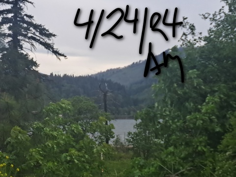
Wednesday: nice westerlies in the Gorge today. incoming snow for Mt. Hood. Rain for the lowlands!
The best wind forecast for the Gorge. The best snow forecast for Mt. Hood. The best weather forecast for the Gorge. Mt. Hood Snow Forecast – 5000′ Snow level 4a-8a 8a-12p 12p-4p 4p-8p 8p-4a Wednesday7000′->5000′->6000′ Thrusday6000′->4000′ Friday4000′->3000′ Mt. Hood Snow Forecast Hello skiers and riders! We’re headed into a cooler, wetter stretch of weather. Snow…
Meet your forecaster: Temira
For almost 30 years, Temira (they/them) has been making the most of the Gorge: riding river swell, shredding powder, and cycling all the gravel and pavement and trails. This is Temira’s playground, their gym… their life’s work.
This passion led Temira to take a vow: In 2006, Temira decided to provide the most accurate, hyper-local weather forecasts possible. Today, Temira’s forecasts have become an essential resource for thousands of skiers, snowboarders, wind sports enthusiasts and Gorge commuters. With Temira’s guidance, you can plan ahead, time your sessions perfectly, and just plain have more fun! But the story doesn’t end there.
There’s “Temira’s Awesome Travel Advisory Service” and “Valuable Advice for Gardeners Inhabiting Neighboring Areas” – the Gorge’s premier microclimate forecast and gardening information. When winter storms, extreme heat, hail, or avalanches on SR-14 and I-84 threaten, TATAS keeps everyone and their tomatoes and giant pumpkins and cash crops safe.
Temira’s relentless efforts keep the forecasts flowing. But it ain’t easy: each forecast takes a couple of hours. That’s where you come in. By contributing, you’re not just supporting Temira’s passion project – you’re investing in the safety and well-being of the entire Gorge community. Your financial support ensures these essential forecasts remain accessible to all, free of charge.
So please take a moment to click one of the buttons below. Donate $19.99 or more (how much does this forecast enhance your life?) and get the email in your inbox. Or just contribute enough for a cup or pound of coffee. I need coffee! Every contribution, no matter the amount, makes a difference. Help me keep this labor of love alive, so we can all commute safely, play in the river, and shred Mt. Hood with the best weather forecasts possible. Thank you!
Electronic payments not your thing? Temira / PO Box 841 / Hood River, OR 97031
Click on the buttons below to make a contribution. Thank you!
The best wind forecast for the Gorge. The best snow forecast for Mt. Hood. The best weather forecast for the Gorge.
Mt. Hood Snow Forecast – 5000′
Snow level
4a-8a
8a-12p
12p-4p
4p-8p
8p-4a
Wednesday 7000′->5000′->6000′
Thrusday 6000′->4000′
Friday 4000′->3000′
Mt. Hood Snow Forecast
Hello skiers and riders! We’re headed into a cooler, wetter stretch of weather. Snow will accumulate! It’s not going to be the driest snow, but it’ll be just right for freshening up the snow surface. Models have us picking up 1.75” to 2.0” water equivalent by Monday. Some of that will fall as rain at 5000′ Thursday, but we’ll see a quick switch to snow.
For Wednesday, expect high clouds in the morning and partly cloudy sky in the afternoon with clouds and a few snain showers overnight. The snow level will be 7000′ in the morning, 5000′ in the afternoon, and 6000′ overnight. Just a trace of precip, if any, will fall. Wind: NW 25-35 in the morning, W 15 in the afternoon, and WSW 15-25 overnight.
Thursday starts with snain at 5000′ and snow above 6000′ with rain below 4500′. Around noon, the snow level drops to 5000′, and it continues to fall overnight landing at 4000′. About 0.5” water equivalent (WE) is forecast during the day for 2-3” wet snow at 5000′. Overnight, 0.7” WE is forecast. Call that 4-5” dense snow. Wind: WSW 15-20 in the morning, SW 15-30 in the afternoon, and WSW 20-25 overnight.
Snow continues all day Friday with the snow level around 4000′. Overnight, it falls to 3000′ with just a few lingering flurries. Friday daytime brings about 0.5” WE for 4-5” average density snow. Overnight, 0.3” WE is forecast for 2-3” more. Wind: WSW 20-25 in the morning, W 30 in the afternoon, and WNW 15-20 overnight. High clouds are forecast Saturday with a little snow overnight. Sunday starts dry and turns snowy in the afternoon. Cool weather with intermittent light snow is forecast for much of next week. Enjoy the late spring freshies!
A poem:
Was that forecast helpful?
Did it save you time or gas money?
Did it make your life more fun?
Then please make a contribution.
Writing this takes me an hour or two a day.
Without your support, I can’t keep it up.
Keep the forecast going.
Subscribe or donate.
And share my forecast with your friends!
Auto-renewing subscription. Easy. Awesome. Set and forget!
Make a one-time contribution to support the forecast
Thank you for contributing and keeping this forecast going!
Not ready to subscribe? No problem – please share this forecast with all your friends too!
Or try a month for free!
Gorge Wind Forecast
Hi friends! I woke up late this morning, and the wind beat me to the river. So did TJ – he’s already out there getting some dawn patrol! Today’s your best bet out of the next few – we’re moving into a very active weather pattern, and that will disrupt wind quality. That said, westerlies of some sort are on tap all the way through the weekend. Given the progressive/active weather, it’s likely the forecast will change from day to day.
For Wednesday, we start with pressures of 30.10/29.98/29.92 for gradients of 0.12 and 0.06. You’ll find 20-23 from Viento to Swell early this morning with 13-16 near Stevenson and also from Mosier to Arlington. As a front approaches midday, the wind will drop to 14-17 at Swell, hold at 20-23 from Stevenson to Viento (and Mosier), and rise to gusty 23-26 from Lyle to Rufus. Being frontally-driven, this wind will probably not be the “right” direction for the Maryhill stretch. But hey, the wind is always the right direction for a trip out east for Indian food at Amayah’s! Current: 190-193kcfs. River temp: 52.16F. High temp forecast: 65F with clearing sky in the afternoon.
Thursday will be rainy. West of Amayah’s (the location formerly known as Biggs), the wind will be 5-10mph or less. Between The Dalles and Rufus, or maybe Arlington, the wind will max out in the evening. You’ll find 13-16 them. High temp: 56F and rainy. Friday starts with W 7-10 all the way from Stevenson to Arlington. West of The Dalles, you’ll find showery weather. In the afternoon, the wind slowly builds to gusty 15-18 form Stevenson to Doug’s with gusty 24-27 from The Dalles to Arlington. High temp: 58F and mostly cloudy. Cool, unsettled, active weather continues this weekend. Without support from an offshore high, wind speeds will likely be limited to the low 20s out east and much less west of The Dalles. That’s subject to change, of course. This cool, unsettled pattern continues through the end of next week.
High clouds this morning turn partly cloudy this afternoon. Temps start in the upper 40s and rise to the mid 60s. Moderately strong westerlies. No rainbows. Thursday will be cloudy and rainy. Temps start in he mid 40s and rise to the mid 50s. Light westerlies. 89% chance of rainbows. Friday will be cloudy then mostly cloudy with intermittent drizzle. Temps start in the upper 40s and rise to the upper 50s. Light to moderate westerlies. 98% chance of rainbows.
Local-ish Events
Please let me know of outdoor-related local-ish events. If you don’t tell me, I don’t know!
On 4/26, Brave Endeavors is sponsoring a community bike swap on the lawn behind Ferment (right by the new Indian food cart).
Regular weekly events:. NK Studio’s by-donation Tuesday morning yoga class is back. Ferment’s Tuesday night 4-mile walk/run is at 6pm. There’s meditation with monks at 5:15pm (an hour) and 6:30pm (30 minutes plus a talk) at Yoga Samadhi in White Salmon. The Tri Club is done for the season. At 7:15am on Wednesdays, there’s a run from the White Salmon Bakery. At 7am on Friday morning, there’s a run from Pine Street Bakery. On Fridays at 2:30pm, there’s a free meditation and stretching class at Yoga Samadhi. On Saturday at 9am, there’s a by-donation outdoor group fitness on the 2rd floor deck about Ferment Brewing.
Cycling
Cows are out on Hospital Hill. NO DOGS. That means you, all of you, even your dog that’s [insert adjective]. No dogs. Do not risk access for everyone. No parking at the corral. Whoopdee flowers are in full bloom. Hospital Hill and Syncline have ticks, oaks, and flowers. Columbia Hills is full of flowers and open to your bike. HRATS have a fundraiser on 4/20. Raffle tickets are on sale now. Buy some and support your trails organization. Definitely got a Tack Alert going on out there right now – lots of good dirt. Some areas of Post are still muddy (shady, cool areas), so consider choosing a different spot to ride. You’ll have Post all summer long! Sisterwives and Kleeway in Post Canyon are currently closed for rebuilding. It’s trail-building season. Get on the HRATS mailing list if you’d like to help out. If you’re parking at Post Canyon, you will need a parking pass. Those can be purchased at many local shops or online.
To provide the best experiences, we use technologies like cookies to store and/or access device information. Consenting to these technologies will allow us to process data such as browsing behavior or unique IDs on this site. Not consenting or withdrawing consent, may adversely affect certain features and functions.
Functional
Always active
The technical storage or access is strictly necessary for the legitimate purpose of enabling the use of a specific service explicitly requested by the subscriber or user, or for the sole purpose of carrying out the transmission of a communication over an electronic communications network.
Preferences
The technical storage or access is necessary for the legitimate purpose of storing preferences that are not requested by the subscriber or user.
Statistics
The technical storage or access that is used exclusively for statistical purposes.The technical storage or access that is used exclusively for anonymous statistical purposes. Without a subpoena, voluntary compliance on the part of your Internet Service Provider, or additional records from a third party, information stored or retrieved for this purpose alone cannot usually be used to identify you.
Marketing
The technical storage or access is required to create user profiles to send advertising, or to track the user on a website or across several websites for similar marketing purposes.
Used to monitor number of Google Analytics server requests
10 minutes
__utmb
Used to distinguish new sessions and visits. This cookie is set when the GA.js javascript library is loaded and there is no existing __utmb cookie. The cookie is updated every time data is sent to the Google Analytics server.
30 minutes after last activity
__utmc
Used only with old Urchin versions of Google Analytics and not with GA.js. Was used to distinguish between new sessions and visits at the end of a session.
End of session (browser)
__utmz
Contains information about the traffic source or campaign that directed user to the website. The cookie is set when the GA.js javascript is loaded and updated when data is sent to the Google Anaytics server
6 months after last activity
__utmv
Contains custom information set by the web developer via the _setCustomVar method in Google Analytics. This cookie is updated every time new data is sent to the Google Analytics server.
2 years after last activity
__utmx
Used to determine whether a user is included in an A / B or Multivariate test.
18 months
_ga
ID used to identify users
2 years
_gali
Used by Google Analytics to determine which links on a page are being clicked
30 seconds
_ga_
ID used to identify users
2 years
_gid
ID used to identify users for 24 hours after last activity
24 hours
_gat
Used to monitor number of Google Analytics server requests when using Google Tag Manager
1 minute
_gac_
Contains information related to marketing campaigns of the user. These are shared with Google AdWords / Google Ads when the Google Ads and Google Analytics accounts are linked together.