| Snow level | 4a-8a | 8a-12p | 12p-4p | 4p-8p | 8p-4a |
|---|---|---|---|---|---|
| Sunday 4000′->8000′ |
 |
|
|
|
|
| Monday 8000′->10,000′ |
|
|
|
|
|
| Tuesday 10,000′->3000′ |
|
|
|
|
|
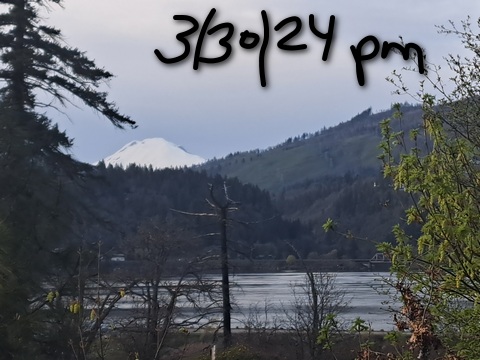
Mt. Hood Snow Forecast
A sunny, but not-too-warm Sunday is forecast. Things heat up on Monday and Tuesday for true spring conditions (slushy, perhaps) with temps nearing 50 on the slopes. Don’t get used to it. Colder weather comes roaring back on Wednesday with the snow level dropping nearly 9000′ over the course of 24-36 hours. There’s not a ton of snow forecast with this system – maybe 3-6” – but it’s better than nothing. 6-12” total are forecast over the course of next week. But first… Oh wait, before we get to that first, this first: 3/31 is the final day to have studded tires on your rig. After that, you’re risking a big fine.
A sunny Sunday is in the cards. The free air freezing level will be 4000′ in the morning, 5500′ in the afternoon, and 8000′ after midnight. Wind will be N 10 all day turning to NNW 30 on Monday morning. Monday will be warm and sunny with the free air freezing level rising from 8000′ to 10,000′. Wind will be NNW 30 in the morning, N 15 in the afternoon, and W 5 overnight. Tuesday will be sunny all day with the freezing level at 10,000′ and max temps pushing 50 degrees. The freezing level starts to fall overnight and lands somewhere between 3000′ and 6000′ around sunrise. Wind on Tuesday: W 5 in the morning, SW 5-15 in the afternoon, and WSW 30-40 overnight.
Snow starts mid-morning on Wednesday. The snow level will be 3000′ around that time and will fall to 1500′ or less overnight. About 3-6” is forecast for the 24 hour period. Wind starts at WSW 30-40 and should drop during the day, but models are bouncing around. Cool weather sticks around through next weekend with a few more inches of snow possible. Have a great Easter on the slopes!
A poem:
Was that forecast helpful?
Did it save you time or gas money?
Did it make your life more fun?
Then please make a contribution.
Writing this takes me an hour or two a day.
Without your support, I can’t keep it up.
Keep the forecast going.
Subscribe or donate.
And share my forecast with your friends!
 |
 |
 |
|
Not ready to subscribe? No problem – please share this forecast with all your friends too!
Or try a month for free!

Gorge Wind Forecast
Hi friends. As I was writing this forecast on Saturday evening, the wind had turned westerly (10-13mph) in Stevenson. It had declined to fill in farther east, but it will do just that for the next four days. I’m picking Monday as the best day for steady, reliable conditions. But first, Sunday. Expect 15-18 right off the bat from Stevenson to Mosier with 11-14 from Lyle to Biggs. The wind builds to 17-20 from Stevenson to Mosier mid-morning and holds through early afternoon. Models knock it back to 14-17 from Stevenson to The Dalles (less than 10-13 to the east) mid-afternoon as metro area heating kicks in. River flow Saturday was 144-162kcfs, river temp is 48.02F, and high temp forecast is 65F.
Monday looks cloudy in the metro area until early afternoon. It also looks sunny and warm in the desert. You know what that means! Look for 24-27 at Viento and Mosier to start the day. Swell and Hood River may be cloudy; if they are, they’ll take a couple hours to catch up. But catch up they shall, probably mid to late morning. The wind then fills in at 24-27 from Stevenson to Doug’s. East of there to Rufus, you’ll probably have 14-17, but sometimes Rufus overperforms in this setup. High temp: 71F and mostly clear. Tuesday looks warm (pushing 75-80) all across the land. The wind drops to 11-14 from Stevenson to Swell as a result. But wait! Models hint at a 17-20 executive session from Stevenson to Doug’s. Fingers crossed! High temp: 77F and clear.
A beast of a cold front swings through on Wednesday. This drops high temps 20 degrees, but it’s not quite the cooldown you were looking for. Models have been all over the place. For now, let’s call it brief 23-26 near Swell before the front arrives and gusty 26-30 east of The Dalles in the afternoon. That’s likely to change. Enjoy all the west wind!
 |
|
Jones, Sauvie’s, Coast Forecast – On vacation ‘til summer unless otherwise noted
Very basic Hood River weather forecast. Don’t plan your life around this. You really should read TATAS
Mostly clear sky early Sunday stays mostly clear. Temps start in the upper 30s and rise to the mid 60s. Moderate westerlies. No rainbows. Monday will be mostly clear. Temps start near 40 and rise to the low 70s. Strong west wind. No rainbows. Tuesday starts with some high clouds and ends sunny. Temps start in the mid 40s and rise to the upper 70s. Light westerlies most of the day. Moderate in the evening. No rainbows. Wednesday looks much cooler with a chance of rain. Read Temira’s Awesome Travel Advisory Service on Facebook for a detailed forecast that may help you plan your day.
Local-ish Events
Please let me know of outdoor-related local-ish events. If you don’t tell me, I don’t know!
Indian Bowl and Roll (the baby sis to Amayah’s) opens April 5th in Hood Rivert. The White Salmon – Bingen community-wide yard sale is April 19th and 20th. On April 16th at 6pm, Master Gardener Denis Carlson gives a talk at the Hood River Library on controlling rodents in your garden.
Regular weekly events:. NK Studio’s by-donation Tuesday morning yoga class is back. Ferment’s Tuesday night 4-mile walk/run is at 6pm. There’s meditation with monks at 5:15pm (an hour) and 6:30pm (30 minutes plus a talk) at Yoga Samadhi in White Salmon. The Tri Club is done for the season. At 7:15am on Wednesdays, there’s a run from the White Salmon Bakery. At 7am on Friday morning, there’s a run from Pine Street Bakery. On Fridays at 2:30pm, there’s a free meditation and stretching class at Yoga Samadhi. On Saturday at 9am, there’s a by-donation outdoor group fitness on the 2rd floor deck about Ferment Brewing.
Cycling
Trails have had a couple days to dry out. Wettest: Post. Driest: Syncline. Sisterwives and Kleeway in Post Canyon are currently closed for rebuilding. Regarding the trails in general: don’t ride in the mud. You’ll damage the trails. Don’t ride if it was below freezing the previous night and is above freezing (or sunny) when you go to ride; freeze-thaw trails are susceptible to permanent damage. Ride gravel. Ride your trainer. Build trails. There are trail builders seeking extra hands on seven additional miles of trail on Whoopdee. Contact HRATS for more information. If you’re parking at Post Canyon, you will need a parking pass. Those can be purchased at many local shops or online.
Sprinter Van of the Week!
 Click here for the Sprinter Van map of the world!!!
Have an awesome day!