

| Snow level | 4a-8a | 8a-12p | 12p-4p | 4p-8p | 8p-4a |
|---|---|---|---|---|---|
| Monday 9000′->10,000′ |
 |
|
|
|
|
| Tuesday 10,000′->4000′ |
|
|
|
|
 |
| Wednesday 4000′->2000′ |
 |
 |
|
|
 |
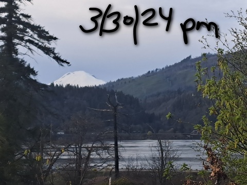
Mt. Hood Snow Forecast
A couple more sunny days are on tap for the mountain before we plunge right back into sub-freezing weather. Get the spring skiing while you can! There’s quite a bit of range in the precip forecast models for the next couple of weeks – they’re calling for anywhere from 1.0” to 3.0” water equivalent. Hard to say how much snow we’ll get given that range, but we will start with a few inches on Wednesday.
But first… a sunny Monday. The free air freezing level (FAF) starts at 9000′ and rises to 10,000′. It stays there overnight. Temps start near 40 and rise to 50 or so at 5000′. Despite the warmth, the snow should start hard-frozen. Get it before it turns to slush! Skaters: Meadows was 10/10 on Sunday and should repeat that on Monday. Wind will be N 25 in the morning, N 15 in the afternoon, and W 5 overnight. Thanks to radiational cooling, the snow should refreeze overnight despite the warmth. That’ll lead to corn snow on Tuesday. The FAF Tuesday will be 10,000′ all day and will fall to 4000′ overnight as the next system arrives. Wind: light westerlies early, SW 10-20 in the afternoon, and W 35 overnight.
Light snowfall is forecast Wednesday daytime. That’s followed by partly cloudy weather in the evening and a return to light snowfall (from the east, not the west!) overnight. The snow level will be 4000′ early, 3000′ in the afternoon, and 2000′ after midnight. About 0.3” water equivalent (WE) is forecast. Call that 3” of new snow. Wind: W 35 early, NW 10-15 in the afternoon, and light/variable overnight. Wraparound moisture on Thursday might bring in a few more inches of snow, but these situations are hard to predict. Looking longer-range, models keep temps at 850mb (5000′ or so) sub-freezing between this Wednesday and the next. All we need with that is some moisture! Enjoy!
A poem:
Was that forecast helpful?
Did it save you time or gas money?
Did it make your life more fun?
Then please make a contribution.
Writing this takes me an hour or two a day.
Without your support, I can’t keep it up.
Keep the forecast going.
Subscribe or donate.
And share my forecast with your friends!
 |
 |
 |
|
Not ready to subscribe? No problem – please share this forecast with all your friends too!
Or try a month for free!

Gorge Wind Forecast
Hi friends! Mother Nature’s dishing up some west wind this week. The first two days of it – warm and sunny – will spoil you for the rest (colder). Monday’s wind is brought to you by stable conditions, offshore high pressure, and a shift of the warmest temps to the east side. The day starts with 19-22 from Viento to Mosier with 11-14 at Stevenson and east of Mosier to Arlington. Stay close to Hood River. The wind rises to 24-27 from Stevenson to Mosier mid-morning with 14-17 from Lyle to Doug’s and 11-14 out east. Models knock the wind back down to 22-25 from Stevenson to Avery in the afternoon. East of there: 11-14 or less. River flow Sunday was 123-159kcfs, river temp is 48.38F, and high temp forecast is 70F. Nice!
Tuesday starts with light westerlies, less than 10mph. We’ll see a slow build to 13-16 from Stevenson to Mosier. In the evening, as temps drop on the west side and hold out east, westerlies pick up to gusty 20-23 from Stevenson to The Dalles for the Executive Session (after 5pm). East of The Dalles: 12-15 as far east as Amayah’s (or Rufus). High temp will be 77F. A cold front swings towards us on Tuesday night. The strongest dynamics, unfortunately, will happen while we’re all sleeping. That leaves us with 14-17 west of The Dalles Wednesday morning and 19-23 out east. Afternoon wind rises to 21-24 from Mosier to Rufus. West of there: 11-14. This could still change, but models have backed off. High temp: 50-55F. West wind sticks around through Saturday, at least. As of right now, models are very enthusiastic about Saturday, but that’s a long ways out to count on. We’ll keep an eye on it!
 |
|
Jones, Sauvie’s, Coast Forecast – On vacation ‘til summer unless otherwise noted
Very basic Hood River weather forecast. Don’t plan your life around this. You really should read TATAS
Monday will be sunny. Temps start near 40 and climb to 70 or so. Moderately strong westerlies. No rainbows. Tuesday will be mostly clear. Temps start in the mid 40s and rise to the upper 70s. Calm wind early. Moderate westerlies later. No rainbows. Wednesday will be high cloudy and then drizzly then mostly cloudy. Temps start in the low 40s and rise to the mid 50s. Moderate westerlies. 99% chance of rainbows. Read Temira’s Awesome Travel Advisory Service on Facebook for a detailed forecast that may help you plan your day.
Local-ish Events
Please let me know of outdoor-related local-ish events. If you don’t tell me, I don’t know!
Indian Bowl and Roll (the baby sis to Amayah’s) opens April 5th in Hood Rivert. The White Salmon – Bingen community-wide yard sale is April 19th and 20th. On April 16th at 6pm, Master Gardener Denis Carlson gives a talk at the Hood River Library on controlling rodents in your garden.
Regular weekly events:. NK Studio’s by-donation Tuesday morning yoga class is back. Ferment’s Tuesday night 4-mile walk/run is at 6pm. There’s meditation with monks at 5:15pm (an hour) and 6:30pm (30 minutes plus a talk) at Yoga Samadhi in White Salmon. The Tri Club is done for the season. At 7:15am on Wednesdays, there’s a run from the White Salmon Bakery. At 7am on Friday morning, there’s a run from Pine Street Bakery. On Fridays at 2:30pm, there’s a free meditation and stretching class at Yoga Samadhi. On Saturday at 9am, there’s a by-donation outdoor group fitness on the 2rd floor deck about Ferment Brewing.
Cycling
Definitely got a Tack Alert going on out there right now – lots of good dirt. Some areas of Post are still muddy (shady, cool areas), so consider choosing a different spot to ride. You’ll have Post all summer long! Sisterwives and Kleeway in Post Canyon are currently closed for rebuilding. It’s trailbuilding season. Get on the HRATS mailing list if you’d like to help out. If you’re parking at Post Canyon, you will need a parking pass. Those can be purchased at many local shops or online.
Sprinter Van of the Week!
 Click here for the Sprinter Van map of the world!!!
Have an awesome day!
PREVIOUS POSTS
- Friday Gorge wind forecast: today’s probably the lightest of the bunch. TATAS Weather: too hot for TATAS.
- Thursday Gorge wind forecast: breezy and warm through Monday. Gorge weather forecast: building heat…
- Wednesday Gorge wind forecast: strong today, windy through the weekend despite the heat. if you’re seeing yesterday’s forecast, try an private browser window.
- Tuesday Gorge wind forecast: breezy through Thursday, then breezy again for the weekend. TATAS weather: mostly 90+ degrees.
- Monday Gorge wind forecast: hot, and maybe just enough. Gorge weather: cooler Tuesday/Wednesday and breezy.

Have an awesome day.
Love, Temira