Thank you for using this forecast. I offer it freely so you can have more fun and plan your life. It does take significant time and energy to produce. If you find yourself using it often, or if you feel your life is more awesome because of my work, please make a donation. You can get this forecast via email by donation. The email subscription isn’t $99/year. Not $50/year. Donating $12.34 or more gets you on the list for 12 months. Thank you for your support and thank you for trusting my forecast.
Click here to donate using a credit card.
Click here to donate via PayPal.
Venmo: @theGorgeismyGym
Snail Mail: PO Box 841, Hood River, Oregon 97031
Get the email version free through the end of October – try it out! Click here.
| Your favorite beach | Dawn Patrol |
9am- 11:30a |
11:30a- 3pm |
3pm- dusk |
|
|---|---|---|---|---|---|
| Rooster Rock | LTV | E5-10 | E10-15 | E10-15 | |
| Steven’s Locks | LTV | E10-15 | E15-20 | E15-20 | |
| Swell-Hood River | LTV | LTV | LTV | LTV | |
| Doug’s, Lyle, Rowena | LTV | LTV | LTV | LTV | |
| Rufus, etc. | LTV | LTV | LTV | LTV | |
| Roosevelt & Arlington | LTV | LTV | LTV | LTV | |
Gorge Wind Forecast
There’s not much gradient and not much wind to start Sunday, and there won’t be much during the day. Wind action will get much more exciting Tuesday into Wednesday, but temps will be so cold you probably won’t want to be on the river!
For Sunday: light and variable wind starts the day. It picks up to E 10-15 near Viento and Rooster with 15-20 near Stevenson in the afternoon. Light and variable wind kicks off Monday. That’ll pick up to W 13-16 from Stevenosn to Hood River in the afternoon with light east wind or light and variable wind east of there. Very strong easterlies move in everywhere overnight.
For Tuesday morning, river-level easterlies will probably be in the 30-40+ range near Rooster and Stevenson with 25-30 near Viento. Temps will be in the mid 20’s. The cold pool will be deep enough that easterlies will also be pouring over the Cascades, giving us the PNW equivalent of California’s Santa Ana winds. Technically, these are called “downslope windstorms”. It’s likely that wind speeds in areas to the west of the Cascade hills will experience very strong wind. Power outages are likely in the Metro Area.
Back to The Gorge… the cold pool becomes more shallow on Wednesday. As easterlies are confined to the Cascade gaps (the Gorge, Enumclaw, etc.), wind speeds through those gaps will increase. Expect 50-60 Wednesday morning with 30-40 Wednesday afternoon. That’s for Rooster. Call it 35-45 for Stevenson. With temps in the low to mid 20’s Wednesday morning, you won’t be on the water anyway! It’s actually possible we could see a return to moderate westerlies on Thurday, but models tend to be too quick on eroding east side cold air. So… we’ll wait for Tuesday’s forecast before making a real prediction.
COAST, JONES, SAUVIE’S: Detailed forecast was on winter break, but it’s back because of coastal wind… Swell forecast by NWS. Wind: north coast/central coast/south coast. Sunday: side-offshore 5-10/15-20/30-35, NW swell 6′ at 11 seconds. Monday: 5-10/15-20/30-35, NW 5′ @ 13. Tuesday: E 15-20/NE10-15/N20-25, W 6′ @ 15 – good day to go watch surfers at Seaside or get some yourself anywhere on the north coast.
Hood River Weather Forecast
Saturday’s thunderstorm was exciting, and sure caught this forecaster off guard! Nothing of the sort will happen on Sunday. Temps will be in the upper 20’s early and mid 50’s later. Light east wind. No rainbows. Monday looks cold and clear. An arctic front Monday night crushes the temperatures. They’ll be in the upper 20’s early and mid 50’s in the afternoon with mid-20’s overnight. Light west wind turns easterly overnight. No rainbows. Tuesday looks cold and extremely dry. Temps will be in the mid 20’s early and low 40’s later. It’s actually possible temps won’t make it out of the 30’s. Widespread east wind. No rainbows.
Looking for a complete Columbia Gorge forecast? Looking for more humor in your weather? Obscenities? You’re looking for my TATAS: Temira’s Awesome Travel Advisory Service on Facebook.
Road and Mountain Biking
FREEZE-THAW WARNING: overnight temps well below freezing will cause freezing and thawing of tacky dirt. Trail tread will be both muddy and extremely delicate in areas not under the canopy. Please don’t ride the trails if you see mud. You’ll do significant damage. Trail sensitivity will increase dramatically as overnight temps drop this week – please avoid Syncline, as it’s the most susceptible to daytime warming and resulting bike tire damage. Remember that the southern half of Whoopdee has been logged (is gone). Riding Underwood? No parking at the trailhead – you’ll need to drive ½ mile east of the trailhead and park there.
Upcoming Events
On Sunday: $5 yoga at Samadhi in White Salmon at 9am and zen meditation at Hood River Foundation for Vibrant Living from 3pm to 5pm. The Hood River County Recreation Trails Committee meeting is Tuesday at 5pm at the Board of Comissioners room at 6th and State. Next Saturday afternoon, 2pm-6pm, is the “Fill Your Pantry” farmers market at Rockford Grange.
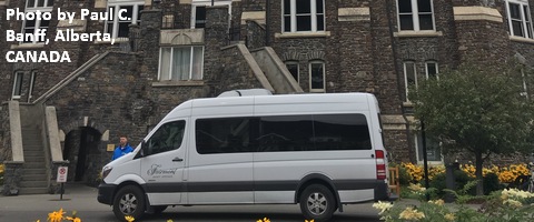
White Sprinter Van of the Week!

Click here for the White Sprinter Van map of the world!!!
Random Morning Thoughts: on vacation.
Click here for the full events calendar.
Have an awesome day today!
Temira


