


Thank you for using this forecast. Like it? Find it useful? Support it (and me!) by sending some cash my way. Why? It takes me an hour or two each morning to produce this, and it makes your life better, safer, and more fun. That’s worth something! You can get the email version sent to you. Not $99 a year. Nope. Not $49. Just $12.34 or more gets you a subscription. Click below to give financial support. Thank you!!
Credit card payments click here – – – – – – – – – Click here to use your PayPal
Venmo: @theGorgeismyGym
Snail Mail: PO Box 841, Hood River, Oregon 97031
(note: I am not a non-profit entity. The only way to accept credit cards with a user-defined amount is to use the ‘donate’ button. Thanks for understanding!)
Auto-renewing subscription. New! Awesome!
The Forecast
| 4a-8a | 8a-12p | 12p-4p | 4p-8p | 8p-4a | |
|---|---|---|---|---|---|
| Saturday 2000′->500′ |
 |
 |
|
 |
 |
| Sunday 500′->6000′ |
|
|
|
|
|
| Monday 6000′->8500′ |
|
|
|
|
|
Mt. Hood Weather Forecast
Blizzard conditions early Saturday back off into the ‘storm skiing’ range for Saturday afternoon. By midnight Saturday, the snowfall will finish up. We then transition into three or four days of dry weather. Models suggest our next round of snow will be Thursday night as a significant front moves in from the Northwest.For Saturday, expect a blizzard through the time lifts open and storm skiing through early afternoon. The snow level will be 1500-2000′ all day. After the snow stops this evening, the freezing level will fall to 0-500′. About 1.3” water value (WV) will fall during the day, for 12-14” of new snow of the wind-affected powder variety. Another 0.1” falls in the evening, for just another inch. Wind will be NW 50 (problematic) early, NW 30-35 midday (just fine), and NE 20 after midnight.
Sunday looks clear and sunny and cold, warming up after midnight. The free air freezing level will be 500′ early, 2500′ in the afternoon, and 6000′ overnight. Wind will be NE 20-30 early, NNW 10-15 in the afternoon, and N 15 overnight.
Monday looks clear, sunny, and warmer. The free air freezing level will be 6000′ all day and 8500′ after midnight. Wind: N 15 early, NE 10-15 in the afternoon, NW 10 after midnight. Ditto on Tuesday with a free air freezing level around 8000′ and NW 10-15. the wind picks up and temps start to drop on Wednesday with a chance of a few flurries. The latest model runs suggest a foot of snow Thursday night into Friday. Enjoy the variety of weather this week!
Gorge Wind Forecast
Strong offshore high pressure on Saturday morning combines with a low moving inland into BC for a strong west wind day. Expect 25-30 in the west early-early with 15-20 east. The wind quickly builds to 30-35 from Moiser to Rufus after sunrise with 28-32 at Arlington. The strongest wind lasts through noon or 1pm before fading to 28-32 from Mosier to Arlington for a few hours and then dropping rapidly after 4pm. Areas west of Swell will likely stay showery all day, lowering wind quality. Clouds will likely make Swell gusty, but still, 25-30 is possible there through early afternoon.Sunday looks light and variable. Monday starts with 18-22 from Viento to Hood River, fills in to Stevenson, and then quickly fades to 10-13 in the afternoon. Keep an eye on Tuesday for a chance at 18-21 from Stevenson to Hood River with 55 degree air temp. River flow is 232kcfs and temp is 39 degrees.
COAST, JONES, SAUVIE’S: Detailed forecast is on winter break.
Hood River Weather Forecast
A showery, mostly cloudy morning sees showers decrease after late morning. Temps will be in the low to mid 40’s all day. Strong west wind. 99% chance of rainbows. Sunday looks partly cloudy early and clear in the afternoon. Temps will be near 30 early and in the mid 40’s later. Light and variable wind. No rainbows. Monday looks sunny. Temps will be in the upper 20’s early and upper 40’s later. Moderate westerlies go light in the afternoon. No rainbows. Next rain: Thursday afternoon. Looking for a complete Columbia Gorge forecast? Looking for more humor in your weather? Obscenities? You’re looking for my TATAS: Temira’s Awesome Travel Advisory Service on Facebook.Road and Mountain Biking
Post, Whoopdee and Hospital are definitely too muddy to ride without doing damage. Syncline may be rideable today (with freeze-thaw above 1500′), but it’s going to be too windy to be pleasant. Warmer weather next week will make it tempting, but it appears overnight temps will dip below freezing. Please don’t. Freeze-thaw conditions will be prevalent on Syncline, Hospital, and Post, and you will do significant and permanent damage. Better: gravel riding.Upcoming Events
You can volunteer at the Rebuild-it Center from 9am to 1pm on Saturdays. Coming up Sunday: Zen meditation from 3-5pm at Hood River Foundation for Vibrant Living. An ice cream social at Rockford Grange from 4:30 to 6:30. Indoor Ultimate Frisbee ($5) at Hood River Middle School from 5pm to 7pm.
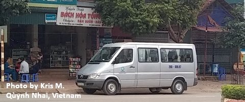
White Sprinter Van of the Week!
Click here for the White Sprinter Van map of the world!!!
Random Morning Thoughts: on vacation.
Click here for the full events calendar.
Have an awesome day today!
Temira
