Support it with a contribution!

Thank you for using this forecast. Writing it takes 60-120 minutes a day; I can only keep it going with your generous financial support. Make a contribution or subscribe and get it in your inbox with bonus material. What’s that cost? Not $99 a year. Nope. Not $49. Contribute $19.99 or more, and you’re on the list for a year. People are added to this list on Thursday and Sunday. Thanks for your patience! Click below to contribute and keep the forecast going for everyone, nearly every day.
Click here to use your PayPal
Venmo: @theGorgeismyGym
Snail Mail: Temira Lital, PO Box 841, Hood River, Oregon 97031
(note: I am not a non-profit entity. The only way to accept credit cards with a user-defined amount is to use the ‘donate’ button. Thanks for understanding!)
Auto-renewing subscription. New! Awesome!
The Forecast
| 4a-8a | 8a-12p | 12p-4p | 4p-8p | 8p-4a | |
|---|---|---|---|---|---|
| Wednesday 3500′->10,000′ |
 |
 |
 |
 |
 |
| Thursday 10k’->12k’->8500′ |
 |
|
|
|
|
| Friday 8500′->2500′ |
|
 |
|
 |
|
Mt. Hood Weather Forecast
A mix of rain and snow fell on Mt. Hood over the last 24 hours. The next 24 will be warm and wet as a tropical atmospheric river focuses on Washington and brushes Oregon. Temps finally drop back to the snow zone Friday morning, but most of the precip will be done by then. Weekend weather looks dry for now, but there’s some variation in model predictions.
Looking at Wednesday, we have temps cold enough for snow at T-Line and Meadows base right now, but not much precip in the air. The snow level climbs from 3500′ this morning to 10,000′ this afternoon and stays there all night. A trace of snow is forecast during the day. Overnight, about 0.5” rain will fall. Wind: W 35 this morning fading to WSW 10-15 this afternoon and rising to SW 25-40 overnight.
Thursday looks rainy. The snow level will be 10,000′ early, 12,000′ in the afternoon, and 8500′ after midnight. Thankfully, most of the moisture will fall north of the Columbia River; Mt. Hood will see about 0.1” rain during the day and 0.5” rain overnight. Wind: SW 25-45 most of the day turning to NW 15-20 after midnight.
The snow level falls to 4500′ around sunrise Friday and keeps dropping. By the afternoon, it falls to 3500′, and after midnight, to 2500′. Unfortunately, most of the moisture will be gone by this time. Just 0.3” water equivalent (WE) is forecast early Friday morning during a period when the rain will be transitioning to snow. That could give the slopes 1-3” snow, but it’ll most likely be the lower end of that. Just a trace is forecast during the day. By afternoon, the weather turns dry and sunny. Wind: NW 15-20 early, NW 20-25 mid-morning, NW 15-20 in the afternoon, and E 25 after midnight. Saturday looks dry, sunny, and cooler with the free air freezing level around 2500′. Don’t panic. Snow will come!
Gorge Wind Forecast
A very active weather pattern continues, and that means gusty wind for the Gorge. A few days of gusty westerlies are followed by a shot at strong easterlies. Wednesday’s starting off with strong wind at Viento and Arlington and light wind everywhere else. Speeds will settle down quickly. By late morning, we’ll have 7-10 western Gorge, 10-13 at Avery, and gusty 18-23 east of Avery. That should last through the day. Thursday looks light and variable everywhere but areas west of Cascade Locks. You’ll find 10-15mph westerlies in the far west Gorge. A much better setup is forecast for Friday. Offshore high pressure builds behind a departing front. Westerlies start at 22-26 from Stevenson to The Dalles and drop to 17-21 by mid-morning. That wind holds through the evening. It’s possible we’ll see stronger wind than that, especially early. Saturday and Sunday and perhaps Monday are looking like strong east wind days.
Coast, Jones, Coast
Done until spring, unless there’s an obvious Coast or Sauvie’s or Jones day.
Hood River Weather Forecast
A mostly cloudy day turns rainy after 5pm. Temps will be in the low 50’s early and mid 50’s later. Light westerlies. 39% chance of rainbows. Thursday will be drizzly or misty or sprinkly in the morning, dry in the afternoon, and rainy overnight. Temps will be in the upper 40’s early and mid 60’s later. Light and variable wind. 22% chance of rainbows. Friday will be rainy in the morning and dry in the afternoon. Temps will be in the upper 40’s early and upper 50’s later. Moderate to strong westerlies early turn moderate later. 99% chance of rainbows.
Looking for a complete Columbia Gorge forecast? Looking for more humor in your weather? Obscenities? You’re looking for my TATAS: Temira’s Awesome Travel Advisory Service on Facebook.
Cycling
SDS, Kreps, and DNR lands have all reopened. Regulated use closure has ended and motorized use is allowed on moto trails. Be aware of recent snowfall about 4500′ or so and plan your rides accordingly.
Local Events
On October 30th, the Hood River Watershed Group has a work party on Whiskey Creek.
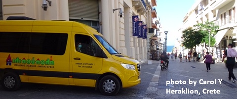
Sprinter Van of the Week!
 Click here for the Sprinter Van map of the world!!!
Have an awesome day!
Click here for the Sprinter Van map of the world!!!
Have an awesome day!