| Mt. Hood Snow Forecast – 5000′ |
|
4a-8a |
8a-12p |
12p-4p |
4p-8p |
8p-4a |
Thursday
10,000′->9000′ |
 |
|
|
 |
|
Friday
9000′->2500′ |
 |
 |
 |
 |
|
Saturday
2500′->10,000′ |
|
|
|
|
|
Mt. Hood Weather Forecast
About 0.6” rain fell overnight on Mt. Hood, and the rain will continue through Friday morning. A quick switch to snow is followed by a quick end to the precipitation with sunny sky for the weekend.
Thursday starts with the snow level around 10,000′. It stays there all day and falls to 9000′ after midnight. About 0.1” to 0.2” rain is forecast during the day. That’s followed by 0.7” rain overnight. Wind: WSW 25-40 in the morning, SW 20-40 in the afternoon, and W 20 overnight.
As a cold front swings through on Friday morning, the snow level falls from 9000′ to 5500′ by 8am. Clear sky after that sees the free air freezing level fall to 5000′ in the afternoon and 2500′ overnight. About 0.3” water equivalent (WE) is forecast while the snow level is falling early in the morning. That’s going to be mixed precip. Expect up to an inch or two of slushy, wet, snainy accumulation at 5000′. Another 0.1” WE is forecast after the snow level settles at its lowest, for up to an inch of additional snow. Wind: W 20 early, NW 25-30 around sunrise, NW 15-20 in the afternoon, and E 25-30 after midnight.
On Friday morning, cool air stacks up against the east side while warmer air pushes in from the SW. This starts the free air freezing level (FAF) at 2500′. It’s rises to 10,000′ or so in the afternoon with pockets of cooler air in spots thanks to easterly flow. Wind: E 25-30 all day fading to E 20-25 after midnight. Sunday sees the FAF at 11,000′ to 12,000′ under sunny sky with east wind at 20-25mph.
Gorge Wind Forecast
Not much happens wind-wise on Thursday, but Friday, Saturday, and Sunday all have the potential for you to get on the Columbia. We’ll have westerlies Friday and strong easterlies on the weekend, possibly all the way through Monday morning.
Thursday, however, will be mostly a not-windy day. Light and variable conditions start us off. In the afternoon, the wind picks up to gusty 10-15 in the far western Gorge, west of Cascade Locks. Models hint at a chance of gusty 14-18 from Avery to Rufus this afternoon with light westerlies to the east and west of that stretch. River flow is 58,400cfs, river temp is 58F, and high temp forecast is 62F.
A cold front swings through on Friday morning and high pressure builds offshore behind it. The wind is likely to beat the models. Here’s what the models say: westerlies at 23-27 from Stevenson to Rufus right off the bat. That lasts a few hours and fades to 18-22 from Stevenson to Rufus with 10-13 in the eastern Gorge. Don’t be surprised if the wind holds at 21-24 from Stevenson to The Dalles. High temp: 58F. We’re looking at easterlies this weekend. Saturday starts with 30-40 at Rooster and 25-35 at Stevenson. Afternoon: 30-35 at Rooster and 20-25 at Stevenson. Copy that for Sunday. Enjoy!
Coast, Jones, Coast
Done until spring, unless there’s an obvious Coast or Sauvie’s or Jones day.
Hood River Weather Forecast
Cloudy sky with sprinkles this morning turns dry midday and rainy overnight. Temps will be in the upper 40’s early and mid 60’s later. Light westerlies or light/variable wind. 68% chance of rainbows. Friday starts with moderate rain around sunrise and then quickly turns dry by late morning. Temps will be in the upper 40’s early and upper 50’s later. Moderate to strong westerlies. 89% chance of early morning rainbows. Saturday will be clear with a good chance of frost. Temps will be in the mid 30’s early and mid 50’s later. Sunny! Easterlies. No rainbows. Ditto for Sunday.
Looking for a complete Columbia Gorge forecast? Looking for more humor in your weather? Obscenities? You’re looking for my TATAS: Temira’s Awesome Travel Advisory Service on Facebook.
Cycling
SDS, Kreps, and DNR lands have all reopened. Regulated use closure has ended and motorized use is allowed on moto trails. Be aware of recent snowfall about 4500′ or so and plan your rides accordingly.
Local Events
On October 30th, the Hood River Watershed Group has a work party on Whiskey Creek.
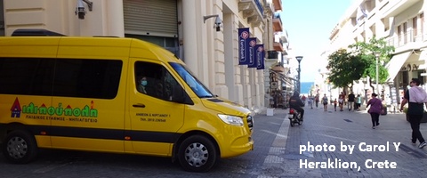
Sprinter Van of the Week!
 Click here for the Sprinter Van map of the world!!!
Have an awesome day!
Click here for the Sprinter Van map of the world!!!
Have an awesome day!
PREVIOUS POSTS

Have an awesome day.
Love, Temira


