

GORGE WIND FORECAST
If you’re still seeing yesterday’s and it’s after 9am, try opening this in an incognito window
SHORT-TERM gorge wind forecast
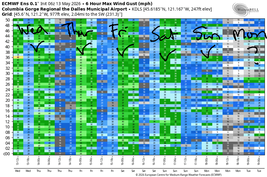
Hi friends! A windy day is on tap today, and west wind of some sort continues all the way through the weekend. Most of this wind will be focused on areas east of Hood River thanks to plenty of cloud cover on the west side. Prepare yourself for somewhat chilly temps – most of the time, most of the places, highs will be 70F or less.
Wednesday started with pressures of 29.93/29.82/29.64 for gradients of 0.11/0.18. Offshore: 30.24 for a whole lot more support. West side: cloudy all day. Early wind was bouncing around in the 20-30mph range east of The Dalles with 15-20mph west of The Dalles (and 29mph at Viento). Areas west of Lyle hover in the gusty 15-20mph range this morning. Models are a bit uncertain about the afternoon for the Corridor. With a forecast for at least some clearing, we could see gusty 23-26+ late morning or early afternoon from Viento to Hood River. Mosier is the questionable zone today – its performance really depends on where the clouds break up. Might be gusty low-mid 20s, might be nuking!
Now, let’s look at the Near East and East: between Lyle and Boardman, afternoon wind rises to 31-35mph late morning and holds until late afternoon before the wind drops to 27-30mph. Go get some! River flow over the last 24 hours was 214-249kcfs (239-247 at Rufus), river temp is 58.1F, and high temp forecast is 62F in Hood River and 70F in the desert.
RIVER FLOW FOR SITES BETWEEN AVERY (EAST OF THE DALLES) AND RUFUS: CLICK HERE FOR JOHN DAY DAM FLOW.
RIVER FLOW FOR SITES BETWEEN STEVENSON AND DOUG’S BEACH (WEST OF THE DALLES): CLICK HERE FOR THE DALLES DAM FLOW

LONGER-TERM gorge wind forecast
Another round of west wind is forecast on Thursday, strongest in the afternoon. Daybreak: cool, cloudy, and potentially a little drizzly with westerlies below 10mph west of The Dalles and 11-14mph from Avery to Boardman. You’ll have to wait for an approaching system to nudge the wind up in the afternoon. After 2pm, we’ll have gusty 16-19mph from Stevenson to Hood River with gusty 20-24mph from Mosier to Arlington, perhaps a bit more near Rowena and Doug’s. All that said… that forecast is from the GFS. The ECMWF are MUCH more optimistic about Thursday and indicate the possibility of 30-35mph. The Euro actually calls for more wind on Thrusday than on Wednesday, so keep your options open! High temp: SIX-SEVEN degrees in Hood River and 74F in the desert.
Lots of moving pieces are in the picture on Friday morning. Generally speaking, the wind starts light west of The Dalles and 15-20mph east to Boardman. Afternoon wind rises to 25-28mph from Lyle to Boardman with gusty 16-19mph from Stevenson to Mosier. Strongest wind looks to be after 5pm. High temp: 63-69F.
Moderately strong (mid-20s or so) westerlies continues both Saturday and Sunday with lesser, but still likely, westerlies on Monday. Beyond that, uncertainty increases. I’ll leave it here for now. Have an awesome day on the Nch’i Wana today. I hope to see you out there!

Was that helpful? I knew it was! Guess what? All of this crucial work – from your personal wind and snow reports to the invaluable TATAS updates – is made possible by my relentless efforts. Maintaining this labor of love isn’t easy. Each daily forecast takes hours. Website hosting, weather model access, and back-end admin work takes time and money. That’s where you come in.
YOUR CONTRIBUTION MAKES A DIFFERENCE
- SUPPORT ACCURATE, HYPER-LOCAL WEATHER FORECASTING
- ENABLE ACCESS FOR ALL, EVEN THOSE WITH LESS MEANS
- SUPPORT A COOL HUMAN WHO WORKS HARD SO YOU CAN PLAY
Take a moment to click one of the buttons below. Donate $19.99 or more (how much does this forecast enhance your life?) and get the email in your inbox. Whether it’s a renewing subscription (auto-renew) or a one-time donation, every contribution makes a real difference. Help me keep this labor of love alive, so we can all continue playing, commuting, and living in the Gorge with peace of mind and the best weather forecasts possible. Thank you!


Hood River, Oregon 97031


JONES BEACH, SAUVIE ISLAND, & COAST FORECAST
Wind northerly unless otherwise indicated. For coast, it’s North/Central/South with the “central” at approximately Florence. Swell forecast from NWS for central coast. Jones: westerly unless otherwise stated. Sauvie Island: northerly unless otherwise stated. Coast Wednesday: SW10-15/WSW20-25/LTV, W swell 7′ at 12 seconds. Thursday: SW10/LTW/N20-25, W 5′ @ 10. Friday: W 15-20/WNW10/N20-25, W 6′ @ 15. Jones Wednesday: 10-13. Thursday: LTW. Friday: 7-10. Sauvie Island Wednesday: SW 101-5. Thursday: 10-13. Friday: W 10-15.
BARE BONES HOOD RIVER WEATHER FORECAST
Clouds and drizzle this morning. Partly cloudy this afternoon. Temps start in the mid 50s and rise to the low 60s. Moderate westerlies. 97% chance of rainbows. Thursday will be cloudy with sprinkles then partly to mostly sunny. Temps start in the upper 40s and rise to SIX-SEVEN degrees. Light westerlies early. Moderate later. 98% chance of rainbows. Friday will be cloudy to start with a few sprinkles. Afternoon: partly cloudy. Temps start in the mid 40s and rise to the low 60s. Light westerlies early. Moderate later. 95% chance of rainbows.
TEMIRA’S AWESOME TRAVEL ADVISORY SERVICE
HYPERLOCAL WEATHER FORECAST FOR THE COLUMBIA GORGE
THE DALLES, HOOD RIVER, WHITE SALMON, TROUT LAKE, STEVENSON, CASCADE LOCKS, PARKDALE, ODELL, HUSUM, BZ, MILL A, WILLARD, GOLDENDALE, RUFUS, ARLINGTON, boardman

Good morning, neighbors! Exciting stuff happened last night: there was thunder! And along with the thunderstorm that meandered from south to north, there was rain. An area in line from Trout Lake to Mt. Hood received between 0.2” to 0.36” rain last night. Elsewhere, rain totals ranged from zero to a bit over a tenth of an inch. Non-convective rain is continuing this morning west of Wyeth – it’s pouring in the commuter zone between Cascade Locks and Troutdale. Be careful out there!
Glenwood this morning
While the roads aren’t icy this morning, and Glenwood is 49 degrees, there’s a slight chance of !CE. Yesterday in The Dalles, a suspicious pair was spotted, but not confirmed as The Droids You’re Looking For: a black Dodge Charger and a black Dodge Durango, the latter with concealed lights. Do keep an eye out for these vehicles in the Gorge today, and call Portland Immigrant Rights Coalition, 888-622-1510, if you see them!
Today’s Gorge weather forecast
In other weather news… you may have noticed that this morning is different than yesterday. It’s cloudy and breezy and cool. Expect this to persist. Heavy rain continues west of Wyeth until 11am, and drizzle continues to Cascade Locks through 5pm. This morning’s sprinkles east of The Dalles fade mid-morning, but drizzle continues east of the Arlington Triangle into late afternoon. Partly cloudy sky lingers all through the Gorge all day long. Wind speeds climb to 15-25mph west of Mosier and 30-35mph from Lyle to Boardman this afternoon as temps rise to the low 60s (Hood River), SIX-SEVEN degrees (The Dalles), and 70 degrees (Pasco). It’s worth mentioning that there’s a wind advisory / high wind warning posted today. Be very, very careful with fire today – while things aren’t bone-dry, they are dry as my aged vag*na, and any fires that start will spread quickly. One last thing – the snow level will fall to around 4000′ today. Not a great day to be playing in the mountains.
Thursday’s Gorge weather forecast
Overnight, the wind dies down, and clouds return. Opening play is low clouds to the west and partly cloudy sky to the east with temps in the upper 40s and light west wind. Afternoon brings mostly clear sky with temps rising to SIX-SEVEN degrees (Hood River), 71 (The Dalles), and 74F (Pasco. Wind will rise to 15-20mph west of Mosier and 20-25mh from Mosier to Arlington’s Triangle.
Friday’s Gorge weather forecast
Chilly air aloft combines with clouds as far east as Biggs on Friday morning for a 45 degree start. Drizzle extends as far east as High Prairie in elevated areas, but there won’t be much drizzle in the lowlands. Above 3500′: snow flurries. Wind starts light westerly west of The Dalles with 15mph east of The Dalles. Afternoon brings temps at 63-69F and westerlies at 15-20mph west of Lyle and 20-30mph from Lyle to Boardman.
Extended Gorge weather forecast
Another round of actual rain is forecast west of the actual town known as Actual Mosier on actual Saturday as temps remain unseasonably cool: 59-66F for highs. While temps aloft will be quite cold, cloud cover Saturday morning should protect us from frost. Wind on Saturday maxes out around 20-30mph out of the west. We’ll add about five degrees of warmth to the highs on Sunday. As of right now, Sunday presents the highest risk of frost. Mostly clear sky combines with 850mb temps near 0C and light to moderate west wind to start the day.
After Sunday, we should be risk-free. I plan to plant my peppers on Monday, but you do you, boo. It is likely Mt. Defiance will pick up a dusting of snow in the next few days, and I’m not sure what we’re supposed to do if Mt. Defiance was snow-free and no longer isn’t? Pull the already-planted tomatoes out of the ground? Safe travels. -TATAS
HEY! DON’T STOP READING! Is this community-focused forecast helpful to you? It sure is! It takes me a couple hours a day to write. Please join your friends and neighbors in contributing to keep it going. Venmo: @thegorgeismygym PayPal: twomirrors@gmail.com USPS: Temira / PO Box 841 / Hood River, Oregon 97031 You can test out the forecast subscription for a few days for free by signing up below. Easy! Do it!
MT HOOD SNOW FORECAST

QR codes and links for end-of-season tips – thank you!!!
Cash/check: Temira – PO BOX 841 – Hood River, Oregon 97031


