
Thank you for using this forecast. Like it? Find it useful? Support it (and me!) by sending some cash my way. What’s it cost to support me and get the email version? Not $99 a year. Nope. Not $49. Just $19.99 or more gets you a year. People are added to this list on Thursday and Sunday. My day job is crisis mental health, and I don’t have time on other days. Thanks for your patience! Click below to contribute. Thank you!!
Click here to use your PayPal
Venmo: @theGorgeismyGym
Snail Mail: PO Box 841, Hood River, Oregon 97031
(note: I am not a non-profit entity. The only way to accept credit cards with a user-defined amount is to use the ‘donate’ button. Thanks for understanding!)
Auto-renewing subscription. New! Awesome!
The Forecast
| 4a-8a | 8a-12p | 12p-4p | 4p-8p | 8p-4a | |
|---|---|---|---|---|---|
| Sunday 3000′->4000′->3000′ |
 |
|
|
|
|
| Monday 3000′->4000′ |
|
 |
|
 |
|
| Tuesday 4000′->10000′ |
|
|
|
|
|
Mt. Hood Forecast
Light snowfall this morning probably sticks around all day (it’s Sunday). For the rest of the week, we have flurries on Monday, sunshine and warm weather through Thursday, and perhaps a return to wet weather next weekend.
Looking at Sunday, we have snowflakes all day. The snow level will be 3000′ in the morning, 4000′ in the afternoon, and 3000′ after midnight. About 0.1” water equivalent (WE) is forecast during the day, for an inch of new. Same overnight. Wind: SW 10-15 in the morning, W 15 in the afternoon, and W 20 overnight.
Monday looks cloudy with flurries in the morning and partly cloudy or clear in the afternoon. Overnight weather will be clear. The snow level will be 3000′ in the morning and 4000′ from mid-afternoon on. Just a trace of snow will fall. Wind: W 20 in the morning, WNW 15-20 in the afternoon, and NW 10-15 overnight.
Sunday returns on Tuesday with the freezing level rising from 4000′ in the morning to 10,000′ overnight. Wind: NW 10-15 early, W 15 from mid-afternoon on. Wednesday and Thursday both look sunny and warm with slopeside temps rising near 50F in the afternoon. We are looking at a return to precipitation next weekend, but it’s not yet clear what type… Enjoy the week!
Note on wind speeds. Different wind directions are experienced in different ways on Mt. Hood. For example, west wind at 50mph will hit the slopes and exposed ridges at W 50. SW 50 may hit the ridges at SW 50, but will likely only be SW 20 below tree line. Hence the ranges for wind. Depends where you are on the mountain. Hopefully that helps clarify.
Gorge Wind Forecast
The Northeast Pacific High will be noticeable weak for the next several days, and weather systems will complicate the picture. Westerlies stick around, but they won’t be all that impressive. Best chance for steadier wind is Monday afternoon. Looking at Sunday, we have a light and variable start. Afternoon wind rises to 5-10 in the west and gusty 18-22 from The Dalles to Rufus. River flow is 185kcfs, river temp is 51F, and high temp forecast is 60F.
Monday starts with W 10-13 all through the Gorge. Midday westerlies rise to 18-22 form The Dalles to Rufus. You might be able to score an executive session: afternoon wind picks up to 22=-25 form Lyle to Arlington. High temp: 59F. Tuesday starts with 5-10 everywhere and picks up to gusty 12-16 everywhere from Stevenson to Arlington. High temp: 65F. It’s possible, but not guaranteed, that we’ll see strong westerlies late Thursday into Friday. Fingers crossed!
Coast, Jones, Sauvie’s
On vacation until the end of snowsports season. Will return in April or May.
Hood River Weather Forecast
Showery weather this morning turns less showery midday and then returns to showery in the afternoon. Temps will be in the mid 40’s early and near 60 later. Light westerlies. 89% chance of rainbows. Monday looks cloudy in the morning and mostly cloudy in the afternoon with scattered sprinkles. Temps will be in the low 40’s early and upper 50’s later. Moderate westerlies. 22% chance of rainbows. Tuesday will be partly cloudy early and sunny later. Temps will be near 40 early and in the mid 60’s later. Light to moderate westerlies. No rainbows.
Looking for a complete Columbia Gorge forecast? Looking for more humor in your weather? Obscenities? You’re looking for my TATAS: Temira’s Awesome Travel Advisory Service on Facebook.
Cycling
Cows are out on Hospital Hill. No parking at the corral. No dogs on the trails. No exceptions. Please respect the wishes of the landowners – they let us use their land, and in return, we respect their rules! Post Canyon: clear of snow to the top of Eldorado, perhaps to top of 140. New Whoopdee: open. Other news: Mountain View Cycles women’s ride is every Thursday, bottom of Post at 5:30pm. Dirty Fingers has Sunday gravel rides. Contact the shops for details.
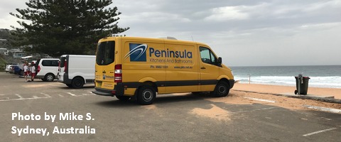
Sprinter Van of the Week!
 Click here for the Sprinter Van map of the world!!!
Local Events
Not much happening thanks to the pandemic… Have an awesome day!