Support it with a contribution!

Thank you for using this forecast. Writing it takes 60-120 minutes a day; I can only keep it going with your generous financial support. Make a contribution or subscribe and get it in your inbox with bonus material. What’s that cost? Not $99 a year. Nope. Not $49. Contribute $19.99 or more, and you’re on the list for a year. People are added to this list on Thursday and Sunday. Thanks for your patience! Click below to contribute and keep the forecast going for everyone, nearly every day.
Click here to use your PayPal
Venmo: @theGorgeismyGym
Snail Mail: Temira Lital, PO Box 841, Hood River, Oregon 97031
(note: I am not a non-profit entity. The only way to accept credit cards with a user-defined amount is to use the ‘donate’ button. Thanks for understanding!)
Auto-renewing subscription. New! Awesome!
The Forecast
| 4a-8a | 8a-12p | 12p-4p | 4p-8p | 8p-4a | |
|---|---|---|---|---|---|
| Saturday 9000′->12000′ |
 |
|
 |
|
 |
| Sunday 12000′->6500′ |
|
|
|
|
|
| Monday 6000′->9000′ |
|
|
 |
 |
|
Mt. Hood Weather Forecast
The forecast for Mt. Hood stays dismal for the next week or so if what you’re looking for is snow. And who isn’t?!?! Even starting next weekend, when models suggest lower temps, there’s no clear sign of cold, snowy weather.
Let’s look at Saturday. It’s currently 40F at the base of Mt. Hood Meadows, at temp more associated with spring skiing than the last few days of November. Today brings another round of light rain to the slopes. The snow level will be 9000′ this morning and will rise to 12,000′ this afternoon. About 0.1” rain is forecast before sunset. Another 0.3” is forecast overnight. Wind SW 10-20 this morning builds to SW 20-45 overnight.
Sunday looks high overcast and dry during the day with light rain after midnight. The snow level will be 12,000′ in the morning, 10,000′ in the afternoon, and 6500′ overnight. Just 0.1” rain is predicted. Wind: SW 20-40 most of the day and W 25 after midnight. Monday will be rainy in the morning and sunny in the afternoon. The snow level will be 6500′ in the morning, briefly as low is 6000′ midday, and 9000′ after midnight. 0.2” to 0.3” rain is forecast. Wind will be W 20-25 in the morning, WSW 15-20 in the afternoon, and W 20-25 overnight.
Looking out into the more distant future, we lean on the ensembles for the forecast. About half of the members suggest a cold front moving in from the east side late next week for cooler surface temps and perhaps a bit of easterly orographic snow. That’s surface air – the vast majority of ensemble members for 850mb (5000′ ish) temps are above freezing through December 7th or 8th. As always, it’s best to be skeptical of extended range forecast details. That said, it’s not looking good for snow. Yet.
Gorge Wind Forecast
Light easterly gradients this fine Saturday morning give just enough wind or some river time. Models then suggest light westerlies the next couple of days. As you may have noticed, forecasting this time of year is really tricky. Use the forecast as a general guide and keep an eye on the river and your river buddies’ text messages.
Saturday starts with E 10-15 at Viento and Rooster. The wind picks up to 15-20 from Rooster to Viento for a few hours in the morning before dropping to E 10-15 in the afternoon. Overnight, the wind turns westerlies. River flow is 42,600cfs, river temp is 49F, and high temp forecast is 54F with rain after 1pm or so. Sunday starts with westerlies at 15-20 west of Bonneville Dam. It looks like the wind could pick up to 14-17 from Stevenson to The Dalles midday before backing off to 8-12 from Stevenson to Arlington early afternoon. High temp: 60F! Monday starts with light westerlies, picks up to 11-14, and backs off to 7-10 in the afternoon. You’ll be dealing with rain through noon or so then sunshine. High temp: 56F.
Coast, Jones, Coast
Done until spring, unless there’s an obvious Coast or Sauvie’s or Jones day.
Hood River Weather Forecast
Clouds this morning stick around and add rain this afternoon. Muggy. Temps will be in the mid 40’s early and mid 50’s later. Calm wind. No rainbows. Sunday will be high overcast. Temps will be in the mid 40’s early and near 60 later. Light westerlies. No rainbows. Monday will be rainy through midday then mostly sunny. Temps will be in the mid 40’s early and mid 50’s later. Light westerlies. 99% chance of rainbows.
Looking for a complete Columbia Gorge forecast? Looking for more humor in your weather? Obscenities? You’re looking for my TATAS: Temira’s Awesome Travel Advisory Service on Facebook.
Cycling
FREEZE-THAW ALERT: if you notice that temps were below freezing last night and will be above freezing today, don’t ride any trail that’s not under a tree canopy. If you do so, you WILL do significant damage. DON’T DO IT! Plentiful rain recently means most tree-covered trails are muddy. Please don’t ride them either. If you do, you’ll be doing significant and possibly permanent damage. No really, please don’t. There are lots of gravel roads and lots of pavement you can ride instead. Enjoy!
Local Events
Please let me know about events. I often only hear about them if you folx let me know!
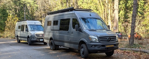
Sprinter Van of the Week!
 Click here for the Sprinter Van map of the world!!!
Have an awesome day!
Click here for the Sprinter Van map of the world!!!
Have an awesome day!