


Get the email free through the end of March – try it out! Click here.
Thank you for using this forecast. I offer it freely so you can have more fun and plan your life. It does take significant time and energy to produce. If you find yourself using it often, or if you feel your life is enhanced by this information, please make a donation. Click right here to donate. I count on your support to pay my bills, and am deeply grateful to you for choosing to help support me. You can get this forecast via email by donation. The email subscription isn’t $99/year. Not $50/year. Donating $12.34 or more gets you on the list for 12 months. Don’t PayPal? Send a check to Temira @ PO Box 841 in Hood River. Thank you for your support and thank you for trusting my forecast.
| 4a-8a | 8a-12p | 12p-4p | 4p-8p | 8p-4a | |
|---|---|---|---|---|---|
| Monday 1000′->2000′->0′ |
 |
 |
 |
|
|
| Tuesday 0′->4000′ |
|
|
 |
 |
|
| Wednesday 4000′->8000′ |
|
|
 |
|
|
Mt. Hood Snow Forecast
The general picture for the next week on Mt. Hood looks something like this: light snowfall followed by clear sky on Monday. Clouds on Tuesday. Light snow switching to light rain, then snow, then rain on Wednesday. After Wednesday, models don’t agree on details. The general picture is intermittently intense rainfall through at least Saturday morning, followed by the potential for a blizzard Saturday night into Sunday. As I said, the details aren’t clear, and things could change.
For Monday, expect orographic (terrain-enhanced) snowfall in the morning and clear sky in the afternoon. The snow level will be around 1000′ early, 2000′ in the afternoon, with freezing temps down to 0′ overnight. About .2” water value (WV) falls in the morning, for a couple inches of snow. Wind will be NW 40 early, fading to WNW 25 in the afternoon and turning to WSW 10-15 overnight.
Tuesday starts off clear, turns cloudy midday, and sees light snowfall after midnight. The free air freezing level will be 0′ early and 4000′ from late morning on. Up to .1” WV falls overnight, for up to 1” of new snow. Wind will be WSW 25ish for the 24 hour period.
Wednesday starts off with snow and then switches to rain, then maybe snow, and then back to rain after midnight. The snow level will be 4000′ early, 6500′ in the afternoon, 5500′ in the evening, and 8000′ after midnight. About .3” WV falls during the day and .1” overnight, for up to 2” of sloppy snow. Wind will be WSW 25 during the day and SW 20 in the evening as the storm track comes straight out of the SW, bringing warmer air.
Models are in disagreement about Thursday. The GFS brings in moderate rain in the morning. The Euro holds off until the evening. The general picture is for the mountain to see periods of heavy rain through at least Saturday morning, possibly Saturday afternoon. There’s potential for heavy snowfall (snow level 3500′) on Sunday, but the current forecast is for west wind at 50mph, enough to severely impact lift operations. Stay tuned for details as the models come into better agreement as we get closer!
Random Morning Thoughts
It’s really a gorgeous Monday out there – snow fell above 700′ or so last night. The Gorge is looking mighty spectacular right now. Today’s the first day of my last quarter of grad school. Just 2.5 months until I’m done. Working, going to grad school, and doing an internship is a lot, but I just keep reminding myself… “One day at a time. This too shall pass. Take care of yourself.”
The future can be scary when it feels like there’s “too much” happening. Many concrete approaches can help, but the most effective is often looking at our reactions to things happening outside of us. Stress comes from within, and it’s ever-so-often created when we want things to be different than they are. We stress ourselves out, and that makes it different to create a better reality. We, in essence, sabotage ourselves.
Learning what we can and cannot change, and learning to tolerate the things we cannot change, is essential for a peaceful life. I did not say easy. Some lives just suck – they are filled with unpleasant events and cultural oppression and plain-old back luck. Learning to tolerate this while taking constructive steps forward can restore a sense of control and reduce stress. Life ain’t easy for most of us. But we can make it more peaceful. May you be at ease. Have an awesome day.
Disclaimer required by my grad school program: I am not your therapist, but I am seeing clients at this time at Comprehensive Healthcare in White Salmon. In the meantime, I am your weather forecaster. Take everything I say with a grain of salt, and consult with your actual therapist about your mental health issues. One other thing: I plan to keep doing this forecast indefinitely. Forecasting and counseling are both deeply meaningful and nourishing to me.
Gorge Wind Forecast
A cold front swinging through the region combines with offshore high pressure on Monday (that’s today!) for moderate and relatively steady (at least in the afternoon) west wind. In the morning, the wind will be 13-16 between Stevenson and Mosier and 19-24 from Rowena to Arlington. In the afternoon, the Stevenson to Mosier stretch will likely stay in the 13-16 range, but locations farther east will be 24-28. Steadiest wind will likely be from Rowena to Rufus, but models do suggest Arlington will be windy as well. Models also suggest a midday lull.
Tuesday looks calm in the morning with W 12-15 from Stevenson to Maryhill in the afternoon. Wednesday brings very light west wind. Models are in disagreement about the weather, and thus also the wind. For Thursday.
Gorge Weather Forecast
It’s mostly cloudy in Hood River right now. Sprinkles in the morning give way to sunshine this afternoon and clear sky (with the potential for black ice) overnight. Temps will be in the upper 30’s early and low 50’s later. Moderate to strong westerlies. 89% chance of rainbows. Tuesday starts off frosty with a partial Nothing, turns sunny, and then turns cloudy. Temps will be near 30 early and in the mid 50’s in the afternoon. Calm wind early. Light westerlies later. No rainbows. Wednesday looks cloudy with light rain. Temps will be in the upper 30’s early and near 60 in the afternoon. Light west wind. Models disagree on Thursday, with the GFS bringing in heavy rain in the morning and the ECMWF holding off until the afternoon.
For weather specifically directed at travel through the Gorge, please visit Temira’s Awesome Travel Advisory Service on Facebook.
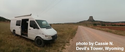
White Sprinter Van of the Week
Click here for the White Sprinter Van map of the world!!!
Road and Mountain Biking
Hood River received about .16” rain yesterday. That’s enough to make Post slippery, if not muddy. Choose a different location to ride today. With strong wind, gravel and road riding will be blustery. Try Tuesday for a light wind, dry day. After Tuesday, we’re looking at significant rain. The HRATS have a trail work party scheduled for this Sunday.
Upcoming Events
Coming up today, there’s meditation at noon at Trinity Natural Medicine. There’s $5 Tai Chi at the Hood River Adult Center at 2:30. This evening at 6pm, there’s community yoga at Samadhi in White Salmon. At 6:30, there’s community yoga at the Mt. Hood Town Hall and community Zumba at St. Francis House in Odell. There’s YogaFaith (Christ-centered yoga) in The Dalles at 6:45pm.
Looking ahead to next weekend, Saturday is the annual Fred Meyer Fuchsia sale. Saturday is also a potluck meal and garden party at Pacific Hermitage. The HRATS have a trail work party SUNDAY at Family Man at 9:30am. The Post Canyon is your Church.
Click here for the full events calendar.
Have an awesome day today!
Temira
