


Thank you for using this forecast. Like it? Find it useful? Support it (and me!) by sending some cash my way. What’s it cost to support me and get the email version? Not $99 a year. Nope. Not $49. Just $19.99 or more gets you a year. People are added to this list on Thursday and Sunday. My day job is crisis mental health, and I don’t have time on other days. Thanks for your patience! Click below to contribute. Thank you!!
 |
|
 |
The Forecast
| Your favorite beach | Dawn Patrol |
9am- 11:30a |
11:30a- 3pm |
3pm- dusk |
|
|---|---|---|---|---|---|
| Rooster Rock | World Naked | bike ride | is | Saturday! | |
| Steven’s Locks | LTW | 10-13 | 15-18 | 17-20 | |
| Swell-Hood River | LTW | 10-13 | 15-18 | 17-20 | |
| Lyle to Doug’s | LTW | LTW | LTW | LTW | |
| Rufus, etc. | LTV | LTV | LTV | LTV | |
| Roosevelt & Arlington | LTV | LTV | LTV | LTV | |
Gorge Wind Forecast
The least-bad-ever Gorge heat wave continues through the weekend with continued light to moderate westerlies. Never-ever has it been windy for every day of a 100+ degree stretch. Thank the stars for the wind! Again today, it should be just enough for foil sports and scattered large-sail windsurfers. Temps will be near 100F Friday through Sunday, and the humidity will make you want to get in the river. Find a way to do that!
Friday starts off with gradients of .07 (pdx-dls) and .01 (dls-psc). Of note: temps will soar to 110 degrees in Pasco today, which will give the nudge to our afternoon thermals. As usual, Viento starts in the 17-21 range, likely reading a bit high as usual. By late morning, we should be seeing 14-17 from Stevenson to Mosier. Afternoon: 17-20 from Stevenson to The Dalles. Atmospheric instability will likely make for gusty wind. River flow readings are 139-158kcfs, river temp is 69F, and high temp forecast is 101F with a dewpoint of 55F this afternoon.
Lesser gradients on Saturday morning start us with calm to light westerlies. From late morning on, it’ll be a slow build. Eventually we should reach 17-20 from Stevenson to The Dalles. High temp: 103F.
Things get interesting – and difficult to predict – on Sunday. A few thoughts: first, it’ll be hot again, likely in the upper 90’s. Next, an incoming impulse, location and path TBD, will trigger instability and possible elevated storms in the afternoon. Finally, that incoming system should drag in cooler air to the west side and kick off stronger westerlies, but timing will be everything. Last time this happened, reality did not cooperate with predictions. The morning starts with 12-15 from Stevenson to Swell with light wind to the east. Midday: 17-20 from Stevenson to Swell with less in Hood river and nothing out east. If the timing works out, we could see gusty 24-27 in the evening from Hood River to The Dalles with 19-23 from Stevenson to Swell. Don’t make plans around it yet!
Monday’s our Big Cooldown. Models are ramping up the wind speed but also ramping up the thunder chances. This morning’s GFS was the high-end outlier with 30-40mph averages. Other ensembles members aren’t as bullish, and the drop in high temps is far from certain (range: 80-94). So, make a gentle pencil note on your calendar to take Monday off, and fill your gas tank; marine clouds will hang out in Hood River all day and send you driving east for wind. Tuesday: also windy. Wednesday: mid-twenties? In other words, you’ll probably be able to get on the river every day. Hooray! Enjoy!
Jones, Sauvie’s, Coast
Coast forecast (north/central/south, waves). Swell forecast provided by NWS. Wind direction northerly unless otherwise noted. Friday: NW10-15/15/20-25+, NW swell 4′ at 9 seconds. Saturday: NW15/10-15/10, NW 3′ @ 9. Sunday: 15/5-10/LTS, NW 5′ @ 8. Jones Friday: 20-23. Saturday: 20-23. Sunday: 23-26. Sauvie’s Friday: 10-13. Saturday: 15-18. Sunday: WNW 10-15.
Mt. Hood Snow Forecast – Back on vacation until next fall
Hood River Weather Forecast
Hot and muggy. Friday starts in the low-mid 70’s and ends in the low triple digits. Moderate westerlies. A random thunderstorm is not out of the question. Saturday will be hot and unstable. Temps will be in the upper 60’s to low 70’s early and low triple digits in the afternoon. Moderate westerlies. Scattered thunder? No rainbows. Sunday will be sunny early and cloudy later with a better chance of thunder. Temps will be in the low 70’s early and upper 90’s in the afternoon. Increasingly muggy as the day goes on. 0.5% chance of rainbows. Light westerlies early. Moderate to strong late in the day.
Looking for a complete Columbia Gorge forecast? Looking for more humor in your weather? Obscenities? You’re looking for my TATAS: Temira’s Awesome Travel Advisory Service on Facebook.
Local-ish Events
Please let me know of outdoor-related local-ish events. If you don’t tell me, I don’t know! Ferment’s Tuesday night 4-mile walk/run is at 6pm. At 7:15am on Wednesdays, there’s a run from the White Salmon Bakery. At 7am on Friday morning, you can get a donut and coffee for going for a run at Kickstand Coffee. The Small Boat paddlers have a group paddle at 6pm on Thursday at the Hatchery. Post and Pint happens Thursday evenings at 5:30. The women’s Post-and-Pinot ride is Wednesday evening at 5:30.
Cycling
Falls Creek is open. All the 44 Road trails are open with a couple of caveats: Lookout Mountain is clear. Fifteen Mile has lots of trees down. Plains of Abraham is open and is rideable. Also, the road connecting Plains of Abraham to Smith Creek closes at noon Monday-Friday and will not be open to bikers during that time. Courtney Road (the road that goes up above Syncline) is closed until October. Do not attempt to use it to access trails. If you’re riding Post Canyon, you will need a parking pass. Those can be purchased at many local shops or online.
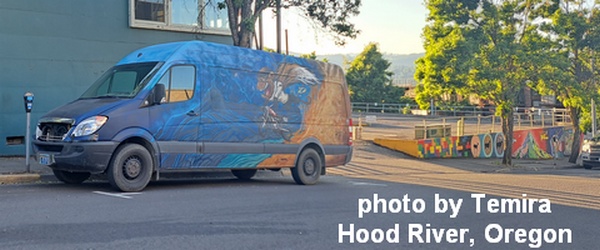
Sprinter Van of the Week!
 Click here for the Sprinter Van map of the world!!!
Have an awesome day!
