


Thank you for using this forecast. I offer it freely so you can have more fun and plan your life. It does take significant time and energy to produce. If you find yourself using it often, or if you feel your life is more awesome because of my work, please make a donation. You can get this forecast via email by donation. The email subscription isn’t $99/year. Not $50/year. Donating $12.34 or more gets you on the list for 12 months. Thank you for your support and thank you for trusting my forecast.
Click here to donate using a credit card.
Click here to donate via PayPal.
Venmo: @theGorgeismyGym
Snail Mail: PO Box 841, Hood River, Oregon 97031
Get the email version free through the end of May – try it out! Click here.
| Your favorite beach | Dawn Patrol |
9am- 11:30a |
11:30a- 3pm |
3pm- dusk |
|
|---|---|---|---|---|---|
| Rooster Rock | E20-25 | E20-25 | LTE | LTW | |
| Steven’s Locks | E10-15 | E20-25 | LTE | W 5 | |
| Swell-Hood River | LTE | E5-10 | E10-15 | LTV | |
| Doug’s, Lyle, Rowena | LTE | E5-10 | E10-15 | E10-15 | |
| Rufus, etc. | LTE | E5-10 | E10-15 | E10-15 | |
| Roosevelt & Arlington | LTE | E5-10 | E10-15 | E10-15 | |
Gorge Wind Forecast
A series of weather systems over the next three days give us a day of easterlies followed by two days of westerlies. Models are in disagreement over the wind speed for Sunday and Monday, so I’d recommend not putting a lot of faith in any forecast you read for those two days.
Consensus is there for the wind on Saturday: widespread easterlies. Max wind will be found in the morning near Rooster Rock, possibly at Stevenson too, with 20-25. In an interesting twist, the wind will die off to nothing at Rooster and Stevenson and pick up to E 10-15 from Swell to Rufus this afternoon as a low pressure system approaches. Seems like a great opportunity for a mellow downwind-downcurrent paddle! River flow is 323kcfs and temp is 54 degrees.
High pressure takes a brief stand off the Oregon Coast on Saturday in between offshore lows. Inland low pressure leads to synoptic (big) scale gradients. Rain will fall in the western Gorge, all the way to The Dalles, for much of the day. This complicates the wind picture, suggesting you will have to drive a long ways to find wind. As I said previously, models disagree: the GFS gives us 28-32 from Avery to Boardman. ECMWF take: 17-21. Big difference, eh? With rain and clouds predicted all the way to Idaho on Saturday, you can expect the wind to be gusty, and I’d lean towards lighter than the GFS prediction.
Similar problems exist in the forecast for Monday: The GFS likes another big eastern Gorge day of 28-32 east of Rufus. Euro: lighter, once again, with a prediction of 22-25, only in the eastern Gorge. Looking farther out, the GFS brings offshore high pressure for a couple days of strong westerlies. Euro predictions are much lighter, again.
JONES, SAUVIE’S, COAST: Jones Saturday: 5-8. Sunday: 5-8. Monday: nope! Sauvie’s Saturday: no. Sunday: no. Monday: no. Coast (north/central/south). Saturday: E5/E5/S10-15, W swell 6′ at 13 seconds and SW 7′ at 8 seconds. Sunday: W5/W5/N10, W 5′ @ 12. Monday: S20/S30/S20, W 7′ @ 11.
Mt. Hood Snow Forecast: on vacation unless needed!
Virtual Spin – video, beats, friends, BIKES!!
Got a schedule that makes it hard to link up with scheduled classes? No worries, we got you. Our virtual spin program gives you access to our all new Spin Studio built for our Cycling program. Connect up with Virtual Classes led by a live coach, or with voiceover some fresh beats and paired with Scenic Rides all over the world. You can even hit one button and play your favorites from NetFlix and a variety of other media services. Or jam out to tunes and catch up with your friends for an all-time great experience in a private studio. Bike Max is 10 people. Meet up with your friends on your schedule and keep your cycling fitness strong all winter long!Get signed up now by clicking here!
Hood River Weather Forecast
Partly cloudy, high overcast sky this morning holds until 3pm or so when light rain begins to fall, continuing overnight. Temps will be in the mid 40’s early and near 70 later. Light easterlies (strong for easterlies near Hood River, tho!), no rainbows. Sunday looks rainy for much of the day. Temps will be in the low 50’s early and low 60’s later. Light westerlies. 57% chance of rainbows. Monday looks sprinkly in the morning and rainy in the afternoon. Temps will be in the upper 40’s early and near 60 in the afternoon. Moderate westerlies. 87% chance of rainbows.
Looking for a complete Columbia Gorge forecast? Looking for more humor in your weather? Obscenities? You’re looking for my TATAS: Temira’s Awesome Travel Advisory Service on Facebook.
Road and Mountain Biking
Logging will begin on the Whoopdee main loop downhill on 5/20. That means if you want to ride the Whoopdee one last time, you will have to do it this weekend. Post is hosting the Cascadia Dirt Cup today, and may not be the best place to ride. Other options: Nestor, Columbia Hills, Hospital Hill, Dog River, Sandy Ridge (free Pivot demos today), Syncline, and Falls Creek from the bottom.
If you’re riding Underwood, please do not park at the trailhead any more as per request by SDS. There is a parking area 0.5 miles farther down the road. The cows are out on Hospital Hill, which happens to be private land owned by the Kreps family. Do not take your dog or you 1) endanger the life of your dog and 2) endanger access to the land for everyone.
Upcoming Events
Outside events today include sailboat races in the easterlies in Cascade Locks. Post Canyon is hosting the Cascadia Dirt Cup mountain bike Enduro race, so pick somewhere else to ride. There are free Pivot mountain bike demos at Sandy Ridge today. Other sports happening today: Dressage at the Hood River Saddle Club and a group road bike ride from Mountain View Cycles at 8:45.
You can help Bryant Pipe celebrate their new building from 11-2, and you can help Lyle celebrate spring with the annual cookout and giveaway on the river from 1 to 5. Looking at tomorrow, sailboat racing continues in Cascade Locks, probably in the rain, and Windance has an all-sports swap meet.
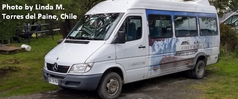
White Sprinter Van of the Week!
Click here for the White Sprinter Van map of the world!!!
Random Morning Thoughts: on vacation.
Click here for the full events calendar.
Have an awesome day today!
Temira