


Thank you for using this forecast. Like it? Find it useful? Support it (and me!) by sending some cash my way. Why? It takes me an hour or two each morning to produce this, and it makes your life better, safer, and more fun. That’s worth something! You can get the email version sent to you. Not $99 a year. Nope. Not $49. Just $12.34 or more gets you a subscription. Click below to give financial support. Thank you!!
Credit card payments click here – – – – – – – – – Click here to use your PayPal
Venmo: @theGorgeismyGym
Snail Mail: PO Box 841, Hood River, Oregon 97031
(note: I am not a non-profit entity. The only way to accept credit cards with a user-defined amount is to use the ‘donate’ button. Thanks for understanding!)
Auto-renewing subscription. New! Awesome!
The Forecast
CoronaChat
First and foremost, do not socialize or come within six feet of people who do not live in your household. That means no teatime with friends (especially you, Brits!), no coffee with friends, no lunch with friends, and no playdates for your kids with kids from other homes. No D&D marathon sessions in the basement, and no climbing in cars together to do activities.
Next, #stayhomesavelives means to avoid activities that could put you at risk. That includes things like mountain biking, paragliding, driving cars, backcountry skiing, etc. Anything you do that could result in injury risks you ending up in the ER taking valuable time, energy, and PPE away from coronavirus patients. That puts frontline medical personnel at risk. STOP IT! You also put yourself at risk if you end up in the doc shop.
A third part of this law, and it is a law, not a suggestion, is that you actually stay home as much as possible. When you go into stores, when you line up for takeout, when you ride trails around other people, you risk exposure. This virus appears to have an airborne component (ask your MD friends), which means that six feet might not cut it in some circumstances. So, only go to the store when you ABSOLUTELY HAVE TO. Don’t go for that one thing you’re missing. Figure out a way to make do.
If you want to understand more, you can read this great article from the NYT on what the new terms mean. You can also read the full text of the WA and OR legal orders. And remember, we have to do this all together. Looking for loopholes so you can keep doing what you want to do puts everyone else at risk. Be safe. Be well.
| 4a-8a | 8a-12p | 12p-4p | 4p-8p | 8p-4a | |
|---|---|---|---|---|---|
| Sunday 3000′->4000′ |
 |
|
 |
|
|
| Monday 4000′->1000′ |
 |
|
|
|
|
| Tuesday 1000′->2500′->1000′ |
|
|
|
|
|
Mt. Hood Weather Forecast
All ski areas and Nordic areas are closed at this time. Meadows and Skibowl have announced that they are not allowing uphill travel. If you attempt to do so, you are trespassing. No hiking for turns. Timberline hasn’t said that, but they have a giant reader board in the parking lot. It says “Stay Home”. I’d encourage you to consider staying out of the backcountry as well – if something happens, you will become a drain on resources as Search and Rescue teams, doctors, and possibly LifeFlight get involved.The next few days look snowy on Mt. Hood, and the warmer, sunnier weather that was previously forecast has disappeared! For Sunday, expect snow all day. The snow level will be 3000′ early and 4000′ from midday on. About 0.4” water value (WV) falls during the day, for up to 4” of new. Another 0.2” WV arrives overnight, for a couple more inches. Wind will be SW 20-30 all day, SW 30-40 around midnight, and SW 30-55 after midnight.
Snow continues on Monday with strong orographic support for SW facing slopes. The snow level will be 4000′ early, 2500′ in the afternoon, and 1500′ after midnight. About 0.8” to 1.0” WV falls during the day, for 7-11” of new. Another 0.8” WV falls overnight with colder temps, for 7-9” of new. Wind will be SW 30-55 early, SW 40-60 midday, SW 30-40 in the afternoon, and W 25 after midnight.
Snow continues Tuesday with colder temps. The snow level will be 1500′ early, 2500′ midday, and down to 500-1000′ after midnight. About 0.2” WV falls during the day, for 2-3” of new. Another 0.4” WV falls overnight, for 4-5” of new. Wind will be W 25 early, W 30 in the afternoon, NW 15-20 in the evening, and W 20 after midnight. Light snowfall continues for a couple more days after that with cool temps and low snow levels.
Gorge Wind Forecast
First, a public service announcement. All Oregon and Washington State Parks are closed at this time. All Port of Hood River waterfront access is closed at this time. The Army Corps has closed Roosevelt Park and John Day Dam access. They have also closed boat ramps. Swell City is also closed.This is an order to obey. It’s not one to sneak around and find a way to get on the river instead. That’s especially for you locals – set a good example so you don’t have folks coming down here from Covid-19 epicenters to play on the river and shop at our stores.
For the wind today, Sunday, it starts light and variable. Afternoon picks up to 10-13 in the west and 18-22 east of The Dalles. River flow is 109kcfs and temp is 44 degrees. Monday starts light, variable, and wet. Afternoon wind picks up to gusty 13-16 in the west and gusty 25-29 from Avery to Arlington. Tuesday starts with W 6-9mph everywhere. Afternoon wind climbs to 15-18 from Stevenson to Biggs.
COAST, JONES, SAUVIE’S: Detailed forecast is on winter break.
Hood River Weather Forecast
It’s a cloudy and drizzly Sunday, and things will stay that way through midday. After that: sprinkles on through the evening with a couple of dry hours late overnight. Temps will be in the mid 40’s early and mid 50’s later. Light to moderate westerlies. 99% chance of afternoon rainbows. Monday looks cloudy and rainy in the morning with a decrease in rain intensity midday and more rain overnight. Temps will be in the upper 40’s all day. Light wind early, moderate in the afternoon. 99% chance of rainbows. Tuesday brings drizzle and sprinkles, on and off, all day. A little chunky rain could be mixed in early as the snow level starts at 1000′. Temps will be in the upper 30’s early and low 50’s later. Light to moderate westerlies. 99% chance of rainbows. Looking for a complete Columbia Gorge forecast? Looking for more humor in your weather? Obscenities? You’re looking for my TATAS: Temira’s Awesome Travel Advisory Service on Facebook.Cycling
All trails and sno-parks in the Mt. Hood National Forest, Gifford Pinchot National Forest, and Columbia Gorge National Scenic Area are closed. While Post Canyon trails may be open as of this morning, you are not allowed to park at the bottom of Post or anywhere else in the trail system. The Mosier Twin Tunnels trail is closed. If you want to ride a bike, please do so on the road where 1) social distancing is possible and 2) you are less likely to get injured and put a strain on the medical system.Upcoming Events – this section is on vacation due to Covid-19
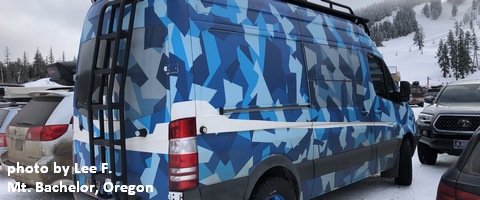
White Sprinter Van of the Week!
Click here for the White Sprinter Van map of the world!!!
Random Morning Thoughts – on break
Click here for the full events calendar.
Have an awesome day!
Temira