


Thank you for using this forecast. Like it? Find it useful? Support it (and me!) by sending some cash my way. Why should you keep doing this when you’re under a stay-at-home order? Because my bills don’t stop – I hope you’ll consider contributing even though the world has ground to a standstill. That’ll keep the forecast going through this crisis, and it’ll mean the forecast is here when we all emerge from our homes. What’s it cost to support me and get the email version? Not $99 a year. Nope. Not $49. Just $19.99 or more gets you a year. Click below to contribute. Thank you!!
Click here to use your PayPal
Venmo: @theGorgeismyGym
Snail Mail: PO Box 841, Hood River, Oregon 97031
(note: I am not a non-profit entity. The only way to accept credit cards with a user-defined amount is to use the ‘donate’ button. Thanks for understanding!)
Auto-renewing subscription. New! Awesome!
The Forecast
Today’s Gorge Wind – these are ranges for the average speed, not a predicted wind range. =)
Your favorite beach
Dawn
Patrol
9am-
11:30a
11:30a-
3pm
3pm-
dusk
Rooster Rock
OPEN!
naked
buns
rejoice!
Steven’s Locks
10-13
10-13
7-10
7-10
Swell-Hood River
G10-20
G10-20
7-10
7-10
Doug’s, Lyle, Rowena
G10-20
G10-20
G10-20
G10-20
Rufus, etc.
30-33
30-33
30-33
30-33
Roosevelt & Arlington
30-33
30-33
30-33
30-33
Gorge Wind Forecast
| Your favorite beach | Dawn Patrol |
9am- 11:30a |
11:30a- 3pm |
3pm- dusk |
|
|---|---|---|---|---|---|
| Rooster Rock | OPEN! | naked | buns | rejoice! | |
| Steven’s Locks | 10-13 | 10-13 | 7-10 | 7-10 | |
| Swell-Hood River | G10-20 | G10-20 | 7-10 | 7-10 | |
| Doug’s, Lyle, Rowena | G10-20 | G10-20 | G10-20 | G10-20 | |
| Rufus, etc. | 30-33 | 30-33 | 30-33 | 30-33 | |
| Roosevelt & Arlington | 30-33 | 30-33 | 30-33 | 30-33 | |
On to Wednesday: weak high pressure builds inland. Offshore high pressure will be strong enough to create a cross-Cascade differential. Morning westerlies start in the “light” zone in the west and 10-13 east of The Dalles. Stay close to home; the wind drops off east of The Dalles in the afternoon and rises to 22-25 under sunny sky from Stevenson to The Dalles.
It appears that a weak frontal system will mosey across the region on Thursday. The most significant impact of this will be clouds and mugginess. Westerlies continue. Morning wind will be 7-10 all through the Gorge. Afternoon westerlies pick up to unreliable, gusty, 24-27 from Stevenson to Arlington under partly cloudy sky with relatively high relative humidity.
Sunny sky and moderate westerlies are on the calendar for Friday. After that, model predictions diverge. Vote early and often for the operational run of the GFS; that one gives us 30-35. However, only about 20-30% of ensemble members agree with that scenario. Don’t be your cookies on it!
Coast, Jones, Sauvie’st
Coast (north/central/south – swell forecast provided by NWS. Wind northerly except as noted). Tuesday: W5/LTW/N20-25, S swell 3′ ‘@ 15 seconds. Wednesday: NW5/N10-15/N30-35, W 3′ @ 10. Thursday: W5/NW5/N15-20, W 3’ @ 10. Jones Tuesday: LTW. Wednesday: W 5-8. Thursday: 7-10. Sauvie Island Tuesday: calm. Wednesday: 10-13. Thursday: 10-13.Open/Closed Launch Site List – Porta-potties only.
Washington:Skamania County – Phase 2, recreate with 5 or less people outside household
Stevenson East Point, Bob’s Beach, Boat ramp: all open
Home Valley: Open
Swell City: Open
Spring Creek Hatchery: Open
Klickitat County – Phase 2
Wunderbar: high water
Bingen Point: Open
Lyle: you have to cross private property to access
Doug’s Beach: Open
Avery: Open
Maryhill: Open for day use only..
The Wall: Open.
Roosevelt: Still CLOSED due to windstorm damage. (6/26)
Oregon: Phase one for Hood River. Phase two for Wasco, Sherman, Gilliam counties.
Rooster Rock: Open
Viento: Open
The Hook: Open
Waterfront Park: Open
Event Site: Open
The Spit: Open
The Marina: Open
Boat ramp: open
Mosier: Only open for residents of 97040. Gate closed.
Rowena: Open
Celilo: Open
Rufus: Open
Arlington: Open
Threemile: Open
Mt. Hood Weather Forecast
Mt. Hood Meadows is now allowing uphill travel within the permit area. However, you will need to park outside their parking lots. Timberline is open for lift-serve skiing with exemplary guidelines for protecting guests and staff from the transmission of novel coronavirus. Please read their guidelines and rules here. Well done, T-Line! The Mt. Hood weather forecast will be on vacation unless something interesting happens in the weather up there. Some of you will be tempted to go out backcountry skiing. Please don’t – accidents do happen, and you may put others at risk. Timberline is allowing uphill access outside the permit area on the climbers’ trail ONLY.Hood River Weather Forecast
Cloudy sky sticks around all day with intermittent sprinkles that last through the evening. Temps will be in the upper 50’s early and upper 60’s later. Light to moderate westerlies. 1% chance of rainbows. Wednesday starts out cloudy and ends clear. Temps will be in the mid 50’s early and mid 70’s later. Little to no wind early. Moderate in the afternoon. No rainbows. Thursday looks muggy and cloudy. Temps will be in the upper 50’s early and mid 70’s later. Light wind early. Moderate later. No rainbows. Looking for a complete Columbia Gorge forecast? Looking for more humor in your weather? Obscenities? You’re looking for my TATAS: Temira’s Awesome Travel Advisory Service on Facebook.Cycling
Eldorado in Post Canyon has reopened. The new Whoopdee trail is being constructed. Contact HRATS if you would like to be part of some small and socially distanced work parties. Syncline/Coyote Wall: Open. Mt. Hood National Forest: Open for day use. Surveyor’s, Dog River, and Oak Ridge snow-free. Kreps/SDS: open. Sandy Ridge: Open. Nestor Peak: open. Falls Creek: open. Columbia Hills State Park: open. Syncline: open . Skamania County trails outside the scenic area: open. Knebal, Eightmile, Fifteenmile, Bottle Prairie, Surveyors, Dog River: open and cleared. Ape Canyon: Open!
Sprinter Van of the Week!
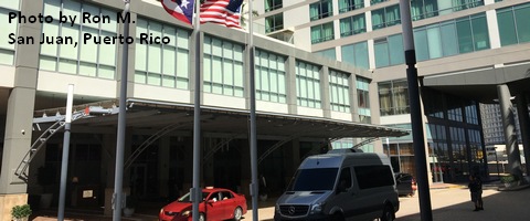
Click here for the Sprinter Van map of the world!!!
Local Events
Not so many events are happening due to this pandemic. There are sailboat races on Wednesday evenings. Dirty Fingers has the weekly Post N’ Pint ride on Thursday evenings and Sunday Service gravel rides. If you want to do trail work, contact HRATS; they are doing small, socially distanced work parties on the new Whoopdee trail. Click here for the full events calendar.Statement on Racial Justice
Black Lives Matter. I say that with no reservations and no caveats, and I stand with Black, indigenous, and other people of color against structural racism, against mass incarceration, against police violence, against unequal treatment, against outright racism, and against any other sorts of targeted behaviors or systems. In June, I donated 10% of the income from this forecast to the National Black Justice Coalition. I encourage you to find a cause and contribute too. Don’t have financial resources? Speak up!
I pledge to speak out against racism, and I pledge to be a humble ally who is willing to look at the ways that I benefit personally from racist structures in this society. I will continue to speak up and help wake up others, and I will listen quietly when people of color need me to.
I ask that all of you also reflect on the ways you benefit from racist societal structures. I recommend reading “White Fragility” and “How to be an Anti-Racist”. Don’t have much time? Read “Unpacking the Knapsack of White Privilege”. Watch the movie “13th”. When others confront you about your racism, take a deep breath, listen quietly, and attempt to quell your natural defensiveness. We have been raised in a society founded on slavery and racism. These values (and yes, some people hold them as values) remain entrenched in our society in subtle and not-so subtle ways. I challenge you to learn to see them so that you can learn to undo them. We can’t undo the damage that’s been done, and we don’t have the right to ask for forgiveness, but we can work to create a more equitable world going forward.
Have an awesome day!
Temira