


Thank you for using this forecast. Like it? Find it useful? Support it (and me!) by sending some cash my way. What’s it cost to support me and get the email version? Not $99 a year. Nope. Not $49. Just $19.99 or more gets you a year. People are added to this list on Thursday and Sunday. My day job is crisis mental health, and I don’t have time on other days. Thanks for your patience! Click below to contribute. Thank you!!
 |
|
 |
Thank you for contributing and keeping this forecast going! Not ready to subscribe? No problem – please share this forecast with all your friends too! I appreciate your support!
The Forecast
| Your favorite beach | Dawn Patrol |
9am- 11:30a |
11:30a- 3pm |
3pm- dusk |
|
|---|---|---|---|---|---|
| Iwash (Rooster) Rock | E40 | E30 | E15-20 | LTE | |
| Stevenson | E25 | E20-25 | E15-20 | LTE | |
| Viento | E15-20 | E15-20 | E10-15 | LTE | |
| Swell-Hood River | LTE | LTE | calm | calm | |
| Lyle to Doug’s | LTE | LTE | calm | calm | |
| Rufus, etc. | LTE | LTE | calm | calm | |
| Roosevelt & Arlington | LTE | LTE | calm | calm | |
Gorge Wind Forecast
 It’s Thursday morning, and I woke up to an unexpectedly strong round of pre-dawn easterlies. So did you! If you want it, move on it. They’ll fade quickly. Expect 30-40 near Iwash for a few hours this morning with 25ish at Stevenson and 15-20 at Viento. By late morning, Stevenson and Iwash drop to 20-25, and Viento will be even less. The wind just keeps fading. By sunset, it should be well on its way to “calm”. River flow yesterday was 99-141kcfs, river temp is 56F, and high temp forecast is 50F.
Friday brings light westerlies, probably less than 10mph, but a short period of 10-13 east of Hood River isn’t out of the question. High temp: 52F. A cold front swings through on Saturday. This one packs some power, but it lacks the helpful offshore high pressure. Ensembles aren’t particularly enthusiastic about this. That said, we could see a few hours of gusty 20-something wind at Rufus mid-morning. You will almost certainly need to drive pre-emptively for this one; our last round of westerlies lasted a good long while thanks to offshore high pressure. We won’t have that support this time. High temp: 53F. Sunday: east 30mph at Iwash with dry weather. Have a great day today!

| FORECAST SPONSORED BY / AWESOME COMPANIES TO SUPPORT | |
 |
|
Jones, Sauvie’s, Coast – On vacation ‘til summer unless otherwise noted
Mt. Hood Snow Forecast – intermittent forecasts until ski season
Ski season’s still out of reach, but we do have a couple rounds of snowfall coming in the next several days. Generally speaking, we won’t be consistently building a snowpack until at least the 19th or 20th; around then, models hint at the range of temps dropping low enough for consistent snowfall. No promises, of course – forecasting that far out is a bit of a fool’s errand.
Thursday starts out clear on the mountain, turns cloudy pretty quickly, and adds snowfall in the evening. The free air freezing level starts at 6500′ with 850mb temp sat +4C. By the afternoon, the snow level falls to 4000′, and it drops to 3000′ overnight. About 0.3” to 0.4” water equivalent (WE) is forecast this evening for 3-4” of snow at 5000′. Wind: SW 10-20 this morning rising to SW 20-35 this afternoon and becoming WNW 25 overnight.
Friday morning starts with some orographic snow flurries. Clouds in the afternoon give way to clear sky overnight. The snow level will be 3000′ during the day and will rise to 4500′ after midnight. Up to 1” of snow is forecast in those morning lingering flurries. Wind: WNW 25-35 early, SW 10-15 in the afternoon, and WSW 30-35 overnight.
Saturday brings another round of snowfall. This one will be a touch warmer, and the p-type may switch to “mixed” at some point, but we should see solid accumulation. The snow level will be 4500′ early and 5500 for a period mid-morning. It then falls to 4000′ by sundown and 3500′ overnight, but which time the snow will be done. About 0.7” to 0.8” WE is forecast during the day for 5-7” dense new snow. Overnight: just a trace. Wind: WSW 30-35 pre-dawn quickly builds to WSW 30-355 and then switches to W 50 mid-morning. Afternoon wind drops to W 40 and then falls further to SW 10-20 overnight. Sunday looks dry, warmer (+3C) and high overcast. We may see some light rain on the slopes on Monday. After that, there’s a fair bit of uncertainty in the exact outcomes, but generally speaking it’ll be intermittently wet and a touch too warm for snow accumulation. That’s okay. Ski season will come eventually!
Hood River Weather Forecast
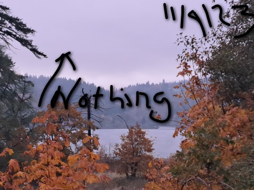
Nothing plus high clouds this morning gives way to increasing clouds with rain this evening. Temps will be in the mid 30’s early and near 50 later. Easterlies. No rainbows. Friday will be showery in the morning and partly cloudy in the afternoon. Temps start in the upper 30’s and rise to the low 50’s. Light westerlies. 94% chance of rainbows. Saturday will be mostly cloudy with showers early and dry weather later. Temps start in the upper 30’s and rise to the low 50’s. Light to moderate westerlies. 98% chance of rainbows.
Looking for a complete Columbia Gorge forecast? Looking for more humor in your weather? Obscenities? You’re looking for my TATAS: Temira’s Awesome Travel Advisory Service on Facebook.
Local-ish Events
Please let me know of outdoor-related local-ish events. If you don’t tell me, I don’t know!
There’s a Nordic ski swap at Working Hands in Hood River on November 11th, 4-6pm. HRATS has a work party s in Post Canyon on November 12th. The. On November 28th, Amayah’s has their one-year anniversary party in Biggs. Also, every first Thursday, 1pm to 4pm, they are offering free meals to all. Yup. That’s right. Free Amayah’s once a month!
Regular weekly events:. NK Studio’s by-donation Tuesday morning yoga class is back. Ferment’s Tuesday night 4-mile walk/run is at 6pm. There’s meditation with monks at 5:15pm (an hour) and 6:30pm (30 minutes plus a talk) at Yoga Samadhi in White Salmon. The Tri Club is done for the season. At 7:15am on Wednesdays, there’s a run from the White Salmon Bakery. At 7am on Friday morning, there’s a run from Pine Street Bakery. On Fridays at 2:30pm, there’s a free meditation and stretching class at Yoga Samadhi. On Saturday at 9am, there’s a by-donation outdoor group fitness on the 2rd floor deck about Ferment Brewing.
Cycling
Mud in many places with the exception of Syncline. Don’t ride in the mud. You’ll damage the trails. Ride gravel. Ride your trainer. Build trails. There are trail builders seeking extra hands on seven additional miles of trail on Whoopdee. Contact HRATS for more information. See events section of this report for upcoming trail work parties on various trail systems. If you’re parking at Post Canyon, you will need a parking pass. Those can be purchased at many local shops or online.
Sprinter Van of the Week!
 Click here for the Sprinter Van map of the world!!!
Have an awesome day!
