


Thank you for using this forecast. Like it? Find it useful? Support it (and me!) by sending some cash my way. What’s it cost to support me and get the email version? Not $99 a year. Nope. Not $49. Just $19.99 or more gets you a year. People are added to this list on Thursday and Sunday. My day job is crisis mental health, and I don’t have time on other days. Thanks for your patience! Click below to contribute. Thank you!!
Click here to use your PayPal
Venmo: @theGorgeismyGym
Snail Mail: PO Box 841, Hood River, Oregon 97031
(note: I am not a non-profit entity. The only way to accept credit cards with a user-defined amount is to use the ‘donate’ button. Thanks for understanding!)
Auto-renewing subscription. New! Awesome!
The Forecast
Today’s Gorge Wind – these are ranges for the average speed, not a predicted wind range. =)
Your favorite beach
Dawn
Patrol
9am-
11:30a
11:30a-
3pm
3pm-
dusk
Rooster Rock
bare
buns
no
sun
Steven’s Locks
5-10
G12-15
G12-15
G14-17
Swell-Hood River
5-10
G12-15
G12-15
G14-17
Lyle to Doug’s
5-10
G12-15
24-27
27-31
Rufus, etc.
5-10
G12-15
24-27
27-31
Roosevelt & Arlington
5-10
G12-15
24-27
27-31
Patrol
11:30a
3pm
dusk
Gorge Wind Forecast
With the exception of Wednesday, you’ve got a good shot at getting on the water for windsports for the next week. Those of you who appreciate a light wind sport will enjoy the heck out of Wednesday. The Poopy Water Warning continues for the Hood River Event Site and Waterfront Park. River flow continues to top 400,000cfs, and the current remains strong. Keep that in mind, and be safe out there!
For Tuesday, we have high pressure off the coast of California and low pressure in the desert with a bit of a weather system moving through in the morning. Wind speeds currently range from zero outside my window to the low 20’s out east. Your focus will be out east again today. By late morning, we’ll see 24-27 from Lyle to Boardman with 12-15 between Stevenson and Mosier (Viento will overperform). Desert heating keeps the wind climbing into the afternoon; max speed will be 27-31 from Lyle to Boardman. West of Lyle, clouds will interfere, and gusty westerlies will bounce around in the 12-17 range. River flow is 376-448kcfs, river temp is 55F, and high temp forecast is 63F. Note: 400kcfs is too much current for the Rufus stretch of the river – it is likely to be flat, not swelly.
High pressure pushes inland on Wednesday. Most of the day will be nearly-not-windy. After 5pm, an approaching front will give the wind an unreliable nudge upward. Expect calm wind to start. Midday easterlies rise to 10-15 between Rooster and Viento. In the early evening, a weather system swings through and turns the flow around. We could see a period of very gusty 14-20 from Stevenson to The Dalles after 5pm. It also wouldn’t be surprising if the wind stays below 15mph. High temp: 76F.
Low pressure takes up residence off the Oregon Coast on Thursday, and a weather system swings inland. The wind will likely stay less than 10mph west of Mosier. East of there, you’ll probably find gusty 17-20 for much of the day. High temp: 73F. Friday, Saturday, and Sunday all look to have westerlies of some sort. Friday doesn’t look all that reliable, but a better setup could materialize for the weekend. Have fun, and stay safe out there on the river!
Jones, Sauvie’s, Coast
Coast forecast (north/central/south, waves). Swell forecast provided by NWS. Wind direction northerly unless otherwise noted. Tuesday: NW5-10/N10/N30, W swell 5′ at 8 seconds. Wednesday: LTV/LTV/LTV, W 3′ @ 8. Thursday: LW/LTNW/N15-20, W 4′ @ 9. Jones Tuesday: 10-13. Wednesday: 16-19. Thursday: LTW. Sauvie’s Tuesday: LTW. Wednesday: W 10. Thursday: LTV.
Mt. Hood Snow Forecast – Back on vacation until next fall
Hood River Weather Forecast
Drizzle this morning gives way to partly cloudy or mostly clear sky this afternoon. Temps will be near 50 early and in the low 60’s later. Moderate westerlies. 99% chance of rainbows. Wednesday will be partially high overcast. Temps will be in the mid 40’s early and mid 70’s later. Calm wind becomes light easterly then moderate westerlies. No rainbows. Thursday will be partly high overcast. Temps will be in the low 50’s early and low 70’s later. Light to moderate westerlies. No rainbows.
Looking for a complete Columbia Gorge forecast? Looking for more humor in your weather? Obscenities? You’re looking for my TATAS: Temira’s Awesome Travel Advisory Service on Facebook.
Local-ish Events
Please let me know of outdoor-related local-ish events. If you don’t tell me, I don’t know!
Looking at next weekend, we have the Bend Short Track Series race, 12 Hours of Post Canyon, the Alpine Epic Race (Oakridge), the annual summer solstice party at Illumination Saddle, the Pray for Wind Party at Kickstand, the Central Gorge Master Gardeners Tour, the White Salmon Backyard Half Marathon, and Six Hours of Mt. Hood MTB race.
Ferment’s Tuesday night 4-mile walk/run is at 6pm. At 7:15am on Wednesdays, there’s a run from the White Salmon Bakery. At 7am on Friday morning, you can get a donut and coffee for going for a run at Kickstand Coffee. The Small Boat paddlers have a group paddle at 6pm on Thursday at the Hatchery. Post and Pint happens Thursday evenings at 5:30 when Post is not too wet to ride. The women’s Post-and-Pinot ride is Wednesday evening at 5:30.
Cycling
It seems likely that Post is too wet to ride. Surveyor’s and Dog River are open. Courtney Road (the road that goes up above Syncline) is closed until October. Do not attempt to use it to access trails. Starting now, you will need a parking pass to park at Post Canyon. This money will support trails. Hospital Hill: cows are out – no dogs allowed. Underwood: do not enter areas that are closed due to logging operations.
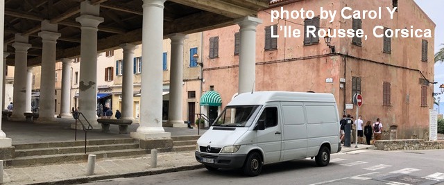
Sprinter Van of the Week!
 Click here for the Sprinter Van map of the world!!!
Have an awesome day!
