| Snow level | 4a-8a | 8a-12p | 12p-4p | 4p-8p | 8p-4a |
|---|---|---|---|---|---|
| Wednesday 9000′->4000′ |
 |
|
 |
 |
 |
| Thursday 4000->6500′ |
 |
|
|
|
|
| Friday 6500′->4000′ |
|
 |
|
|
|
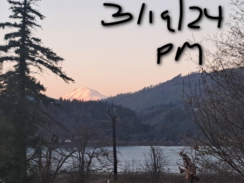
Mt. Hood Snow Forecast
We had about a week of spring skiing, and now we’re going to transition back to winter. It’ll take until Saturday for the transition to complete, but after that… models drag in a seemingly endless set of just-cold-enough systems. Through the first few days of April, we’re expecting 4-6” water equivalent in the Cascades. Even if temps are right on the edge, that’s a few more feet of snow added to the snowpack!
Wednesday starts out clear, turns high overcast, and adds some light snow overnight. The freezing level will be 9000′ in the morning and 4000′ from the evening on into Thursday morning. With clear sky Tuesday night into Wednesday morning, the snow should set up overnight for a granular start and a corn finish. Just a trace of snow is forecast overnight. Wind: WSW 20-25 in the morning, SW 20-35 in the afternoon, and WSW 20-25 after midnight.
Thursday starts with light snow and transitions to sun up high and clouds below 6000′ or so. overnight, the sky turns partly to mostly cloudy. Snow level: 4000′ in the morning, 4500′ in the afternoon, and 6500′ overnight with temps in the low to mid 30s on the slopes during the day. Just a trace of snow is forecast. Wind: WSW 20-25 in the morning SW 10-20 in the afternoon, and S 5-15 overnight.
Friday starts partly cloudy and adds rain or snain. This transitions to snow overnight. The snow level will be 6500′ in the morning, 5500′ in the afternoon, and 4000′ after midnight. About 0.2” water equivalent (WE) is forecast during the day for a trace to an inch of wet new snow. Overnight, 0.3” WE is forecast. Call that 1-3” wet snow depending on elevation. Wind: S 5-10 in the morning, and SW 10-20 in the afternoon and evening. Light snow Saturday gives way to (probably) partly cloudy weather Sunday. The precip really gets going next week with system after system swinging through. I’ve got no complaints with us continuing to build the snowpack. I bet you like this too. Enjoy!
A poem:
Was that forecast helpful?
Did it save you time or gas money?
Did it make your life more fun?
Then please make a contribution.
Writing this takes me an hour or two a day.
Without your support, I can’t keep it up.
Keep the forecast going.
Subscribe or donate.
And share my forecast with your friends!
 |
 |
 |
|
Not ready to subscribe? No problem – please share this forecast with all your friends too!
Or try a month for free!

Gorge Wind Forecast
Hi friends! Nice to see you all on the water at the Hatch today. We’ll have another day of west wind Wednesday, lighter westerlies on Thursday, and then a switch to light easterlies (with rain) on Friday. Some sort of gusty westerlies are forecast for the weekend, but it’s too early to make a call on the details. Wednesday morning starts with a deep marine push on the west side and lingering warmth in the desert. This starts the day with 10ish at Stevenson, 14-17 from Viento to Mosier, and 11-14 from Lyle to Arlington. Watch for a late morning build to 18-22 from Stevenson to Doug’s with 20-23 from Avery to Arlington. As the incoming weather system continues to push cool air into the west side, the focus shifts eastward. Expect Stevenson to Hood River to drop to 11-14 in the afternoon. We’ll see Lyle to Biggs rise to 24-27 with 20-23 at Arlington. The best shot for Rufus to Arlington will be after 4pm as cool air settles in to the west and the desert reaches peak heating. We’re lacking offshore support for this, so 26-29 is probably the max we’ll see. River flow Tuesday was 99-152kcfs, river temp is 45.14F, and high temp forecast is 60F for Hood River and 65F for Arlington.
On Thursday, weak high pressure inland combines with an offshore low and lingering temp differentials for a light westerly day. Expect 7-10 all the way from Stevenson to Arlington to start. Afternoon: 7-10 in the west and 11-14 east of The Dalles. High temp: 60F. Friday looks drizzly with easterlies at 10-15 at Stevenson and Iwash (Rooster). Elsewhere: light wind. High temp: 60F. Models are hinting at light and rainy westerlies on Saturday with possibly stronger west wind on Sunday thanks to offshore high pressure. Fingers crossed. See you out there Wednesday! PS: if you were out there Tuesday, don’t forget to dry your wetsuit!
 |
|
Jones, Sauvie’s, Coast Forecast – On vacation ‘til summer unless otherwise noted
Very basic Hood River weather forecast. Don’t plan your life around this. You really should read TATAS
Partly cloudy sky Wednesday morning adds high clouds later and rain after midnight. Temps start in the mid 40s and rise to 60 or so. Moderate westerlies. No rainbows. Thursday will be intermittently drizzly in the morning and partly high cloudy in the afternoon. Temps start in the mid 40s and rise to 60. Light westerlies. 87% chance of rainbows. Friday will be rainy. Temps start in the mid 40s and rise to 60. Mostly cloudy. Light east wind. 79% chance of rainbows. Read Temira’s Awesome Travel Advisory Service on Facebook for a detailed forecast that may help you plan your day.
Local-ish Events
Please let me know of outdoor-related local-ish events. If you don’t tell me, I don’t know!
On Thursday, March 21st, you can watch the BEST MOVIE EVER, The Neverending Story, at the Trout Lake Hall at 5pm (free). On Thursday, March 21st, you can watch the BEST MOVIE EVER, The Neverending Story, at the Trout Lake Hall at 5pm (free). March 23rd is the Glides of March Nordic race at Teacup. Skibowl has their spring party March 23rd and 24th.
Regular weekly events:. NK Studio’s by-donation Tuesday morning yoga class is back. Ferment’s Tuesday night 4-mile walk/run is at 6pm. There’s meditation with monks at 5:15pm (an hour) and 6:30pm (30 minutes plus a talk) at Yoga Samadhi in White Salmon. The Tri Club is done for the season. At 7:15am on Wednesdays, there’s a run from the White Salmon Bakery. At 7am on Friday morning, there’s a run from Pine Street Bakery. On Fridays at 2:30pm, there’s a free meditation and stretching class at Yoga Samadhi. On Saturday at 9am, there’s a by-donation outdoor group fitness on the 2rd floor deck about Ferment Brewing.
Cycling
We have reports of brown pow in Post Canyon to 8-Track. Whoopdee, Hospital, and Syncline are also good for riding right now per Strava (the app, not my cat). Sisterwives and Kleeway in Post Canyon are currently closed for rebuilding. Regarding the trails in general: don’t ride in the mud. You’ll damage the trails. Don’t ride if it was below freezing the previous night and is above freezing (or sunny) when you go to ride; freeze-thaw trails are susceptible to permanent damage. Ride gravel. Ride your trainer. Build trails. There are trail builders seeking extra hands on seven additional miles of trail on Whoopdee. Contact HRATS for more information. If you’re parking at Post Canyon, you will need a parking pass. Those can be purchased at many local shops or online.
Sprinter Van of the Week!
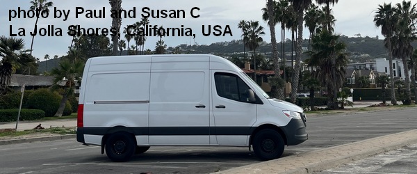 Click here for the Sprinter Van map of the world!!!
Have an awesome day!