


Thank you for using this forecast. Like it? Find it useful? Support it (and me!) by sending some cash my way. What’s it cost to support me and get the email version? Not $99 a year. Nope. Not $49. Just $19.99 or more gets you a year. People are added to this list on Thursday and Sunday. My day job is crisis mental health, and I don’t have time on other days. Thanks for your patience! Click below to contribute. Thank you!!
 |
|
 |
The Forecast
| Your favorite beach | Dawn Patrol |
9am- 11:30a |
11:30a- 3pm |
3pm- dusk |
|
|---|---|---|---|---|---|
| Rooster Rock | tanning | naked | today? | hydrate! | |
| Steven’s Locks | 5-10 | 10-15 | 20-23 | 20-23 | |
| Swell-Hood River | 17-20 | 22-25 | 22-25 | 15-18 | |
| Lyle to Doug’s | 5-10 | 10-15 | 20-23+ | 23-26 | |
| Rufus, etc. | 5-10 | 10-15 | 20-23+ | 23-26 | |
| Roosevelt & Arlington | 10-15 | 10-15 | 20-23+ | 23-26 | |
Gorge Wind Forecast
A weather disturbance off to the NW will have enough influence on Gorge weather over the next few days to add a bit of gustiness and unreliability to the mix. That said, we’ll have moderately strong westerlies over the next few days. Tuesday and Wednesday give you a shot at the eastern Gorge. You’ll probably be closer to Hood River on Thursday despite the cooler temps. The first-look weekend forecast is calling for hotter weather and mid to upper teen westerlies. Subject to change, of course!
Looking at Tuesday… we have a little system up north by Vancouver Island. Despite the distance, it’ll impact the Gorge. Early gradients were .10 (pdx-dls) and .04 (dls-psc). Westerlies were generally in the teens with low 20’s at Viento. We’ll see a quick build to 22-25 from Viento to Mosier with 13-16 out to Arlington. Stevenson could take a little longer to wake up, but should be in the teens by late morning. Afternoon wind drops to gusty 15-18ish west of Hood River with 22-25 from Mosier to Arlington. Hood River itself… could go either way. Models drag the low-mid 20’s westerlies all the way to Threemile this afternoon. River flow readings are 158-175kcfs, river temp is 70F, and high temp forecast for Hood River is 88F. Arlington: 92F.
That weather system moves closer on Wednesday and does the same thing as Tuesday – shifts the wind to the east. Morning westerlies will be 14-17 from Stevenson to Mosier with 7-10 to the east. By late morning: 17-20 Stevenson to Mosier. A brief period of 20-23 is possible early afternoon. The wind then turns gusty, drops for a little bit, and then does the eastern shift/build: gusty 24-27 from Lyle to Arlington.
Models generally agree on Thursday being the windiest day along the Columbia (Tuesday and Wednesday will actually be windier at elevation, but that doesn’t matter so much to you!). Westerlies pick up to 23-26 between Stevenson and The Dalles. We’re currently looking at upper teens Friday through Sunday – although models are predicting lighter wind, they do tend to underestimate with the setup. Also worth noting – there’s a lot of spread in the models, so the weekend forecast isn’t reliable at this point. Have a great week!
Jones, Sauvie’s, Coast
Coast forecast (north/central/south, waves). Swell forecast provided by NWS. Wind direction northerly unless otherwise noted. Tuesday: 15-20/15-20/10-15, NW swell 4′ at 7 seconds. Wednesday: LTW/LTNW/N15-20, NW 3′ @ 7. Thursday: 15-20/20-25/30-35, NW 3′ @ 9. Jones Tuesday: 10-13. Wednesday: 21-24. Thursday: LTW. Sauvie’s Tuesday: 8-11. Wednesday: 16-19. Thursday: 12-15.
Mt. Hood Snow Forecast – Back on vacation until next fall
Hood River Weather Forecast
Partly cloudy sky this morning turns clear. Temps will be in the upper 60’s early and upper 80’s later. Moderate westerlies. No rainbows. Wednesday will be sunny. Temps start in the low 60’s and end in the upper 80’s. Moderate westerlies. No rainbows. Thursday will be partly cloudy. Temps will be in the upper 50’s early and upper 70’s later. Moderate to strong westerlies. No rainbows.
Looking for a complete Columbia Gorge forecast? Looking for more humor in your weather? Obscenities? You’re looking for my TATAS: Temira’s Awesome Travel Advisory Service on Facebook.
Local-ish Events
Please let me know of outdoor-related local-ish events. If you don’t tell me, I don’t know! Ferment’s Tuesday night 4-mile walk/run is at 6pm. At 7:15am on Wednesdays, there’s a run from the White Salmon Bakery. At 7am on Friday morning, you can get a donut and coffee for going for a run at Kickstand Coffee. The Small Boat paddlers have a group paddle at 6pm on Thursday at the Hatchery. Post and Pint happens Thursday evenings at 5:30. The women’s Post-and-Pinot ride is Wednesday evening at 5:30.
Cycling
Falls Creek is open. All the 44 Road trails are open with a couple of caveats: Lookout Mountain is clear. Fifteen Mile has lots of trees down. Plains of Abraham is open and is rideable. Also, the road connecting Plains of Abraham to Smith Creek closes at noon Monday-Friday and will not be open to bikers during that time. Courtney Road (the road that goes up above Syncline) is closed until October. Do not attempt to use it to access trails. If you’re riding Post Canyon, you will need a parking pass. Those can be purchased at many local shops or online.
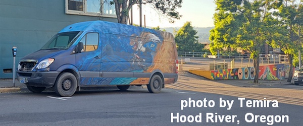
Sprinter Van of the Week!
 Click here for the Sprinter Van map of the world!!!
Have an awesome day!
