
Thank you for using this forecast. Like it? Find it useful? Support it (and me!) by sending some cash my way. What’s it cost to support me and get the email version? Not $99 a year. Nope. Not $49. Just $19.99 or more gets you a year. People are added to this list on Thursday and Sunday. My day job is crisis mental health, and I don’t have time on other days. Thanks for your patience! Click below to contribute. Thank you!!
Click here to use your PayPal
Venmo: @theGorgeismyGym
Snail Mail: PO Box 841, Hood River, Oregon 97031
(note: I am not a non-profit entity. The only way to accept credit cards with a user-defined amount is to use the ‘donate’ button. Thanks for understanding!)
Auto-renewing subscription. New! Awesome!
The Forecast
| 4a-8a | 8a-12p | 12p-4p | 4p-8p | 8p-4a | |
|---|---|---|---|---|---|
| Thursday 6000->5500′ |
 |
|
|
 |
 |
| Friday 5500′->2000′ |
|
 |
|
|
|
| Saturday 2000′ |
 |
|
|
|
|
Mt. Hood Forecast
Clear sky and sunshine on Thursday gives way to light snow, or maybe just flurries, through at least part of the weekend. Thursday’s weather starts out sunny and ends with some partial high clouds and a lovely sunset. The free air freezing level (FAF) will be 6000′ in the morning, 6500′ in the afternoon, and 5500′ overnight. 5000′ temps max out in the upper 30’s. No precip. Wind: S 10-25 all day building to SW 25-50 overnight.
A weak cold front swings in on Friday, but most of the associated moisture will stay far to the west of Mt. Hood. SAD! The day starts with high clouds and turns snowy around sunrise. The snow level will initially be 5500′, but will drop to 4500′ by 10am, and will continue to fall, eventually landing at 2000′ in the evening. About 0.2” water equivalent (WE) falls during the day, for a couple inches of new snow. Another 0.1” WE falls overnight, giving the slopes another inch of new. Wind: SW 25-50 early slowly fades to SW 10-25 in the afternoon and turns to WSW 20-25 in the evening and W 30 overnight.
Flurries alternate with sunbreaks on Saturday. The snow level will be 2000-2500′ for the 24 hour period. Less than an inch of snow falls. Wind: W 30 for much of the day. W 15-20 in the afternoon. SW 10-20 overnight.
Sunday looks mostly cloudy with scattered flurries. The snow level will be 2000-2500′. Up to 1” of new snow falls. Not much, in other words! Wind: SW 10-20 in the morning anad SW 5-10 in the afternoon. Models currently suggest relatively dry, relatively cool weather next week. Have fun on the slopes!
Note on wind speeds. Different wind directions are experienced in different ways on Mt. Hood. For example, west wind at 50mph will hit the slopes and exposed ridges at W 50. SW 50 may hit the ridges at SW 50, but will likely only be SW 20 below tree line. Hence the ranges for wind. Depends where you are on the mountain. Hopefully that helps clarify.
Gorge Wind Forecast
Slightly more active weather means gustier wind over the next few days. For Thursday, we’ll have variable to 5 in the morning, E 10-15 near Stevenson early afternoon, and gusty 14-17 from Stevenson to The Dalles late afternoon. River flow is 123kcfs, river temp is 41F, and high temp forecast is 56F. Friday starts with E 10-15 near Rooster and E 20-25 near Cascade Locks. The wind goes calm for a few hours in the morning and then turns westerly. Expect gusty, drizzly 7-10 Doug’s Beach westward. East of there, you’ll find gusty 20-30 after 1pm. Worth the drive? Meh. High temp: 54F. Saturday starts with light westerlies. Afternoon wind picks up to 10-13 in the west and 19-23 east of The Dalles. High temp: 50F. Sunday’s max wind appears to be W 11-14.
Coast, Jones, Sauvie’s
As needed until next spring and summer.
Hood River Weather Forecast
Mostly cloudy sky this morning turns clear midday and partly overcast this evening with a decent shot at a colorful sunset. Temps will be in the mid 30’s early and mid 50’s later. Light wind through early afternoon. Then moderate westerlies. No rainbows. Friday looks drizzly or showery. Temps will be near 40 early and in the mid 50’s later. Easterlies early. Light westerlies in the afternoon. 99% chance of rainbows. Saturday looks sprinkly in the morning and sunny in the afternoon. Temps will be in the upper 30’s early and near 50 later. Moderate westerlies. 99% chance of rainbows.
Looking for a complete Columbia Gorge forecast? Looking for more humor in your weather? Obscenities? You’re looking for my TATAS: Temira’s Awesome Travel Advisory Service on Facebook.
Cycling
We are in winter riding season, and the trails are apt to be fragile. If it was below freezing last night and is above freezing now, don’t ride. If it was below freezing last night and it is sunny now, don’t ride unless you are under a tree canopy for the entire ride. Freeze-thaw conditions, when ridden upon, result in permanent trail damage. Please consider doing something else, perhaps riding a gravel road in the trees or going to the mountain. Thank you!
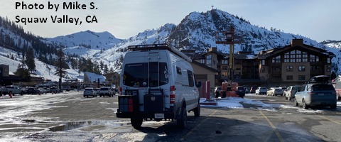
Sprinter Van of the Week!
 Click here for the Sprinter Van map of the world!!!
Local Events
Weekly events: The Kainos Coffee run happens in The Dalles every Tuesday morning at 6am. There are sailboat races at the Hood River Marina every Wednesday evening. Dirty Fingers has a group mountain bike ride (bring lights) Wednesday nights at 5:30pm. Cheno has an outdoor HIIT workout at Griffin House in Hood River at 6pm on Wednesday nights. There is a BLM rally every Tuesday evening at 5:30 at the Salmon Fountain in Hood River, and there’s a White Coats for BLM rally every Thursday at noon at 12th and May in Hood River. Have an awesome day!