


Thank you for using this forecast. Like it? Find it useful? Support it (and me!) by sending some cash my way. What’s it cost to support me and get the email version? Not $99 a year. Nope. Not $49. Just $19.99 or more gets you a year. People are added to this list on Thursday and Sunday. My day job is crisis mental health, and I don’t have time on other days. Thanks for your patience! Click below to contribute. Thank you!!
 |
|
 |
The Forecast
| Your favorite beach | Dawn Patrol |
9am- 11:30a |
11:30a- 3pm |
3pm- dusk |
|
|---|---|---|---|---|---|
| Rooster Rock | tanning | naked | today? | hydrate! | |
| Steven’s Locks | LTW | LTW | 10-13 | 18-22+ | |
| Swell-Hood River | LTW | LTW | 10-13 | 18-22+ | |
| Lyle to Doug’s | LTW | LTW | 5-10 | 11-14 | |
| Rufus, etc. | LTV | LTV | LTV | LTV | |
| Roosevelt & Arlington | LTV | LTV | LTV | LTV | |
Gorge Wind Forecast
In the last 24 hours, models have really shifted away from the ideal cooling scenario and moved into a lesser and slower cooldown. Don’t worry too much – we’ll still have stronger westerlies than we’ve been seeing, and there’s no sign of a wind shutdown in the next week!
Sunday looks like a repeat of what we’ve seen for much of this week: light wind early and just enough wind in the evening for the flotilla of foils. Expect light westerlies through mid-morning and then a slow build to 10-13 from Stevenson to Hood River early afternoon. Give it a couple more hours, and we should have 18-22 between Stevenson and Mosier with a chance of 21-24. River flow readings are 130-162kcfs, river temp is 70F, and high temp forecast is, yet again, 102F.
It won’t be quite as hot on Monday, and it’ll definitely be windier, but elevated thunderstorm could be part of the picture. Fortunately, the low-level air looks pretty stable in the central Gorge, so the wind should continue until an actual storm moves over your head. Dawn Patrol brings 22-25 from Stevenson to Mosier with 12-15 east to Arlington. Midday westerlies build to 24-27 from Stevenson to Avery with 15-18 at Rufus and 10ish farther east. Models suggest the wind will drop to 17-20 from Stevenson to Swell in the afternoon and climb to 25-29 between Hood River and Rufus. High temp: 91F in Hood River and 99F at Rufus.
Model range increases on Tuesday, which makes it hard to give an accurate/precise forecast. As of right now, models suggest mid 20’s with a few outliers calling for stronger wind. This wide range of possibilities continues into the future. Generally speaking, it looks like we’ll have enough wind for many people, actually, most people, to be on the river. Temps will range from 85-90 – note, that’s a lot warmer than the low 70’s that were initially forecast for the middle of next week. Stay cool, and enjoy the wind!
Jones, Sauvie’s, Coast
Coast forecast (north/central/south, waves). Swell forecast provided by NWS. Wind direction northerly unless otherwise noted. Sunday: 20-25/10ish/LTS, NW swell 5′ at 7 seconds. Monday: 10-15/LTV/LTS, NW 4′ @ 7. Tuesday: 10-15/10-15/LTV, NW 5′ @ 8. Jones Sunday: 21-24. Monday: 21-24. Tuesday: 17-21. Sauvie’s Sunday: 14-17. Monday: 11-14. Tuesday: 10-13.
Mt. Hood Snow Forecast – Back on vacation until next fall
Hood River Weather Forecast
Partial high overcast sky on Sunday. Temps in the low 760’s early and near 100 later. Light westerlies most of the day. Moderate in the evening. Slight chance of thunder. 0.01% chance of rainbows. Monday will have some high clouds and a chance of thunder. Muggy to very muggy. Temps start near 70 and end near 90. Moderate to strong westerlies. 1% chance of rainbows. Tuesday will be sunny. Temps start in the mid 60’s and end in the upper 80’s. Moderate to strong westerlies. No rainbows.
Looking for a complete Columbia Gorge forecast? Looking for more humor in your weather? Obscenities? You’re looking for my TATAS: Temira’s Awesome Travel Advisory Service on Facebook.
Local-ish Events
Please let me know of outdoor-related local-ish events. If you don’t tell me, I don’t know! There is a flatwater paddle clinic at Go Foil today ($100). Tonight is the World Naked Bike Ride in Portland. 9pm at Peninsula Park.
Ferment’s Tuesday night 4-mile walk/run is at 6pm. At 7:15am on Wednesdays, there’s a run from the White Salmon Bakery. At 7am on Friday morning, you can get a donut and coffee for going for a run at Kickstand Coffee. The Small Boat paddlers have a group paddle at 6pm on Thursday at the Hatchery. Post and Pint happens Thursday evenings at 5:30. The women’s Post-and-Pinot ride is Wednesday evening at 5:30.
Cycling
Falls Creek is open. All the 44 Road trails are open with a couple of caveats: Lookout Mountain is clear. Fifteen Mile has lots of trees down. Plains of Abraham is open and is rideable. Also, the road connecting Plains of Abraham to Smith Creek closes at noon Monday-Friday and will not be open to bikers during that time. Courtney Road (the road that goes up above Syncline) is closed until October. Do not attempt to use it to access trails. If you’re riding Post Canyon, you will need a parking pass. Those can be purchased at many local shops or online.
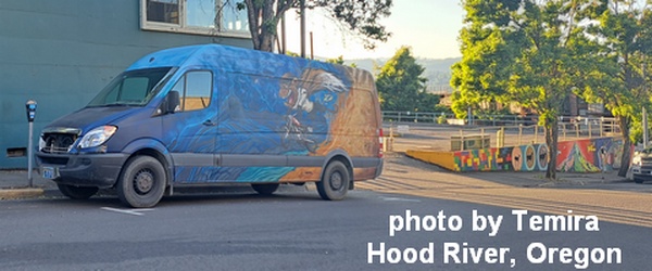
Sprinter Van of the Week!
 Click here for the Sprinter Van map of the world!!!
Have an awesome day!
