Wow. What a storm cycle it’s been on Mt. Hood. Meadows has received 54” of new snow in the last 5 days, and they’ve already had more powder days this year then they had all last year. Looking ahead to the rest of the week, it seems like little Skibowl might just get enough snow to get really, really open. As a matter of fact, this week’s forecast looks even better for them than it does for the big daddy resorts. Continued after the chart.
 |
4a-8a | 8a-12p | 12p-4p | 4p-8p | 8p-4a |
|---|---|---|---|---|---|
| Today 1000′ |
 |
|
 |
|
 |
| Tomorrow 0′–>2000′ |
|
|
 |
 |
|
| The next day 1000′–>0′ |
 |
|
|
|
|
Mt. Hood Snow Forecast, continued…
But back to today… we’ll see orographic (terrain-enhanced) snow flurries through early afternoon today before the sky clears tonight. The snow level will be around 1000′ early, dropping to the surface tonight. We’ll get .1-.3” water value (WV) today, for another 2-3” of new snow. Wind today will be NW 40 early, NW 15-20 midday, and N 20-30 tonight.
Tomorrow starts off clear and sunny, becomes cloudy midday, and sees some snow flurries in the evening and overnight. The snow level will be at the surface early, rising to 2000′ in the afternoon and staying there overnight. Mt. Hood will receive .3” WV, for 2-3” of new snow. Wind tomorrow will be N 20-30 early, swinging to NW 20-25 in the afternoon.

Donate and keep the forecasts coming
See below for details.
Wednesday starts off with moderate snowfall and transitions to some totally ridiculous snowfall, possibly eventually mixed with sleet, after 4pm. The snow level will be 2000′ early, dropping down to the surface (in the Gorge, at least), after 4pm. This is a warm system, but it’s going to take time for it to erode the cold air away, so this will likely stay all snow through Thursday morning. Now for the fun part: the morning system, the colder one, will have .6” WV, and will drop 5-7” of new snow. The afternoon system has about 3” WV, yes, three inches. That’s going to drop 18-24”+ of new snow, assuming it stays all snow, and I think it just might! Wind on Wednesday will be WNW 20 early, backing off to W 15 or less in the afternoon.
It looks like this warm, pineapply, atmospheric river will finally erode all the upper level cold air by Thursday morning, leaving us with a snow level of 7000′ on Thursday, all the way through Friday morning. We’ll see 2” WV that falls as rain between 4am and 4pm, and another 1.5-2” rain between 4pm Thursday and 4am Friday. Holy moly… can you say avalanche danger? Flooding? Ice storm in the Gorge? Ack. Wind Thursday will be LTV early and WSW 30 in the afternoon.
Support your forecaster, Temira!

Thank you for using this forecast. Does it save you time, gas money, or help you have more fun in your life? Make a donation! Get your forecast here for free or donate and get on the mailing list for year-round wind forecasts and ski season snow forecasts. Just click on my photo to donate via PayPal or credit card. The email isn’t $99/year. Not $50/year. No, just $12.34 or more gets you on the list for 12 months, and sometimes there are cool prizes. Don’t PayPal? Send a check to Temira @ PO Box 841 in Hood River. Thank you for your support, and thank you for trusting my forecast.
Gorge Wind Forecast
Looks like we’ll see gusty westerlies at 13-16 through the whole Gorge this morning with gusty westerlies at 15-18 in the western Gorge this afternoon. Tomorrow looks like W 10-13 pretty much everywhere, pretty much all day long. We”ll see light and variable wind on Wednesday morning, becoming E 15-18 Wednesday afternoon. Thursday looks like E 40, and that’s very, very problematic. Friday, as of right now, looks like east wind early, thankfully switching to west wind in the afternoon.
Random Morning Thoughts
Goodness gracious we’re on a wild ride in the weather department this year. We’re 5” over the average rainfall for the water year already, and there are inches more on the way this week. It’s certainly exciting, especially for a weather geek like me. That brings me to the weather for the Gorge this week. Models suggest a big ol’ snowy and icy mess.
It’s okay. There’s nothing you can do about it. There’s nothing any of us can do about it. And hey, maybe it won’t happen.
Either way, now’s the time to prepare yourself mentally. Get ready to completely let go of your obsession with getting things done, because if the forecast verifies, you’re not going to be getting anything (other than sledding) done on Thursday. That might be hard to hear, I know. That’s why we’re all going to prepare now. Get ready to drop your worries, set aside expectations of accomplishment, and prepare to embrace a spectacularly wild weather vacation day.
If you’re prepared, you’ll be more likely to see this as vacation, rather than frustration. Have an awesome day!
Disclaimer required by my grad school program: I am not your therapist. I am your weather forecaster. Take everything I say with a grain of salt, and consult with your actual therapist about your mental health issues.
Gorge Weather Forecast
I wrote all the other sections of the forecast before this one today because this one is the most interesting by far. We’ll see a partly cloudy day today with sprinkles in the morning. Temps will be in the low 40’s early and the mid 40’s in the afternoon. Moderate westerlies, 91% chance of rainbows. Expect black ice tonight.
Tomorrow starts out partly cloudy, clear, or maybe Nothing. Hard to say, to be honest, but light west wind hints at less clouds rather than more. Clouds move in during the afternoon, and we may see a few sprinkles overnight.Temps will be just below freezing early (black ice, people) with highs in the low 40’s. Light west wind.
The shit hits the fan Wednesday night if nothing changes between now and then. We’ll starts off the day with temps in the mid 30’s. The high will be around 40, but a switch to east wind in the evening will drop the temp below freezing. So, rain during the day, then a switch to snow around 7pm. Heavy snow, very heavy snow. Like goodbye I-84 kind of snow. As the upper air warms on Thursday and the Gorge stays cold, the snow will switch to everyone’s favorite: freezing rain. If this plays out, we won’t climb back above freezing until midday Friday.
Now, it’s possible the models won’t verify in reality. But it’s possible they will. If you haven’t put your snow tires on, do it now. If you do not have chains, buy some. Stock up on food and dry firewood, and find a friend who has non-electric heat.
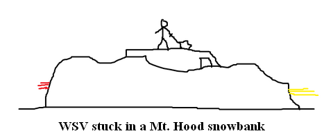
White Sprinter Van of the Day
Road and Mountain Biking
Given what’s in the Gorge weather forecast, you may want to get out and enjoy the gravel roads and the pavement now. If you have a fat bike, you might be okay later this week, but other than that, you’re not riding your bike outdoors for a while.
Upcoming Events
Happy Monday! There’s free Tai Chi at the Mt. Hood Town Hall at noon. At 6:30pm, there’s Zumba at the Parkdale Community Center, there’s Yoga at Yoga Samadhi, and there’s Yoga at the Mt. Hood Town Hall. Coming up tomorrow, there’s pickup touch rugby at 5pm at the ball fields next to Jackson Park. There’s free yoga at the Mosier Community Center at 7pm. There’s meditation at Yoga Samadhi at 6:30, there’s Zumba at the Parkdale Community Center, and there’s $12 prime rib at Cebu.
Have an awesome day today!
Temira

The Clymb: free membership. Cheap gear.
Temira approves. Click to join.