| Mt. Hood Snow Forecast – 5000′ |
|
4a-8a |
8a-12p |
12p-4p |
4p-8p |
8p-4a |
Monday
8000′->4500′ |
 |
 |
|
|
 |
Tuesday
4500′->11,000′ |
 |
|
|
|
|
Wednesday
11,000′->9000′ |
|
|
|
|
|
Mt. Hood Weather Forecast
Too-warm weather continues for the next few days. After that, significant differences in the models and their ensembles make it hard to know whether we’ll see rain or snow. Generally speaking, the long-range forecast brings precipitation to Mt. Hood.
Monday starts with dry weather and a system headed this way. The snow level starts at 8000′ and drops to 6500′ in the afternoon. It’ll fall to 4500′ overnight after this cold front swings through, but the moisture will be done by then. About 0.2” water equivalent is forecast today. That’ll fall as rain. A trace of snow is forecast overnight. Wind: SE 10-20 early, SW 15-25 from midday on, WSW 15 in the evening, and SW 5-15 after midnight.
Tuesday looks mostly dry under high overcast sky. A bit of mist is possible late in the evening, but probably won’t even be measurable. The free air freezing level (FAF) will be 4500′ in the morning and will slowly rise to 11,000′ after midnight. Wind: SW 5-15 all day building to SSW 10-20 after midnight.
Wednesday looks mostly cloudy. Rain may move in late, but model differences keep this forecast imprecise. As of now, it appears the snow level will hover around 10,000′, and precipitation will be in the 0.1-0.2” range with moderate SW wind. Models hint at very active weather for the second half of the week, but details aren’t yet clear. Hoping for snow, and lots of it!
Gorge Wind Forecast
Easterlies continue for the next few days. Model differences starting Thursday make the forecast unreliable. That said, a series of weather systems is likely to affect us, and that’s likely to give us a chance for westerlies. Let’s look at Monday: the easterlies start at 40-45 at Rooster and 30ish at Stevenson with 20-25 at Viento. Gradients: 0.23 and 0.03. The wind holds until early afternoon and then drops to 25-30 at Stevenson and 30-35 at Rooster. Rain moves in around the time the wind drops. East of Hood River, the wind will be light and variable in the afternoon after a 5-10mph start. River flow is 91,700cfs, river temp is 56F, and high temp forecast is 47F. Before I forget… there was another dirty-water reading at the Hook a couple of days ago. Know before you go!
Tuesday starts with E 15-20 at Rooster and Stevenson. Afternoon wind builds to 20-25mph. High temp: 53F. Wednesday starts with 35-40mph at Rooster and 30-35mph at Stevenson with 20-25mph at Viento. The wind holds all day long. High temp: 57F. Fingers crossed for westerlies Thursday and Friday!
Coast, Jones, Coast
Done until spring, unless there’s an obvious Coast or Sauvie’s or Jones day.
Hood River Weather Forecast
Mostly clear sky early quickly turns cloudy and then drizzly by late morning. Temps will be in the upper 30’s early and upper 40’s later. Light easterlies. 6% chance of rainbows. Tuesday looks high overcast and dry. Temps will be in the mid-upper 30’s early and low 50’s later. Calm wind. No rainbows. Wednesday starts mostly cloudy and stays that way. Rain moves in overnight. Temps will be in the low 40’s early and upper 50’s later. Light easterlies. No rainbows.
Looking for a complete Columbia Gorge forecast? Looking for more humor in your weather? Obscenities? You’re looking for my TATAS: Temira’s Awesome Travel Advisory Service on Facebook.
Cycling
SDS, Kreps, and DNR lands have all reopened. Regulated use closure has ended and motorized use is allowed on moto trails. Be aware of recent snowfall about 4500′ or so and plan your rides accordingly.
Local Events
Please send me information about events. You probably know about something I don’t!
Sprinter Van of the Week!
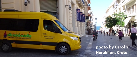 Click here for the Sprinter Van map of the world!!!
Have an awesome day!
Click here for the Sprinter Van map of the world!!!
Have an awesome day!
Temira Lital is a recreation and travel weather forecaster based in Hood River, Oregon. Temira uses they/them pronouns. They're also a mental health counselor. Temira bikes, skis, windsurfs, paddles a SUP, swims in mountain lakes, and loves gardening. Most recently they've taken up SUP foiling. Temira is powered by La Croix, protein, and beets.
View Archive →
