


Thank you for using this forecast. Like it? Find it useful? Support it (and me!) by sending some cash my way. What’s it cost to support me and get the email version? Not $99 a year. Nope. Not $49. Just $19.99 or more gets you a year. People are added to this list on Thursday and Sunday. My day job is crisis mental health, and I don’t have time on other days. Thanks for your patience! Click below to contribute. Thank you!!
 |
|
 |
The Forecast
| Your favorite beach | Dawn Patrol |
9am- 11:30a |
11:30a- 3pm |
3pm- dusk |
|
|---|---|---|---|---|---|
| Rooster Rock | tanning | naked | today? | hydrate! | |
| Steven’s Locks | 5-10 | 10-15 | 20-23 | 20-23 | |
| Swell-Hood River | 21-24 | 25-28 | 25-28 | 22-25 | |
| Lyle to Doug’s | 14-17 | 17-21 | 25-28 | 25-28 | |
| Rufus, etc. | 17-20 | 21-24 | 25-29 | 25-29 | |
| Roosevelt & Arlington | LTV | 10-15 | 20-23 | 25-29 | |
Gorge Wind Forecast
The longest, hottest, and definitely windiest heat wave in Gorge history has come to an end. The Gorge responds by upping the wind speeds a bit. Given various factors (instability to the south, an offshore disturbance Tue/Wed), the forecast is a bit tricky. Let’s just give it a shot, shall we?
Monday starts off with gradients of .12 (pdx-dls) and .03 (dls-psc). Westerlies were generally in the 14-17 range all the way from Hood River to Arlington with 21-24 from Viento to Swell and 5-10 at Stevenson. Models suggest the wind will jump to 25-28 from Viento to Doug’s (20-23 at Stevenson) by late morning with 20-23 at Rufus and light westerlies at Arlington. Afternoon wind dips to gusty 20-24 from Stevenson to Hood River and holds at 25-29 from Mosier to Arlington. River flow readings are 172-191kcfs, river temp is 70F, and high temp forecast is 92F in Hood River and 97F at Rufus. Caveat: should the thunderstorms push into the Gorge, all bets are off on the forecast.
Tuesday starts with 22-25 from Stevenson to Rufus with 15-18 at Arlington. The western Gorge, thanks to that disturbance well offshore, drops to gusty 19-23. Lyle to Threemile rise to 24-27 in the afternoon, perhaps a bit more. In the evening, areas east of Mosier hold, and areas west of Mosier dip to gusty 17-20. High temp: 87F Hood River. 93 at Rufus.
Wednesday sees an offshore disturbance move closer. That gives it more power to disrupt the consistency of the wind. We start with 13-16ish from Stevenson to Hood River with 10-13 east to Arlington. Midday: gusty 19-23 from Stevenson to Rufus. Afternoon holds the potential for 23-27 from Hood River to Rufus. West of Hood River, afternoon westerlies drop into the teens.
Models are hinting at stronger wind on Thursday as cooler air arrives. Keep an eye on that one. After Thursday, there’s quite a bit of uncertainty in the models, with high temp predictions running anywhere form 90F to 104F. So, we’ll leave the forecast here for now. Enjoy!
Jones, Sauvie’s, Coast
Coast forecast (north/central/south, waves). Swell forecast provided by NWS. Wind direction northerly unless otherwise noted. Monday: NW5-10/LTV/LTV, NW swell 4′ at 7 seconds. Tuesday: 10-15/10-15/LTN, NW 5′ @ 8. Wednesday: LTW/LTW/N5-10, NW 3′ @ 7. Jones Monday: 11-14. Tuesday: 10-13. Wednesday: 22-25. Sauvie’s Monday: 10-13. Tuesday: 11-14. Wednesday: 16-19.
Mt. Hood Snow Forecast – Back on vacation until next fall
Hood River Weather Forecast
High clouds stick around through early afternoon and then should dissipate. Temps will be in the upper 70’s early (not awesome, not cool enough to open windows) and low 90’s later. Moderate to strong westerlies. No rainbows. Tuesday will have high clouds (colorful sunrise) to start with clear sky in the afternoon. Temps start in the mid 60’s (about time) and end in the upper 80’s (still too hot to keep windows open). Muggy early. Drier later. Moderate to strong westerlies. No rainbows. Wednesday will be sunny. Temps start near 60 (thank goodness – open the windows) and end in the upper 80’s. Moderate westerlies. No rainbows.
Looking for a complete Columbia Gorge forecast? Looking for more humor in your weather? Obscenities? You’re looking for my TATAS: Temira’s Awesome Travel Advisory Service on Facebook.
Local-ish Events
Please let me know of outdoor-related local-ish events. If you don’t tell me, I don’t know! Ferment’s Tuesday night 4-mile walk/run is at 6pm. At 7:15am on Wednesdays, there’s a run from the White Salmon Bakery. At 7am on Friday morning, you can get a donut and coffee for going for a run at Kickstand Coffee. The Small Boat paddlers have a group paddle at 6pm on Thursday at the Hatchery. Post and Pint happens Thursday evenings at 5:30. The women’s Post-and-Pinot ride is Wednesday evening at 5:30.
Cycling
Falls Creek is open. All the 44 Road trails are open with a couple of caveats: Lookout Mountain is clear. Fifteen Mile has lots of trees down. Plains of Abraham is open and is rideable. Also, the road connecting Plains of Abraham to Smith Creek closes at noon Monday-Friday and will not be open to bikers during that time. Courtney Road (the road that goes up above Syncline) is closed until October. Do not attempt to use it to access trails. If you’re riding Post Canyon, you will need a parking pass. Those can be purchased at many local shops or online.
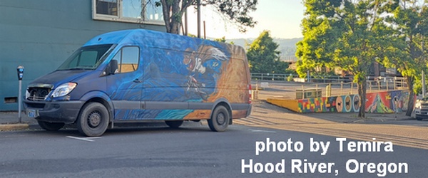
Sprinter Van of the Week!
 Click here for the Sprinter Van map of the world!!!
Have an awesome day!
