

GORGE WIND FORECAST
If you’re still seeing yesterday’s and it’s after 9am, try opening this in an incognito window AND/OR FLUSHING YOUR CACHE or do a do a hard refresh (Ctrl+Shift+R / Cmd+Shift+R)

Keep in mind that this forecast attempts to predict what the iKite/iWind sensors will read. Think like a local! All sensors are not equal. Swell reads low. Viento/Arlington/The Wall read high compared to Swell. 30mph at Rufus (The Wall sensor) is about 23-24mph at Swell. 30mph at Swell is about 35-37mph at Rufus/Viento/Arlington. Hope that helps!
SHORT-TERM gorge wind forecast

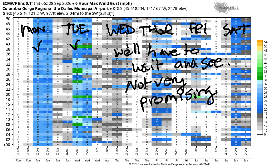
Hi friends! A couple days of moderate west wind are on tap. Wednesday will be light and variable, under 10-13mph all day. Starting Thursday, we’re likely to see a blend of easterlies and westerlies in the Gorge wind forecast through next weekend; the exact forecast depends on the strength/location of a probable (80% chance) ridge of high pressure.
Monday started with pressures of 30.06/30.04/30.02 and light/variable wind. It also started out very dark at 6:30am – we’re losing daylight fast! Not much wind happens this morning, and that’s probably fine, as it’s only 41 degrees out there! Around noon, westerlies begin to build. They’ll slowly climb to 17-20mph mid to late afternoon from Stevenson to Avery. River flow over the last 24 hours was 58-103kcfs, river temp is 65.5F, and high temp forecast is 71 in Hood River.

RIVER FLOW FOR SITES BETWEEN AVERY (EAST OF THE DALLES) AND RUFUS: CLICK HERE FOR JOHN DAY DAM FLOW.
RIVER FLOW FOR SITES BETWEEN STEVENSON AND DOUG’S BEACH (WEST OF THE DALLES): CLICK HERE FOR THE DALLES DAM FLOW

LONGER-TERM gorge wind forecast
Tuesday sees a weak weather system approach in the morning and move inland late in the afternoon or early in the evening. Morning wind will be gusty 18-21mph from Stevenson to the Hatch, 10-13mph or so from Hood River to Doug’s, and gusty 19-22mph from Avery to Arlington. The wind holds for a few hours in the morning. As the system pushes inland, Stevenson-Doug’s drops to 14-17mph, and Avery to Threemile rises to gusty 20-23mph. High temp: 67 in Hood River and 75 in the desert.
Wednesday starts with light westerlies, under 10mph. Afternoon wind turns light easterly, maxing out at 10-13mph near Stevenson with under 10mph everywhere else. High temp: 72 in Hood River. Thursday (probably) brings stronger easterlies, perhaps 20-25mph. Models are hinting at westerlies in the teens on Friday. If you’d like more consistent wind, consider the south coast – models suggest it will be windy there (20+) every day through Friday. Enjoy your day today. Hope to see you on the Nch’i Wana soon!
Tip via venmo, cash or check
Want to subscribe to the email version, support Temira, and get the forecast earlier? Click on the blue box up above or use the methods below. Year-round is $29.99 or more if you think it’s worth more. Only need snow or only need wind? Warm season (May-Oct) or cold season (Nov-Apr) is $19.99 or more if you think it’s worth more. Thanks for your support!

JONES BEACH, SAUVIE ISLAND, & COAST FORECAST
Wind northerly unless otherwise indicated. For coast, it’s North/Central/South with the “central” at approximately Florence. Swell forecast from NWS for central coast. Jones: westerly unless otherwise stated. Sauvie Island: northerly unless otherwise stated.
Coast Monday: LTNW/LTN/N25-30, NW swell 6′ @ 15 seconds. Tuesday: SW15/LTV/N20-25, NW 7′ @ 13. Wednesday: N15-20/N15-20/N30-35, NW 6′ @ 12. Jones Monday: 7-10. Tuesday: LTV. Wednesday: LTE. Sauvie Island Monday: 7-10 > 5pm. Tuesday: LTV. Wednesday: 11-14.
BARE BONES HOOD RIVER WEATHER FORECAST
Clear sky early and mostly clear with a few high clouds later. Temps start in the low 40s and rise to the low 70s. Light westerlies early. Moderate westerlies later. No rainbows. Tuesday will be mostly cloudy. Temps start in the upper 40s and rise to six-seven degrees. Moderate westerlies. 1% chance of rainbows. Wednesday will be cloudy then mostly clear with a few high clouds. Temps start in the low 50s and rise to the low 70s. Light and variable wind. No rainbows.
BIKE TRAILS INFO
NEXT WORK PARTY: October 25th and November 8th in Post Canyon with the HRATS.
CLOSED TRAILS: Anything south of the 44 Road due to the Grasshopper Fire / Forest Closure Order: for example – Boulder Lakes, Gunsight, Gumjuwac, Lookout Mountain, 450, Fifteenmile.
TEMIRA’S AWESOME TRAVEL ADVISORY SERVICE
HYPERLOCAL WEATHER FORECAST FOR THE COLUMBIA GORGE
THE DALLES, HOOD RIVER, WHITE SALMON, TROUT LAKE, STEVENSON, CASCADE LOCKS, PARKDALE, ODELL, HUSUM, BZ, MILL A, WILLARD, GOLDENDALE, RUFUS, ARLINGTON, boardman

Good morning, neighbors! Unless something changes dramatically in the models, we’ll have mellow (warm, mostly sunny) weather for the better part of the next couple of weeks. Next best chance of rain is Tuesday evening west of Hood River when a weak system exercises its right to rain. You too should exercise your rights: to speak (1A) and to vote (15A and 19A). If you are in Washington, you can use voter.votewa.gov to check your registration. If you are in Oregon, you can check using the MyVote website. If you just want the weather, you can keep reading!
Monday started off clear and dark. It’s TATAS’ favorite time of year – dark when they get up, and dark when they go to bed! Know what else happened this morning? A hard frost in Glenwood (28 degrees) and 31 degrees in Centerville and Trout Lake. Steele Road in The Dalles dropped to 32, and Parkdale fell to 32-38. By the afternoon, we’ll be far from frosty: just a few high clouds with temps ranging from 70 in Stevenson to 71 in Hood River, 77 in The Dalles, and 74 in Pasco. This onshore temp gradient results in afternoon westerlies at 15-20mph between Stevenson and Avery.
A weak weather system moves through on Tuesday like waves of emotion moving through your nervous system. Emotions are just fine – they’re not permanent, and they will end if you don’t freak out about them. Anyway…
Tuesday morning starts cloudy west of Cascade Locks and partly high overcast to the east. Early temps: 40-55. A little drizzle falls west of Cascade Locks between 8am and 11am to remind you what drizzle feel like. Another round of light rain is forecast west of Wyeth from 8pm to 2am. In between those two rounds of drizzle, we’ll have increasing clouds west of Mosier and continued partly high overcast sky to the east. West wind will be 15-20mph pretty much all day between Stevenson and Arlington, although areas between Hood River and Murdoch will be lighter. High temps range from 65 in Stevenson to six-seven in Hood River, 74 in The Dalles, and 77 in Pasco, where it’s still warm enough to get outside and do some tanning.
Wednesday starts cloudy west of Wyeth and cloudy east of Biggs with mostly clear sky in between. Morning temps: 45-55. Afternoon: 72-77, hottest in The Dalles. Wind will be light and variable. Looking deeper into the future, there’s about an 80% chance of warm (70-80), sunny weather at least through next weekend. Rain chances are minimal for the ten day period after Tuesday. It’s going to be beautiful weather to start on the garden cleanup! Safe travels. -TATAS
HEY! DON’T STOP READING! Is this community-focused forecast helpful to you? It sure is! It takes me a couple hours a day to write. Please join your friends and neighbors in contributing to keep it going. Venmo: @thegorgeismygym PayPal: twomirrors@gmail.com USPS: Temira / PO Box 841 / Hood River, Oregon 97031
MT HOOD SNOW FORECAST

QR codes and links for end-of-season tips – thank you!!!
Cash/check: Temira – PO BOX 841 – Hood River, Oregon 97031

