
Thank you for using this forecast. I offer it freely so you can have more fun and plan your life. It does take significant time and energy to produce. If you find yourself using it often, or if you feel your life is more awesome because of my work, please make a donation. You can get this forecast via email by donation. The email subscription isn’t $99/year. Not $50/year. Donating $12.34 or more gets you on the list for 12 months. Thank you for your support and thank you for trusting my forecast.
Click here to donate using a credit card.
Click here to donate via PayPal.
Venmo: @theGorgeismyGym
Snail Mail: PO Box 841, Hood River, Oregon 97031
Get the email version free through the end of January – try it out! Click here.
| 4a-8a | 8a-12p | 12p-4p | 4p-8p | 8p-4a | |
|---|---|---|---|---|---|
| Monday 0′->1000′->0′ |
 |
|
|
|
|
| Tuesday 0′->1500′->1000′ |
|
 |
 |
 |
|
| Wednesday 1000′ |
|
|
|
 |
|
Mt. Hood Weather Forecast
Monday should be clear to partly cloudy on Mt. Hood. Snowfall returns for Tuesday and Wednesday followed by another round of clear weather on Thursday and Friday. Weekend weather: more snow.
Monday riders will find chilly temps and mostly clear sky. The free air freezing level will be at the surface early and near 1000′ later. Mountain temps will be in the low double digits. Wind will be N 20 early, NW 20 in the afternoon, and NW 15 overnight.
Tuesday starts off clear and quickly turns cloudy. Light snowfall starting around 1pm turns heavy after 4pm. The snow level will be 0′ early, 1500′ in the afternoon, and 500-1000′ overnight. About 0.1” water value (WV) falls in the afternoon, for up to 1” of new snow. Another 0.7” WV falls overnight, for 7-9” of fluffy powder. Wind will be NW 15 early, NW 20 in the afternoon, and NW 30 overnight.
Light snowfall continues on Wednesday, tapering off as the day goes on and ending with clear sky overnight. Snow level 1000′ all day and down to the surface overnight. Precip: 0.3” WV during the day, for 3-4” of powder. Just a trace falls in the afternoon. Wind will be NW 30 early, NW 10 in the afternoon, and NE 20 overnight.
Thursday looks sunny. The free air freezing level will be 0′ early and 1000′ in the afternoon. Mountain temps will be in the teens. Wind: NE 20 in the morning, NE 15 in the afternoon, and W 5 after midnight. Clouds build Friday during the day. Snowfall starts up in the afternoon. Approximately half a foot of snow falls by Saturday morning. Models agree on more snow for the weekend, but not on the details of what causes it or the snow level. Let’s just say the forecast is promising and leave it at that.
Gorge Wind
For Monday, we start with calm wind in the west and light easterly flow out east. The wind will switch to westerly around 10am with W 10-13 from Stevenson to Mosier for the rest of the day. Light east flow continues east of Moiser. Tuesday starts off with light westerlies. The wind picks up to 14-17 from Stevenson to The Dalles with E 0-5 east of The Dalles. Wednesday starts with W 17-20 from Stevenson to Arlington. The wind slowly fades during the day. By 4pm, it’ll be light and variable. Easterlies build Wednesday night into Thursday morning.
JONES, SAUVIE’S, COAST: now on vacation for the fall and winter. Will return in spring.
Virtual Spin – video, beats, friends, BIKES!!
Got a schedule that makes it hard to link up with scheduled classes? No worries, we got you. Our virtual spin program gives you access to our all new Spin Studio built for our Cycling program. Connect up with Virtual Classes led by a live coach, or with voiceover some fresh beats and paired with Scenic Rides all over the world. You can even hit one button and play your favorites from NetFlix and a variety of other media services. Or jam out to tunes and catch up with your friends for an all-time great experience in a private studio. Bike Max is 10 people. Meet up with your friends on your schedule and keep your cycling fitness strong all winter long!Get signed up now by clicking here!
Hood River Weather Forecast
Nothing clouds Monday morning turn to partly cloudy sky this afternoon. Temps will be in the low 30’s early and mid 30’s later. Calm wind turns westerly in the afternoon. No rainbows. Tuesday looks Nothing early and rainy after noon. Temps will be near freezing early and in the upper 30’s later. Snow level 1000′. West wind. 28% chance of rainbows. Wednesday starts off showery and becomes mostly cloudy. Nothing returns overnight. Temps will be in the low to mid 30’s early and near 40 in the afternoon. West wind. 89% chance of rainbows.
For weather specifically directed at travel through the Gorge, please visit Temira’s Awesome Travel Advisory Service on Facebook.
White Sprinter Van of the Week!
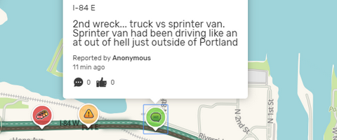
Click here for the White Sprinter Van map of the world!!!
Road and Mountain Biking
Silly rabbit… it’s not biking season in the Gorge. It’s XC skiing and BC skiing season! Wax those skis with some red and get out and play in the snow!
Upcoming Events
Our Monday community events start with by donation yoga at Flow at 8;30. There’s meditation at Trinity Natural Medicine at noon, $5 Tai Chi at the Hood River Adult Center at 2:30, free stress reduction class at HAVEN in The Dalles at 5:30, yoga at Samadhi at 6, and Zumba at Mid-Valley Elementary at 6:30. There’s also pickup kickball at Bingen’s Daubenspeck Park at 6.
Random Morning Thoughts
Click here for the full events calendar.
Have an awesome day today!
Temira