


Thank you for using this forecast. Like it? Find it useful? Support it (and me!) by sending some cash my way. What’s it cost to support me and get the email version? Not $99 a year. Nope. Not $49. Just $19.99 or more gets you a year. People are added to this list on Thursday and Sunday. My day job is crisis mental health, and I don’t have time on other days. Thanks for your patience! Click below to contribute. Thank you!!
 |
|
 |
Thank you for contributing and keeping this forecast going! Not ready to subscribe?
No problem – please share this forecast with all your friends too! I appreciate your support!
Or… Try the email free until the end of this month
The Forecast
| 4a-8a | 8a-12p | 12p-4p | 4p-8p | 8p-4a | |
|---|---|---|---|---|---|
| Tuesday 4000′->1500′ |
 |
 |
|
|
|
| Wednesday 1500′->6000′ |
 |
 |
|
|
|
| Thursday 6000′->6500′->2500′ |
|
 |
|
|
 |
Mt. Hood Snow Forecast
It’s Tuesday morning, and we’re starting out with packed powder up high and hardpack down low. That won’t last long – lots of snow is on the way to cover up the groom. If you like storm skiing, get yourself some today. Want dry weather? Wednesday and/or Thursday is the plan. Light snowfall returns, most likely, for the latter half of the week. Some models are hinting at a big dumping Monday into Tuesday. Fingers crossed!
Tuesday starts cloudy, but snow quickly arrives. The snow level will be 4000′ this morning, 3500′ this afternoon, and 1500′ after midnight. About 0.8” water equivalent (WE) is forecast today for 8” of 10:1, average quality snow. Overnight, another 0.4” WE is forecast for 4-5” powder. Today’s wind will be right in “storm-skiing” range, but probably won’t shut down lifts. Morning wind will be WSW 25-30. It rises to W 40 in the afternoon and turns to WNW 35-45 overnight.
Flurries and sunbreaks start the day on Wednesday. High clouds move in mid-morning, and the precip shuts off. That’s the whole plan for the day. The snow level will be 1500′ early, and the free air freezing level will slowly rise during the day. It eventually settles at 6000′ overnight as 850mb temps rise to +2C. Just 0.1” WE is forecast in the morning for up to 1” of powder. Wind: WNW 35-45 early, W 15 mid-morning, and light southerly from late evening on through Thursday morning. High clouds start the day on Thursday, but sun should make a showing in the afternoon. Overnight: light snowfall. The snow level will be 6000′ early, 6500′ in the afternoon, and 2500-3000′ when the precip arrives. About 0.2 WE is forecast. Call that a couple inches of standard-issue PNW snow overnight. Wind: S 5-10 early, SW 10-20 in the afternoon, and WSW 15-20 from early evening on through the night.
Light snow probably continues Friday and Friday night. This sets up a dry day Saturday, probably. The next big storm is currently forecast for Monday into Tuesday. Models currently have it coming out of the NW, which is the best possible setup. This makes for lots of snow, and usually makes for cold snow. Fingers crossed!
| FORECAST SPONSORED BY / AWESOME COMPANIES TO SUPPORT | |
 |
|
Gorge Wind Forecast
It’s Tuesday, and westerlies pick up today. Wednesday will be a light/variable day, and easterlies return on Thursday. Westerlies, thanks to strong offshore high pressure, will probably outperform models on Friday. Let’s look at Tuesday. We have light onshore gradients, just enough for westerlies at 7-10mph through most of the Gorge. Rain moves in and adds some wind. You’ll find gusty 21-24 from Stevenson to The Dalles after 1pm with gusty 15-20 in the eastern Gorge. River flow readings are 111-129kcfs, river temp is 38F, and high temp forecast is 47F. Wednesday starts with W 11-14 all through the Gorge. By midday, the wind turns calm. In the evening, it swings to light easterly. Thursday starts with E 30-35 at Rooster and 20-30 at Stevenson. Afternoon wind evens out to 20-25 at both. High temp: 48F.
Jones, Sauvie Island, Coast – Done for the Season
Hood River Weather Forecast
Clouds this morning quickly give way to moderate rain. This continues basically the rest of the day. Temps will be near 40 in the morning and in the upper 40’s later. Moderate westerlies. 89% chance of rainbows. Wednesday will be partly cloudy then high overcast. Temps will start in the mid 30’s and rise to the mid 40’s. Light westerlies turn calm in the afternoon. 4% chance of rainbows. Thursday will partly Nothing then sunny then overcast with light rain overnight. Temps start near 30 and end near 50. Easterlies. NO rainbows.
Looking for a complete Columbia Gorge forecast? Looking for more humor in your weather? Obscenities? You’re looking for my TATAS: Temira’s Awesome Travel Advisory Service on Facebook.
Local-ish Events
Please let me know of outdoor-related local-ish events. If you don’t tell me, I don’t know!
Regular weekly events: NK Studios in Bingen has a donation-based yoga class at 7:30am every Tuesday. Ferment’s Tuesday night 4-mile walk/run is at 6pm. There’s meditation with monks at 5:15pm (an hour) and 6:30pm (30 minutes plus a talk) at Yoga Samadhi in White Salmon. At 7:15am on Wednesdays, there’s a run from the White Salmon Bakery. At 7am on Friday morning, there’s a run from Pine Street Bakery. On Fridays at 2:30pm, there’s a free meditation and stretching class at Yoga Samadhi. There’s a weekly group paddle to the Event Site on Sunday at 11 am followed by a free pint at the fire pit at Ferment. That’s the “Paddle n’ Pint”. Also: Wednesday Paddle Sprints at the Event Site at Noon.
Cycling
If you ride in the mud, you’ll do significant and permanent damage to the trail bed. Be thoughtful about your riding choices. Also, it’s winter. Be prepared to turn around due to freeze-thaw mud. If it was below freezing the night before your ride, don’t ride trails that are exposed to the open air. Those trails will have freeze-thaw conditions, and you’ll do major damage. Consider gravel riding! If you’re parking at Post Canyon, you will need a parking pass. Those can be purchased at many local shops or online.
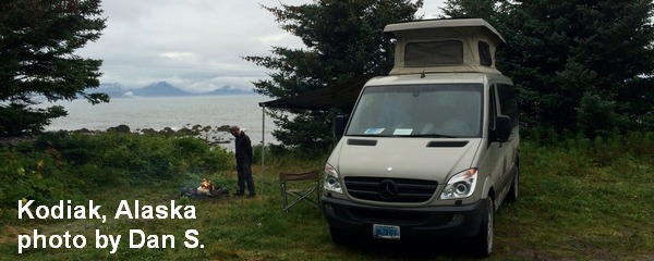
Sprinter Van of the Week!
 Click here for the Sprinter Van map of the world!!!
Have an awesome day!
PREVIOUS POSTS
- Thursday Gorge wind forecast & local weather: breezy with increasing sun. I’m headed out on retreat – see ya May 8th!
- Wednesday Gorge wind forecast & Gorge weather: nuking and pouring. What a combo!
- Tuesday Gorge wind forecast & Gorge weather: lots of wind, lots of rain, not much frost…
- Monday Gorge wind forecast & Gorge weather: lots of clouds and lots of west wind this week!
- Sunday Gorge wind forecast & Gorge weather: easterlies and cloudy today. Blasting westerlies possible Tuesday and Wednesday!

Have an awesome day.
Love, Temira