

 |
4a-8a | 8a-12p | 12p-4p | 4p-8p | 8p-4a |
|---|---|---|---|---|---|
| Sunday 0′ |
 |
 |
 |
|
|
| Monday 0′ |
|
|
 |
|
 |
| Tuesday 0′ |
|
 |
|
|
|
Mt. Hood Snow Forecast
Today’s forecast is a little tricky, in that the precipitation type depends a lot on the exact track of the incoming low pressure system. If the system goes north of the Columbia (model consensus), the snow will be dense and possibly mixed with rain at times. If it goes south of the Columbia (outliers, and similar to the system that brought 10” of snow to Portland last year), the mountain will see lots of cold, light snow.
So, for Sunday, the mountain will see light snow in the morning and heavier snow after 4pm with a break midday. The snow level will be near the surface all day, with a potential bump up to 3000’+ in the evening. 1-2” of snow will fall before 4pm. Models suggest .5” water value (WV) overnight, but WNW wind will increase that. We’ll see .5-.9” WV tonight, for 4-8” of dense snow (unless rain gets mixed in). Wind will be WSW 10 early, WSW 20 in the afternoon, and WNW 35 overnight.
Monday morning starts off with lingering flurries and then becomes clear with low clouds and/or orographic snow flurries. Maybe an inch or two will fall in the morning. The snow level will be near 0′ all day. Wind will be WNW 35 in the morning, NW 20 in the afternoon, and NW 15 overnight. Come to think of it, with wind that strong and from that direction, 3-4” of snow is possible.
Tuesday starts out clear and turns snowy in the evening. This forecast is also a bit complicated, as the system is relatively warm and will depend on both the storm track and depth of cold air in place at the surface. For now, let’s call it a 3000′ system, but the snow will likely be dense. The GFS has .7” WV, but W wind could up that a bit. Let’s call it 7-10” on Tuesday night. Wind will be NW 15 early, W 30 fin the afternoon, W 35 overnight. Additional heavy snow falls on Wednesday. The long-range forecast calls for snow on Thursday and rain on Friday, but that could change a lot between now and then.
 >
>
Does this forecast save you time, gas money, or help you have more fun in your life? Make a donation to support continued forecasting, and get the forecast in your inbox each day. Click on the button to donate. The email subscription isn’t $99/year. Not $50/year. No, just $12.34 or more gets you on the list for 12 months. Don’t PayPal? Send a check to Temira @ PO Box 841 in Hood River. Thank you for your support and thank you for trusting my forecast.
Random Morning Thoughts
Happy Christmas Eve and happy holidays to all of you! Holidays mean something different to each of us. For me, they are a time to play, a time when there’s just enough space in my busy life to get out an enjoy the snow, the company of friends and even the-gym-is-my-gym. From the cozy space of my brightly-lit office this morning, I’m wishing all of you the best. I hope that your holiday season has flashes of joy, moments of love, and times of peace. I’m sending you well wishes and hopes that you are free from suffering and surrounded by a community of people who care. I’m also sending you gratitude for supporting me in my forecasting ventures and also in my pursuit of my counseling degree. I wish you a life filled with goodness, and I thank you for being a part of my life. Have an awesome day.
Disclaimer required by my grad school program: I am not your therapist, but I am seeing clients at this time at Comprehensive Healthcare in White Salmon. In the meantime, I am your weather forecaster. Take everything I say with a grain of salt, and consult with your actual therapist about your mental health issues. One other thing: I plan to keep doing this forecast indefinitely. Forecasting and counseling are both deeply meaningful and nourishing to me.
Gorge Wind Forecast
East wind at 50mph continues all day, dropping to 40mph around midnight. For Christmas Day, we’ll have east wind at 20-25 in the morning, 5-10 in the afternoon, and 30-35 overnight. Tuesday has east wind at 40mph all day.
Gorge Weather Forecast
For Sunday, we’ll have light snow in the morning and heavier snow in the afternoon. 1-2” before noon, and 2-4” tonight. Temps will be in the low 20’s this morning and upper 20’s this afternoon. East wind. No rainbows. Icy roads. Monday starts off with 1-2” of snow and then dries out after 11am. Temps will be in the mid 20’s early. NWS says mid 30’s in the afternoon. I think we might climb to 33 and then drop below freezing again. East wind. No rainbows. Tuesday looks cold and dry to start with 4-6” snow in the evening. Temps will be in the upper 20’s early and mid 30’s in the afternoon. East wind. No rainbows.
For weather specifically directed at travel through the Gorge, please visit Temira’s Awesome Travel Advisory Service on Facebook.
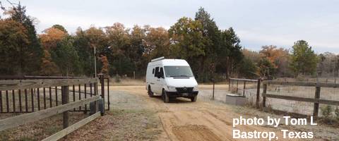
White Sprinter Van of the Week
Road and Mountain Biking
Post Canyon is currently closed to prevent trail damage. Other trails now have snow on them, as do the roads. Should make for an interesting Cold Lap group ride this afternoon at 3pm at Dirty Fingers.
Upcoming Events
On Sunday, there are three free yoga classes: 9am at Samadhi in White Salmon, 4pm at Pure Yoga in The Dalles, and 6pm at Pure Yoga Hood River. There’s pickup touch rugby for all ages at 11am at the Hood River Marina.
Click here for the full events calendar.
Have an awesome day today!
Temira
