


Thank you for using this forecast. Like it? Find it useful? Support it (and me!) by sending some cash my way. What’s it cost to support me and get the email version? Not $99 a year. Nope. Not $49. Just $19.99 or more gets you a year. People are added to this list on Thursday and Sunday. My day job is crisis mental health, and I don’t have time on other days. Thanks for your patience! Click below to contribute. Thank you!!
 |
|
 |
Thank you for contributing and keeping this forecast going! Not ready to subscribe?
No problem – please share this forecast with all your friends too! I appreciate your support!
Or… Try the email free until the end of this month
The Forecast
| 4a-8a | 8a-12p | 12p-4p | 4p-8p | 8p-4a | |
|---|---|---|---|---|---|
| Sunday 5500′->3500′ |
 |
|
 |
|
|
| Monday 3500′->1500′ |
|
|
 |
|
 |
| Tuesday 1500′->4000′->3000′ |
 |
 |
|
|
|
Mt. Hood Snow Forecast
A cloudy, spring-day start to Sunday gives way to a return to winter this afternoon. Snow continues through Monday. We’re back to sunshine on Tuesday and Wednesday before we descend into increasingly wintry weather through next week end. Models don’t agree on how much snow will fall next week, but they do agree that it’ll be snow (maybe even potentially at your house!) through the extended period.
Sunday starts off cloudy and turns snowy by late morning or early afternoon. The free air freezing level will be 5500′ to start, but by the time the snow arrives, the snow level will be 4000-5000′. It falls to 3500′ overnight. About 0.2” water equivalent (WE) is forecast for the afternoon, for 1-2” of heavy snow. Another 0.2” WE is forecast overnight. That’ll be a bit lighter and should groom out into packed powder. Wind: S 5-10 to start, S 15-30 in the afternoon, and W 20 after midnight.
Snow continues through Monday evening. The snow level will be 3500′ in the morning, 2500′ in the afternoon, and down to 1500′-2000′ under mostly cloudy sky overnight. About 0.3-0.6” WE is forecast during the day for 3-6” of new snow. Up to one inch of snow falls at the tail end of this system overnight. Wind: W20 in the morning, W 30 in the afternoon, and S 5-10 after midnight.
Tuesday will be mostly cloudy to start but should quickly clear. The free air freezing level will be 1500′ in the morning, 4000′ in the afternoon, and 3000′ overnight. Get the snow early for the best packed powder results – the sun is strong enough to warm it despite the low freezing levels. Wind: S 5-10 in the morning, E 10-15 from early afternoon on through the night. Wednesday looks sunny and then partly to mostly cloudy with a trace of snow overnight. Steadier snow moves in midday Thursday and continues on and off through the weekend and start of the following week. Probably. Models disagree on snow amounts, but they’re pretty sure it’ll be snow that falls and not rain. Hi winter. Welcome back!
| FORECAST SPONSORED BY / AWESOME COMPANIES TO SUPPORT | |
 |
|
Gorge Wind Forecast
Easterlies on Sunday give way to westerlies on Monday, variable wind on Tuesday, and (probably) several days of chilly westerlies for the second half of next week. Sunday starts with 30-35 at Rooster and 20-25 at Stevenson. The wind briefly rises to 25-30 at Stevenson and drops to 20-25 at Rooster. In the afternoon, the wind drops to light easterly at all locations as drizzle arrives. Monday starts with light west wind. Afternoon westerlies rise to gusty 15-18 west of The Dalles and gusty 25-29 from The Dalles to Threemile. Don’t forget to stop at Amayah’s Indian in Biggs on your way home! High temp: 49F. Tuesday starts with westerlies at 15-20 out east and 5-10 in the west. The wind turns around midday. Rooster to Viento pick up to 10-15mph, and the eastern gorge rises to E 5-10. High temp: 55.
Jones, Sauvie Island, Coast – Done for the Season
Hood River Weather Forecast
High clouds this morning thicken today and drizzle arrives early afternoon. Temps will be near 40 early and in the low 50’s later. Easterlies. 19% chance of rainbows. Monday will be intermittently drizzly. Temps start in the low 40’s and rise to the upper 40’s. Light westerlies. 99% chance of rainbows. Tuesday will be dry. Partly cloudy sky starts the day and sun finishes it. Temps will be in the low-mid 30’s early and mid 50’s later. Light westerlies early switch to light easterlies later. No rainbows.
Looking for a complete Columbia Gorge forecast? Looking for more humor in your weather? Obscenities? You’re looking for my TATAS: Temira’s Awesome Travel Advisory Service on Facebook.
Local-ish Events
Please let me know of outdoor-related local-ish events. If you don’t tell me, I don’t know!
The Meadows Strava Nordic race started 3/17. There’s a seed swap and plant sale at Rockford Grange at 2pm on Sunday the 19th. April 2nd is an end-of-season party at Meadows Nordic. April 15th at 10am is the “Run with the Wild 5k” fun run to support the Wildland Firefighter Foundation.
Regular weekly events: NK Studios in Bingen has a donation-based yoga class at 7:30am every Tuesday. Ferment’s Tuesday night 4-mile walk/run is at 6pm. There’s meditation with monks at 5:15pm (an hour) and 6:30pm (30 minutes plus a talk) at Yoga Samadhi in White Salmon. At 7:15am on Wednesdays, there’s a run from the White Salmon Bakery. At 7am on Friday morning, there’s a run from Pine Street Bakery. On Fridays at 2:30pm, there’s a free meditation and stretching class at Yoga Samadhi. On Saturday at 9am, there’s a by-donation outdoor group fitness on the 2rd floor deck about Ferment Brewing. There’s a weekly group paddle to the Event Site on Sunday at 11 am followed by a free pint at the fire pit at Ferment. That’s the “Paddle n’ Pint”. Also: Wednesday Paddle Sprints at the Event Site at Noon.
Cycling
Many of the trails will be muddy with the exception of Syncline. Please avoid the muddy trails (Hospital Hill, Whoopdee, Post) – if you ride them, you’ll do major damage and ruin the next person’s ride.. You might be able to ride the Deschutes or Klickitat trails or Syncline, but you’ll be most successful on gravel. If it was below freezing the night before your ride, don’t ride trails that are exposed to the open air. Those trails will have freeze-thaw conditions, and you’ll do major damage. Consider gravel riding! If you’re parking at Post Canyon, you will need a parking pass. Those can be purchased at many local shops or online.
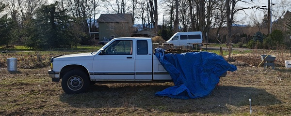
Sprinter Van of the Week!
 Click here for the Sprinter Van map of the world!!!
Have an awesome day!
PREVIOUS POSTS
- Thursday Gorge wind forecast & local weather: breezy with increasing sun. I’m headed out on retreat – see ya May 8th!
- Wednesday Gorge wind forecast & Gorge weather: nuking and pouring. What a combo!
- Tuesday Gorge wind forecast & Gorge weather: lots of wind, lots of rain, not much frost…
- Monday Gorge wind forecast & Gorge weather: lots of clouds and lots of west wind this week!
- Sunday Gorge wind forecast & Gorge weather: easterlies and cloudy today. Blasting westerlies possible Tuesday and Wednesday!

Have an awesome day.
Love, Temira