| Snow level | 4a-8a | 8a-12p | 12p-4p | 4p-8p | 8p-4a |
|---|---|---|---|---|---|
| Saturday 7000′->2500′ |
 |
 |
 |
|
 |
| Sunday 2500′->5500′->4000′ |
|
|
|
|
|
| Monday 4000′->2500′ |
|
|
|
|
 |
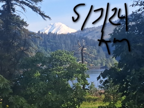
Mt. Hood Snow Forecast
Hi skiers and riders! Heavy snowfall and full-on storm skiing remains in our early may forecast. I’m going to try and keep this quick because I have a long drive this morning. We’ll see snowfall through Tuesday. After that, we enter a much warmer, much sunnier period. Total snowfall prior to that should be somewhere in the 1.5 feet to 3.0 feet range.
Saturday starts with rain. The transition to snow happens late morning. The snow level will be 7000′ early, 5000′ midday, 3500′ in the afternoon, and 2500′ overnight. About 0.5” water equivalent (WE) mixed precip is forecast for the daytime. Call that 2-3” wet snow. Overnight, 0.6” WE is forecast with the potential for 25-40% more thanks to orographics. Call it 6-9” increasingly powdery snow. Temps fall during the day and land in the upper 20s to low 30s. Wind: S 15-25 early shifts to W 15 midday, WNW 25-35 in the afternoon, and W 45-50 overnight.
Full on storm skiing is forecast for Sunday. The snow level will briefly rise high enough for some very wet snow or snain, but it’ll be low enough for snow for most of the 24 hour period. The snow level starts at 2500′, rises to 5500′ in the afternoon, and falls to 4000′ overnight. About 0.8” WE is forecast during the day. Call that 6-8” increasing wet snow. Overnight, 1.0” WE falls for 9-11” relatively dense new. Temps max out around 33F in the afternoon before falling to the low 30s overnight. Orographic assistance could add 30% to those totals.
Snow continues on Monday. The snow level will be 4000′ in the morning and will fall to 3500′ in the afternoon. Overnight, it drops to 2500′. About 0.5” WE is forecast during the day for 5-=6” new snow. Overnight, another 0.3” to 0.4” WE falls for 3-4” more. Wind could increase those totals by 20%: W 40 in the morning, W 30 in the afternoon, and WNW 30-40 overnight. Light snow continues into Tuesday midday before the sky clears. After that, it’s warm and sunny weather through the latter part of next week and maybe longer. Enjoy this late season dump!
A poem:
Was that forecast helpful?
Did it save you time or gas money?
Did it make your life more fun?
Then please make a contribution.
Writing this takes me an hour or two a day.
Without your support, I can’t keep it up.
Keep the forecast going.
Subscribe or donate.
And share my forecast with your friends!
 |
 |
 |
|
Not ready to subscribe? No problem – please share this forecast with all your friends too!
Or try a month for free!

Gorge Wind Forecast
Hi friends! Complicated weather is still in the cards for the weekend. While we still have a forecast for strong westerlies, there’s lots of rain in the picture. That rain is really going to mess with wind quality and predictability. Even so… west wind of the “enough” variety sticks around through Tuesday. After that, high pressure builds in and first shuts down the wind and next switches it to easterlies, briefly, at least.
Saturday kicks off with pressures of 29.57/29.52/29.57 for gradients of W 0.05 and east 0.05. That wacky setup is due to the positioning of a low pressure system. That will slide east today and 1) increase gradients and 2) keep the rain coming. By mid-morning, westerlies rise to gusty 19-22 from Stevenson to Mosier (with rain) and 10-13 east of Mosier to wherever the low is. Early afternoon wind holds in the west and raise to 25-28 from Avery to Rufus (with rain). Evening wind should climb to 27-31 from Avery to Threemile with 14-17 west of Avery. For the final act, westerlies pick up to 21-24 from Stevenson to Mosier for the Executive (after 5pm) Session. Weather today includes rain all the way to Boardman through mid to late afternoon. After that, the rain settles back to areas from Stevenson or Wyeth westward. To the east: dry and overcast. High temp will be 58F in Hood River and 62F in Arlington.
The latest round of model output has backed Sunday’s wind down from “nuking” to “strong”. It’s also extended the duration of rain wrapping around a low pressure system. Still… there’s a Wind Advisory posted for the Arlington area. Overall setup includes a big low along the east border of Idaho, an incoming front, strong upper level wind, and high pressure centered off California. That’s not ideal, but the upper-level wind should help. All that said… expect a very gusty and somewhat unreliable day thanks to rain. The wind starts with 26-30 from Celilo to Boardman with gusty 20-23 from Stevenson to Avery. It’ll be rainy everywhere, all the way to Boardman. As a matter of fact, it’ll be pouring east of The Dalles. Early afternoon sees the wind rise to 27-30 from Avery to Threemile with 23-26+ from Stevenson to Doug’s. From mid to late afternoon on, the rain will start to diminish in a circular pattern centered on The Dalles. In other words, the closer you are to The Dalles, the earlier the rain will stop. Latest model run has rain stopping at Biggs around 2pm and stopping at Arlington after 5pm. Intermittent rain continues as far east as Hood River into the evening. Hopefully that helps you plan! Also of note: the number of ensemble members calling for a “nuking” day is down to about 10%. We’ll take another look at the complicated setup tomorrow.
Monday starts with 15-18 all the way from Stevenson to Arlington. Showers will reach to The Dalles on and off all day. This means you’ll find the best results east of The Dalles. Indeed, the wind will rise to 27-30 out there with a more “normal” overall setup. Tuesday looks like another decent day out east, perhaps 27-30 or a bit more. That’s all for now. Have a great day out there today!
Jones, Sauvie’s, Coast Forecast – On vacation ‘til summer unless otherwise noted
Very basic Hood River weather forecast. Don’t plan your life around this. You really should read Temira’s Awesome Travel Advisory Service on Facebook
Drizzle arrives soon and turns to steady rain and sticks around until mid to late afternoon. Temps start in the low 50s and rise to the upper 50s. Moderately strong westerlies. 99% chance of rainbows. Sunday will be rainy in the morning and less rainy but still intermittently rainy in the afternoon. Temps start in the low 40s and rise to the mid 50s. Strong westerlies. 99% chance of rainbows. Monday will be showery all day. Temps start in the mid 40s and rise to the mid 50s. Light westerlies early. Moderate westerlies later. 99% chance of rainbows.
Local-ish Events
Please let me know of outdoor-related local-ish events. If you don’t tell me, I don’t know!
Regular weekly events:. NK Studio’s by-donation Tuesday morning yoga class is back. Ferment’s Tuesday night 4-mile walk/run is at 6pm. There’s meditation with monks at 5:15pm (an hour) and 6:30pm (30 minutes plus a talk) at Yoga Samadhi in White Salmon. The Tri Club is done for the season. At 7:15am on Wednesdays, there’s a run from the White Salmon Bakery. At 7am on Friday morning, there’s a run from Pine Street Bakery. On Fridays at 2:30pm, there’s a free meditation and stretching class at Yoga Samadhi. On Saturday at 9am, there’s a by-donation outdoor group fitness on the 2rd floor deck about Ferment Brewing.
Cycling
With all this rain incoming, will be too muddy to ride without causing damage to the trails. Cows are out on Hospital Hill. NO DOGS. That means you, all of you, even your dog that’s [insert adjective]. No dogs. Do not risk access for everyone. No parking at the corral. Whoopdee flowers are in full bloom. Hospital Hill and Syncline have ticks, oaks, and flowers. Columbia Hills is full of flowers and open to your bike. Definitely got a Tack Alert going on out there right now – lots of good dirt. It’s trail-building season. Get on the HRATS mailing list if you’d like to help out. If you’re parking at Post Canyon, you will need a parking pass. Those can be purchased at many local shops or online.
Sprinter Van of the Week!
 Click here for the Sprinter Van map of the world!!!
Have an awesome day!