


Thank you for using this forecast. Like it? Find it useful? Support it (and me!) by sending some cash my way. What’s it cost to support me and get the email version? Not $99 a year. Nope. Not $49. Just $19.99 or more gets you a year. People are added to this list on Thursday and Sunday. My day job is crisis mental health, and I don’t have time on other days. Thanks for your patience! Click below to contribute. Thank you!!
 |
|
 |
Thank you for contributing and keeping this forecast going! Not ready to subscribe?
No problem – please share this forecast with all your friends too! I appreciate your support!
Or… Try the email free until the end of this month
The Forecast
| 4a-8a | 8a-12p | 12p-4p | 4p-8p | 8p-4a | |
|---|---|---|---|---|---|
| Saturday 2000′->1500′ |
 |
|
|
|
|
| Sunday 1500′->2000′->500′ |
|
|
|
|
|
| Monday 500′->2000′->0′ |
 |
 |
|
|
|
Mt. Hood Snow Forecast
Piles and piles and piles of fresh snow are present on Mt. Hood today. It’s the first powder day of April, and you’ll want to get it. Or get tomorrow. The extended forecast takes us into spring skiing by next weekend.
For Saturday, we’ll have a powder day with free refills. The snow level will be 2000-2500′ this morning, 1500′ this evening, and 1000-1500′ overnight. About 0.5” water equivalent (WE) is forecast today for 5-6” new snow. Overnight: same. Another 5-6” new snow. Orographics could nudge the snowfall even higher. Wind: W 35 for the 24 hour period. If you’re headed up, practice deep snow safety and also bring a shovel so you can get out of the parking lots at the end of the day.
Snow continues on Sunday. The snow level will be 1000-1500′ early, 2000′ in the afternoon, and 0-1000′ after midnight. About 0.6” WE falls during the day for 6-7” powder. Overnight, another 0.4” WE is forecast for 4-5” powder. Wind: WNW 30-35 in the morning, W 20 in the afternoon, and NW 15-25 after midnight.
Monday may start off sunny, but it will end with a few flurries from instability-driven clouds. Overnight, a more organized system may drop a little snow. The snow level will be 0-1000′ in the morning, 2000′ in the afternoon, and 0-1500′ after midnight. Just a trace is forecast during the day. From late afternoon on through the night, up to 0.2” or 0.3” WE is forecast for up to a few inches of snow. Wind: NW 15-25 early, NW 25-35 in the afternoon, NW 20-30 in the evening, and WSW 10-15 overnight.
Tuesday looks partly cloudy and cool with a few flurries. Wednesday and Thursday look dry. Models disagree on the weather for next weekend, but there’s a good sign temps will be warmer. Spring skiing is on the way. Get the powder now!
| FORECAST SPONSORED BY / AWESOME COMPANIES TO SUPPORT | |
 |
|
Gorge Wind Forecast
Thanks to the rain, not much is happening out there this morning, but that will change. After noon or so, the westerlies pick up. We’ll have gusty 15-18 west of Lyle with gusty 25-29 from Lyle (or perhaps Avery) to Arlington. River flow range yesterday was 99-152kcfs. River temp is 44F. High temp forecast today is 48F. Sunday starts off calm or very light westerly. In the afternoon, the wind rises to 17-21 (with showers) or a bit more from Stevenson to Arlington. Head out east for the steadiest wind. High temp: 45F. Monday starts with W 7-10 all through the Gorge. Afternoon wind picks up to 18-23 from Stevenson to Avery. High temp: 47F.
Jones, Sauvie Island, Coast – Done for the Season
Hood River Weather Forecast
Intermittently drizzly weather continues all day with a chance of thunder and hail. Temps start in the upper 30’s and rise to the upper 40’s. Moderate westerlies. 99% chance of rainbows. Sunday will be showery. Temps start in the mid 30’s and rise to the mid 40’s. Calm wind early., Moderate westerlies later. 94% chance of rainbows. Monday start with a few wet flurries and turns partly cloudy. Temps start right around freezing and rise to the mid-upper 40’s. Moderate westerlies. 11% chance of rainbows. Keep an eye on next weekend for 60-70+ degrees! Maybe!
Looking for a complete Columbia Gorge forecast? Looking for more humor in your weather? Obscenities? You’re looking for my TATAS: Temira’s Awesome Travel Advisory Service on Facebook.
Local-ish Events
Please let me know of outdoor-related local-ish events. If you don’t tell me, I don’t know!
The Meadows Strava Nordic race started 3/17. The Women’s Adventure Film Festival plays Wednesday the 29th at the Skylight Theater in Hood River. There is a bike swap at Beargrass Bicycles on April 1st. Sellers check in at 9am. Swap 10am-1pm. April 2nd is an end-of-season party at Meadows Nordic. April 15th at 10am is the “Run with the Wild 5k” fun run to support the Wildland Firefighter Foundation.
Regular weekly events: NK Studios in Bingen has a donation-based yoga class at 7:30am every Tuesday. Ferment’s Tuesday night 4-mile walk/run is at 6pm. There’s meditation with monks at 5:15pm (an hour) and 6:30pm (30 minutes plus a talk) at Yoga Samadhi in White Salmon. At 7:15am on Wednesdays, there’s a run from the White Salmon Bakery. At 7am on Friday morning, there’s a run from Pine Street Bakery. On Fridays at 2:30pm, there’s a free meditation and stretching class at Yoga Samadhi. On Saturday at 9am, there’s a by-donation outdoor group fitness on the 2rd floor deck about Ferment Brewing. There’s a weekly group paddle to the Event Site on Sunday at 11 am followed by a free pint at the fire pit at Ferment. That’s the “Paddle n’ Pint”. Also: Wednesday Paddle Sprints at the Event Site at Noon.
Cycling
Cows are going in soon on Hospital Hill. That means dogs are no longer allowed. Even if your dog is cool. Even if you’re a local. Even if … you get the picture! Hospital Hill is private land. Please respect the wishes of the landowners – they’re generous enough to let folks use that land, and dogs have been shot there before. On to trails… It’s muddy – we got over half an inch of rain on Tuesday. Please don’t ride muddy trails, or you’ll do permanent damage. If it was below freezing the night before your ride, don’t ride trails that are exposed to the open air. Those trails will have freeze-thaw conditions, and you’ll do major damage. Consider gravel riding! If you’re parking at Post Canyon, you will need a parking pass. Those can be purchased at many local shops or online.
Sprinter Van of the Week!
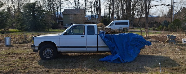 Click here for the Sprinter Van map of the world!!!
Have an awesome day!
PREVIOUS POSTS
- Thursday Gorge wind forecast & local weather: breezy with increasing sun. I’m headed out on retreat – see ya May 8th!
- Wednesday Gorge wind forecast & Gorge weather: nuking and pouring. What a combo!
- Tuesday Gorge wind forecast & Gorge weather: lots of wind, lots of rain, not much frost…
- Monday Gorge wind forecast & Gorge weather: lots of clouds and lots of west wind this week!
- Sunday Gorge wind forecast & Gorge weather: easterlies and cloudy today. Blasting westerlies possible Tuesday and Wednesday!

Have an awesome day.
Love, Temira