
Thank you for using this forecast. Like it? Find it useful? Support it (and me!) by sending some cash my way. What’s it cost to support me and get the email version? Not $99 a year. Nope. Not $49. Just $19.99 or more gets you a year. Click below to contribute. Thank you!!
Click here to use your PayPal
Venmo: @theGorgeismyGym
Snail Mail: PO Box 841, Hood River, Oregon 97031
(note: I am not a non-profit entity. The only way to accept credit cards with a user-defined amount is to use the ‘donate’ button. Thanks for understanding!)
Auto-renewing subscription. New! Awesome!
The Forecast
| 4a-8a | 8a-12p | 12p-4p | 4p-8p | 8p-4a | |
|---|---|---|---|---|---|
| Monday 1500′->4000′ |
 |
 |
 |
|
 |
| Tuesday 4000′->2500′ |
 |
|
|
|
|
| Wednesday 2500′->1500′ |
|
|
|
|
|
Mt. Hood Weather Forecast
There’s been some excellent XC and skate skiing and apparently BC skiing as well the last few days, and the snowpack is only going to grow more this week. Timberline: open, but you need reservations. Teacup: open, and you need to wear a mask. Meadows: opening 11/30, reservations required. Meadows Nordic: unknown. Weather this week: snowfall Monday, Tuesday evening, Wednesday daytime, and Wednesday night. Dry weather Tuesday, Thursday, and Friday. Just a note: I have switched from “water value” (WV) to “water equivalent” (WE) for two reasons. First, it is more correct. Second, it spells something.A fast-moving cold front swings through on Monday for a few inches of snow. The snow level will be 2500′ daytime and 4000′ or so overnight. About 0.2” to 0.3” water equivalent (WE) falls during the day, for 2-3” of fresh Cascade-style power. Just a trace falls overnight. Wind: WNW 35 in the morning, NW 20-25 in the afternoon, and WNW 15-20 after midnight.
Tuesday will be clear above 8000′ an in the morning, clear above 6500′ in the afternoon, and snowy in the evening and overnight. In other words, the slopes will be cloudy in the morning unless you get way up high. The snow level will be about 4000′ in the morning, 4500′ in the afternoon, 3500′ in the evening, and 2000-2500′ overnight. About 0.8” WE falls overnight, for 7-9” of new. Wind: WNW 15-20 early, SW 20-40 in the afternoon, W 35 in the evening, and WSW 25-40 overnight.
Snow continues Wednesday. The snow level will be 2000-2500′ in the morning, 2500′ in the afternoon, and about 1000′ under clear sky overnight. About 0.5” WE falls during the day, for 5-6” of powder. Another 0.2” falls overnight, for 2-3” more. Wind: WSW 30-40 in the morning, W 20 in the afternoon, and NW 20-25 after midnight. Thursday looks clear and cold. Friday looks clear and warmer with the freezing level rising to 9000′ in the afternoon. Models disagree on Saturday – might be dry, might pick up a little bit of precip. Enjoy the early-season snow!
Gorge Wind Forecast
Light and variable wind Monday morning turns around to W 10-13 from Stevenson to Arlington this afternoon. River flow is 133kcfs. River temp is 49 degrees. Predicted high temp is 46. Tuesday starts with light easterlies. The wind picks up to E 20-25 near Stevenson around noon (with rain), goes calm mid-afternoon, and turns around to gusty mid 20’s west of Hood River and east of The Dalles around or after 4pm. High temp: 48. Wednesday starts with W 5-10 in the west and 12-15 east of Biggs. The wind fades to light and variable in the afternoon. High temp: 46.Coast, Jones, Sauvie’s
As needed until next spring and summer.Hood River Weather Forecast
Cloudy weather early turns rainy in the morning and dry and mostly cloudy in the afternoon. Temps will be in the upper 30’s early and mid 40’s later. Light and variable wind early. Light westerlies in the afternoon. 89% chance of rainbows. Tuesday starts cloudy and turns sprinkly daytime and rainy in the late afternoon and evening. Temps will be in the upper 30’s early and upper 40’s later. Light wind until sunset, and then moderate westerlies. 11% chance of rainbows. Wednesday brings light rain and showers. Temps will be in the upper 30’s early and mid 40’s in the afternoon. Light westerlies becoming light and variable in the afternoon. 99% chance of rainbows. Thanksgiving looks dry. Looking for a complete Columbia Gorge forecast? Looking for more humor in your weather? Obscenities? You’re looking for my TATAS: Temira’s Awesome Travel Advisory Service on Facebook.Cycling
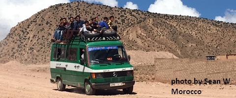
11/8: GP will be closed through December for upgrades. Contact HRATS if you’d like to help. Motorized use is open on ALL Hood River County Land now. Do be aware of the possibility of freeze-thaw (muddy) conditions\. Do not ride if it was below freezing last night and is above freezing when you want to ride. The soil structure will be liquefied, and you will do permanent damage to trails.Sprinter Van of the Week!
 Click here for the Sprinter Van map of the world!!!
Local Events
Weekly events: The Kainos Coffee run happens in The Dalles every Tuesday morning at 6am. There are sailboat races at the Hood River Marina every Wednesday evening. Dirty Fingers has a group mountain bike ride (bring lights) Wednesday nights at 5:30pm. Cheno has an outdoor HIIT workout at Griffin House in Hood River at 6pm on Wednesday nights. There is a BLM rally every Tuesday evening at 5:30 at the Salmon Fountain in Hood River, and there’s a White Coats for BLM rally every Thursday at noon at 12th and May in Hood River. Have an awesome day!Temira