


Thank you for using this forecast. Like it? Find it useful? Support it (and me!) by sending some cash my way. What’s it cost to support me and get the email version? Not $99 a year. Nope. Not $49. Just $19.99 or more gets you a year. People are added to this list on Thursday and Sunday. My day job is crisis mental health, and I don’t have time on other days. Thanks for your patience! Click below to contribute. Thank you!!
 |
|
 |
Thank you for contributing and keeping this forecast going! Not ready to subscribe?
No problem – please share this forecast with all your friends too! I appreciate your support!
Or… Try the email free until the end of this month
The Forecast
| 4a-8a | 8a-12p | 12p-4p | 4p-8p | 8p-4a | |
|---|---|---|---|---|---|
| Monday 0′ |
 |
|
|
|
 |
| Tuesday 0′->5000′ |
|
|
|
|
|
| Wednesday 5000′ |
|
|
 |
|
|
Mt. Hood Snow Forecast
Yesterday was quite the windy day on Mt. Hood. Timberline called things off around 9am, and Meadows gave up at 4pm after running minimal lifts during the day. Nordic: operations normal. For this week, we’ll have dry weather through at least Thursday afternoon and perhaps through Friday morning. Snow is likely for a good portion of the Friday-Sunday period.
Monday, however, will just be clear and cold with temps in the teens on the alpine slopes and single digits down in the Nordic zone. A few high clouds join this afternoon, and temps rise to the upper 20’s at 5000′. Wind: NE 15-20 this morning, N 10 this afternoon, and W 25 overnight.
Tuesday brings high clouds all day and all night. The free air freezing level (FAF) will be 0′ in the morning (temps in the 20’s) and 5000′ from the afternoon on through the evening. No precipitation. Wind will be W 20-25 for the 24 hour period.
Wednesday will also be high overcast. The FAF will be 5000′ all day as 850mb temps hold between 0C and +1C. Wind: W 25 in the morning, SW 15-25 in the afternoon, and SSW 10-20 overnight. Thursday daytime should be dry and high overcast with temps in the low 30’s and light to moderate SW wind. Snow arrives sometime Thursday night or Friday morning; models call for about half a foot of new on Friday. The current run of the models takes the wind to W 55 Friday afternoon, which would have impacts on lifts, so cross your fingers for lesser wind in future model runs. Have a wonderful sunny Monday!
| FORECAST SPONSORED BY / AWESOME COMPANIES TO SUPPORT | |
 |
|
Gorge Wind Forecast
Easterlies today (Monday) give way to light and variable wind the next couple of days. Temps won’t rise above freezing today, so maybe call it a rest day! We start with easterlies at 30-35 at Rooster. Those hold all day. Stevenson will be 25ish all day, and Viento 20-25. River flow reading is 141kcfs, river temp is 39F, and high temp forecast is 31F. Tuesday starts calm at Rooster and light easterly at Stevenson. The wind turns to W 10-13 at Stevenson in the afternoon for a couple hours. High temp: 37F. Wednesday starts with E 10-15 at Stevenson and calm wind elsewhere. The wind turns calm all through the Gorge in the afternoon. Stronger easterlies are forecast Thursday afternoon.
Jones, Sauvie Island, Coast – Done for the Season
Hood River Weather Forecast
Clear sky this morning picks up a few high clouds later. Temps will be in the low double digits early and low 30’s later. Light easterlies. No rainbows. Thursday will be high overcast. Temps start in the mid 20’s and rise to the mid-upper 30’s. Calm wind. No rainbows. Wednesday will be high overcast. Temps start in the upper 20’s and rise to the upper 30’s or near 40. Calm wind. No rainbows.
Looking for a complete Columbia Gorge forecast? Looking for more humor in your weather? Obscenities? You’re looking for my TATAS: Temira’s Awesome Travel Advisory Service on Facebook.
Local-ish Events
Please let me know of outdoor-related local-ish events. If you don’t tell me, I don’t know!
There’s a giant, all-hands-on-deck HRATS Family Man cleanup happening on Feb 4th. Please bring wheelbarrows and snacks. Regular weekly events: Ferment’s Tuesday night 4-mile walk/run is at 6pm. At 7:15am on Wednesdays, there’s a run from the White Salmon Bakery. At 7am on Friday morning, there’s a run from Pine Street Bakery. On Friday’s at 2:30pm, there’s a free meditation and stretching class (brand new) at Yoga Samadhi. There’s a weekly group paddle to the Event Site on Sunday at 11 am followed by a free pint at the fire pit at Ferment. That’s the “Paddle n’ Pint”. Also: Wednesday Paddle Sprints at the Event Site at Noon. The sprint course is 2 two laps around the sailing buoy near Wells Island and back – 3.5 miles.
Cycling
Be thoughtful about your riding choices as we enter this dry period. If it was below freezing the night before your ride, don’t ride trails that are exposed to the open air. Those trails will have freeze-thaw conditions, and you’ll do major damage. Consider gravel riding! If you’re parking at Post Canyon, you will need a parking pass. Those can be purchased at many local shops or online.
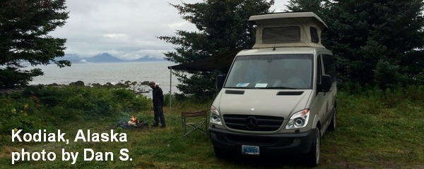
Sprinter Van of the Week!
 Click here for the Sprinter Van map of the world!!!
Have an awesome day!
PREVIOUS POSTS
- Thursday Gorge wind forecast & local weather: breezy with increasing sun. I’m headed out on retreat – see ya May 8th!
- Wednesday Gorge wind forecast & Gorge weather: nuking and pouring. What a combo!
- Tuesday Gorge wind forecast & Gorge weather: lots of wind, lots of rain, not much frost…
- Monday Gorge wind forecast & Gorge weather: lots of clouds and lots of west wind this week!
- Sunday Gorge wind forecast & Gorge weather: easterlies and cloudy today. Blasting westerlies possible Tuesday and Wednesday!

Have an awesome day.
Love, Temira