


Thank you for using this forecast. Like it? Find it useful? Support it (and me!) by sending some cash my way. What’s it cost to support me and get the email version? Not $99 a year. Nope. Not $49. Just $19.99 or more gets you a year. People are added to this list on Thursday and Sunday. My day job is crisis mental health, and I don’t have time on other days. Thanks for your patience! Click below to contribute. Thank you!!
 |
|
 |
Thank you for contributing and keeping this forecast going! Not ready to subscribe? No problem – please share this forecast with all your friends too! I appreciate your support!
The Forecast
| Snow level | 4a-8a | 8a-12p | 12p-4p | 4p-8p | 8p-4a |
|---|---|---|---|---|---|
| Friday 9500′->5500′ |
 |
|
|
|
 |
| Saturday 5500′->3000′ |
|
 |
|
 |
 |
| Sunday 3000′->4000′ |
 |
|
|
|
|
Mt. Hood Snow Forecast
While the weather remains rather uninteresting and uninspiring on the slopes for the next five to six days, the future beyond that looks much brighter. Models agree that 850mb temps (5000′) will fall to -5C or so (that’s a snow level around 1500′) and hold there with quite a bit of incoming moisture. Very good. Very good. 14 day snow percentiles… 25th: 21”. 50th: 28”. 90th: 46”.
No snow is forecast for Friday, but the warm, semi-slushy snowpack should be fun to ride. Expect high overcast sky with a bit of drizzle or mixed precip overnight. The snow level will be 9500′ all day, 6500′ in the evening, and 5500′ after midnight. Just 0.05” to 0.1” rain or snain is forecast overnight. Wind: S 15-30 all day becoming SW 10-20 after midnight.
A little snow is in the forecast on Saturday. The snow level will be 5500′ in the morning, 3500′ in the afternoon, and 3000′ under clear sky overnight. About 0.1” to 0.2” water equivalent (WE) falls during the day for an inch or two of snow. The sky clears overnight, just in time for some night skiing at Meadows. Wind: SW 10-20 all day fading to SW 5-15 after midnight.
Clear, sunny, cool weather is forecast on Sunday. The free air freezing level will be 3000′ in the morning and 4000′ in the afternoon. Wind: SW 5-15. Monday looks nearly identical. High clouds Tuesday morning give way to some snow (maybe) on Tuesday night. Models suggest anywhere from no snow to 5” with the majority calling for 2-3”.
Things get a lot more interesting late next week when the weather turns colder and wetter. As of right now, models call for the weather to stay cold and damp once it starts behaving that way. That translates to a vastly improved outlook for ski season, even potentially for the lower-elevation resorts and the Nordic areas. Looking forward to that, for sure! Have a great day!
Gorge Wind Forecast
 A big east wind day is on tap today. Get it, because the next chance is probably next Tuesday. Models then hint at a chance of westerlies Wednesday or later next week, but there’s not a consensus on that happening. Fingers crossed! For Friday, we starts with pressures of 29.85/30.16/30.17 for gradients of 0.31 (BIG!) and 0.01. Viento and Iwash sensors are down this morning, but best guess is it’s 50-60 average at Iwash, 35-40 at Stevenson, and 25ish at Viento. The wind holds all day. River flow yesterday was 75-137kcfs, river temp is 45F, and high temp forecast is 45F under cloudy sky.
Saturday starts with E 15ish at Iwash and Stevenson. The wind turns calm midday and switches to light westerlies, 5-10mph at most, from Stevenson to Swell or Hood River in the afternoon. High temp: 46F under mostly cloudy sky. Sunday brings easterlies at 15mph to both Iwash and Stevenson. High temp: 47F under partly cloudy sky. Easterlies start to pick up again on Monday, but probably won’t be quite enough. Models hint at stronger easterlies on Tuesday with a shot at west wind Wednesday and perhaps Friday or Saturday. We’ll keep a close eye on it. It’s worth noting that temps are going to be much cooler (still above freezing, but colder) in about a week, and are forecast to stay cooler. So, get it now!

| FORECAST SPONSORED BY / AWESOME COMPANIES TO SUPPORT | |
 |
|
Jones, Sauvie’s, Coast – On vacation ‘til summer unless otherwise noted
Hood River Weather Forecast
Clouds stick around today with a few sun breaks. Temps start near 40 and rise to the mid 40’s. Easterlies. No rainbows. Saturday will be drizzly in the morning and dry in the afternoon under partly to mostly cloudy sky. Temps start in the upper 30’s and rise to the mid 40’s. Easterlies in the morning. Calm wind midday. Very light westerlies later. 59% chance of rainbows. Sunday will be Nothing then partly cloudy and dry all day. Temps start in the upper 30’s and rise to the mid-upper 40’s. Easterlies. No rainbows.
Looking for a complete Columbia Gorge forecast? Looking for more humor in your weather? Obscenities? You’re looking for my TATAS: Temira’s Awesome Travel Advisory Service on Facebook.
Local-ish Events
Please let me know of outdoor-related local-ish events. If you don’t tell me, I don’t know!
Registration is open for Gorge Ultimate winter league. Sign up here: https://gorge.ultimatecentral.com/e/winter-league-2024 – Teacup has an après ski fundraiser at the Ruins on January 27th. $25. Amayah’s Indian Cafe (Biggs) offers a free meal every first Thursday from 1-4pm.
Regular weekly events:. NK Studio’s by-donation Tuesday morning yoga class is back. Ferment’s Tuesday night 4-mile walk/run is at 6pm. There’s meditation with monks at 5:15pm (an hour) and 6:30pm (30 minutes plus a talk) at Yoga Samadhi in White Salmon. The Tri Club is done for the season. At 7:15am on Wednesdays, there’s a run from the White Salmon Bakery. At 7am on Friday morning, there’s a run from Pine Street Bakery. On Fridays at 2:30pm, there’s a free meditation and stretching class at Yoga Samadhi. On Saturday at 9am, there’s a by-donation outdoor group fitness on the 2rd floor deck about Ferment Brewing.
Cycling
Regarding the trails in general: don’t ride in the mud. You’ll damage the trails. Don’t ride trails if it was below freezing the previous night and is above freezing when you want to ride. Ride gravel. Ride your trainer. Build trails. There are trail builders seeking extra hands on seven additional miles of trail on Whoopdee. Contact HRATS for more information. If you’re parking at Post Canyon, you will need a parking pass. Those can be purchased at many local shops or online.
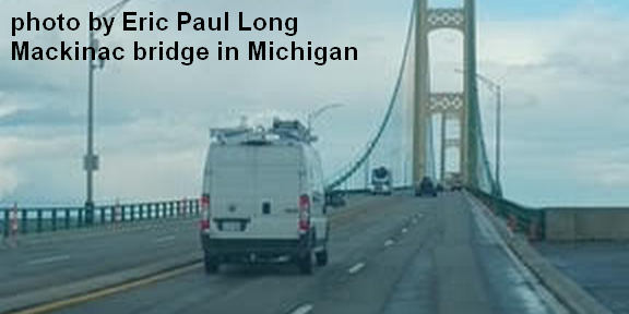
Sprinter Van of the Week!
 Click here for the Sprinter Van map of the world!!!
Have an awesome day!
PREVIOUS POSTS
- Thursday-Friday Mt Hood snow forecast & Gorge wind n’ weather: dry, mostly sunny, lots of east wind…
- Tuesday-Wednesday Mt Hood snow forecast & Gorge wind n’ weather & some protests Tuesday…
- Sunday-Monday Mt Hood snow forecast & Gorge wind n’ weather: same old same old sunshine, Nothing cloud, strong east wind…
- Saturday Mt Hood snow forecast & Gorge wind n’ weather: SOSO – sun for the slopes, nuking east wind + Nothing in the Gorge.
- Friday Mt Hood snow forecast & Gorge wind n’ weather: sunny and warm on the slopes; windy AF in the Gorge.

Have an awesome day.
Love, Temira