

 |
4a-8a | 8a-12p | 12p-4p | 4p-8p | 8p-4a |
|---|---|---|---|---|---|
| Saturday 0′ |
 |
 |
 |
|
 |
| Sunday 5000′->3000′->0′ |
|
 |
 |
|
|
| Monday 500-1000′ |
|
|
|
|
|
Mt. Hood Snow Forecast
Looks like quite a bit more snow is coming. For Friday night, we’ll see .8-1.0” water value (WV), for 8-10” of snow by Saturday morning. Flurries on Saturday morning give way to sunshine in the afternoon. Snow level 0′. Wind W 20 early, light and variable in the afternoon, and WSW 20 after midnight.
A little bit of dense, wet snow will fall on Sunday morning (with freezing rain in the metro area) followed by actual snow in the afternoon. The snow level will be around 5500′ briefly in the morning and near the surface in the afternoon with temps at 5000′ in the upper 20’s. This means the snow will be heavy/dense. We’ll see about .1” WV in the morning, for an inch of snow. The evening system, starting around 1pm, will bring in 1” WV, for 8-10” of dense new snow. Wind Sunday will be WSW 20 for much fo the day, and WSW35 in the evening, turning to NW 35 after midnight.
Monday starts off with mid-level clouds and turns clear in the afternoon. The free air freezing level will be 500-1000′ all day. Wind will be NW 35 for the first half o fthe day and NW 20 in the afternoon and evening. Tuesday looks sunny for much of the day with some light but as-of-now unspecified precip in the afternoon.
 >
>
Does this forecast save you time, gas money, or help you have more fun in your life? Make a donation to support continued forecasting, and get the forecast in your inbox each day. Click on the button to donate. The email subscription isn’t $99/year. Not $50/year. No, just $12.34 or more gets you on the list for 12 months. Don’t PayPal? Send a check to Temira @ PO Box 841 in Hood River. Thank you for your support and thank you for trusting my forecast.
Random Morning Thoughts
It can be difficult and uncomfortable to confront our friends on their behaviors. We worry about impacting the friendship. We worry about hurting the other person. We worry about driving them away. This is part of my job as a therapist, and it’s hard for me too!
Difficult conversations are tough because they leave us feeling vulnerable. Honesty can be scary. Leaning into this discomfort allows us to be more comfortable with the discomfort. It’s counterintuitive but true! Our tolerance increases for both conflict and intimacy, and that leads to improvement in our relationships with others.
It is, of course, important to have these conversations in respectful and vulnerable way. For example, saying, “Your drinking is way out of hand!” (an accusation) is probably going to lead to a defensive reaction. Something along the lines of, “I’m worried about you because you’re drunk/high most of the time I see you,” (a statement of your concern and a fact) is more likely to lead to conversation.
Difficult conversations are difficult because growth edges are uncomfortable. Discomfort isn’t a warning sign; it’s actually a sign of a place we can grow. Have an awesome day, and happy soslstice! May you be a light in the world.
Disclaimer required by my grad school program: I am not your therapist, but I am seeing clients at this time at Comprehensive Healthcare in White Salmon. In the meantime, I am your weather forecaster. Take everything I say with a grain of salt, and consult with your actual therapist about your mental health issues. One other thing: I plan to keep doing this forecast indefinitely. Forecasting and counseling are both deeply meaningful and nourishing to me.
Gorge Wind Forecast
For Saturday, easterlies at 35 near Rooster pick up to 45 in the afternoon. On Sunday, snowfall combines with east wind at 50mph in the morning and freezing rain with E 25mph in the afternoon. Monday looks cloudy with temps in the mid 20’s early and low 30’s in the afternoon.
Gorge Weather Forecast
Rain for Friday switches to snow late Friday night. 1/2”-2” by Saturday AM, depending on when the cold air gets here. Expect very icy roads Saturday morning. Temps will be near 30 early and 33 in the afternoon. East wind. No rainbows. Snow starts up again on Sunday morning and continues all Day. Temps will be in the mid 20’s early and upper 20’s in the afternoon. 3-5” for Hood River. East wind. No rainbows. Monday may wee a few additional flurries in the morning. Temps will be in the mid 20’s early and low 30’s in the afternoon. The cold air will clear out of the western Gorge, but will quite likely stay entrenched near Hood River. Light wind. No rainbows.
For weather specifically directed at travel through the Gorge, please visit Temira’s Awesome Travel Advisory Service on Facebook.
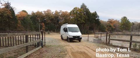
White Sprinter Van of the Week
Road and Mountain Biking
Post Canyon is currently closed to prevent trail damage. Syncline was good two days ago, but it may go to freeze-thaw mud after today and should be avoided. I imagine Nestor Peak is good. Whoopdee is probably a no-go due to mud and rain and freeze-thaw. Same for Hospital Hill.
Upcoming Events
Christmas and Christmas Eve are coming up. So is a snowstorm.
Click here for the full events calendar.
Have an awesome day today!
Temira
