


Thank you for using this forecast. Like it? Find it useful? Support it (and me!) by sending some cash my way. Why? It takes me an hour or two each morning to produce this, and it makes your life better, safer, and more fun. That’s worth something! You can get the email version sent to you. Not $99 a year. Nope. Not $49. Just $12.34 or more gets you a subscription. Click below to give financial support. Thank you!!
Credit card payments click here – – – – – – – – – Click here to use your PayPal
Venmo: @theGorgeismyGym
Snail Mail: PO Box 841, Hood River, Oregon 97031
(note: I am not a non-profit entity. The only way to accept credit cards with a user-defined amount is to use the ‘donate’ button. Thanks for understanding!)
Auto-renewing subscription. New! Awesome!
The Forecast
| 4a-8a | 8a-12p | 12p-4p | 4p-8p | 8p-4a | |
|---|---|---|---|---|---|
| Saturday 500′->0′ |
 |
 |
|
|
 |
| Sunday 0′ |
|
|
 |
|
|
| Monday 0′->6500′ |
 |
|
|
|
|
Mt. Hood Weather Forecast
Ski season continues at most resorts despite the chaos in the world. Some resorts across the country have decided to shorten their seasons due to the Covid-19 pandemic. For now, Mt. Hood goes on with a snowy weekend and increasing sunshine and warmth next week.For Saturday, expect snow in the morning, mostly cloudy sky in the afternoon, and light snow overnight. The snow level will be 0-500′ all day and 0′ overnight. Mountain temps will hover in the teens to low 20’s. Expect about 0.2” water value (WV) during the day, for 2-3” of dry powder. Another 0.1” WV falls overnight, for another inch of new snow. Wind will be SW 10-15 all day, switching and building to E 30 after midnight.
Sunday looks partly cloudy with flurries as east wind drives some orographic snowfall. The snow level will be 0′ all day. About 0.1” WV falls during the day, for an inch of new. Same overnight. Wind: E 30 daytime, SE 15 in the evening and overnight. Easterly wind tends to affect Timberline more than Meadows, but you’ll want to check both websites for any possible lift impacts before you leave home.
Monday looks clear and sunny. The free air freezing level will be 0′ early, 5500′ in the afternoon, and 6500′ overnight. No snowfall. Mountain temps will start in the mid to upper 20’s and will rise above freezing. Wind: SE 20-30 in the morning, E 20 in the afternoon, and E 30 overnight. Sunshine and above-freezing weather continues on Tuesday before some clouds return on Wednesday. Go get a break from all this and make some turns!
Gorge Wind Forecast
Easterlies are back for a few days along with too-cold weather. For Saturday, you’ll find E 25-30 all day at Rooster with E 15-20 in other locations. Sunday starts with E 40-50 at Rooster and 30-40 at Stevenson and 20-30 at Viento. Temps will be in the mid 20’s, so forget about river time! Afternoon wind drops by about 10mph. Monday starts with E 30-40 and drops to E 15-20.COAST, JONES, SAUVIE’S: Detailed forecast is on winter break.
Hood River Weather Forecast
It’s snowing in Hood River down to river level to start the day, and it probably won’t warm up much as easterlies push cold air this way. Expect 1/2” to 1” before it stops midday. Temps will be in the low 30’s early and mid 30’s later. Moderate easterlies, even in Hood River. No rainbows. Too cold. Sunday looks cloudy with light snow for much of the day with partly cloudy sky in the evening. About 1/2” of new snow will fall. Temps will be in the mid 20’s early and mid 30’s later. East wind. No rainbows. Monday starts with a partial Nothing and ends clear. Temps will be in the mid 20’s early and upper 40’s (??? maybe!) later. Light east wind. No rainbows. Looking for a complete Columbia Gorge forecast? Looking for more humor in your weather? Obscenities? You’re looking for my TATAS: Temira’s Awesome Travel Advisory Service on Facebook.Cycling
It’s been raining all night and snowing above 1000′ or so. That’ll likely mess up your cycling plans. It’ll also make the trails muddy. If you ride, you’ll damage them. Please don’t! With temps dropping into the 20’s overnight the next few nights, major freeze-thaw is expected. Stay off exposed trails: Syncline, Hospital Hill, Kleeway, Mobius, Seven Streams… those are just a few examples. The damage you do is nearly permanent, so do something else instead!Upcoming Events
Saturday is Pi Day. Shortt Supply has the 3.14 Fun Run at 9:30 am. Bring a pie if you are so inclined. The Upper Wind Whitewater Festival takes place in Stabler on Saturday. Ferment Brewing has a 5k Fun Run Saturday. Sunday is the “Glides of March” Strava race at Teacup, it’s Meadows’ Spring Demo Day, and it’s also “The Ruff”, a trail run race on Dog Mountain. Ouch. There are two free daylong meditation experiences this weekend at the Mt. Adams Zen Temple. Metta (loving-kindness) practice on Saturday, and a daylong silent retreat on Sunday. Double check all of these events, as many gatherings have been canceled due to Covid-19.
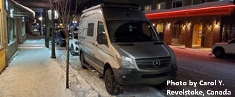
White Sprinter Van of the Week!
Click here for the White Sprinter Van map of the world!!!
Random Morning Thoughts: on vacation.
Click here for the full events calendar.
Have an awesome day!
Temira