| Snow level | 4a-8a | 8a-12p | 12p-4p | 4p-8p | 8p-4a |
|---|---|---|---|---|---|
| Thursday 4500′->5500′ |
 |
 |
 |
 |
 |
| Friday 5500′->7000′->6000′ |
 |
 |
 |
 |
 |
| Saturday 6000′->3000′ |
 |
 |
 |
 |
 |
Mt. Hood Snow Forecast
Hi skiers and riders! The snowpack continues to grow, and with the exception of a rainy period Friday night into early Saturday morning, it’ll continue to grow through the middle of next week. The 25% percentile to 75% range through Monday morning is 12” to 20”. By Wednesday, that range is 22-29”. Given the strong orographics on Sunday (more about that later), we could easily beat that. Add in a range of 2.75” to 3.5” water equivalent, and we have signs that we’ll be the percentiles. Snow-worthy weather continues through next Wednesday. After that, warm weather returns.
Thursday kicks off with moderate snowfall and quickly turns clear. Just a reminder: no hiking at Meadows today – it’s transition day. You can return to hiking on Monday. The snow level today will be 4500′ in the morning. The freezing level rises to 5500′ overnight as warmer air from the next system pushes in. A couple inches of snow are forecast this morning at 5000′ prior to clearing sky mid-morning. Wind: E 10 to start, ENE 15-20 midday, NE 5 in the afternoon, and S 10-20 overnight.
Clear sky Friday morning quickly gives way to high clouds, lower clouds, even lower clouds, and then, sadly, rain. The snow level will be 5500′ early and will rise to 7000′ in the afternoon. Overnight, it drops back to 6000′ or so, and the rain turns to snain. We’re expecting about 0.6” rain overnight, although a very weak atmospheric river could make for slightly higher rainfall. Wind will be S 10-20 all day and will turn variable to 15 depending on elevation overnight.
Saturday starts with mixed precip and quickly switches to snow. Nice day for the Pond Skim at Meadows, not! The snow level starts at 6000′ and falls to 3500′ around sunrise. It stays there all day and drops to 3000′ overnight. About 0.3” water equivalent (WE) is forecast during the day for 1-3” increasingly dry snow. Overnight, 0.6” WE falls in the form of 6-7” decent powder. Actually, make that 7-9” decent powder, as the wind is going to enhance snowfall: variable to 15 early, WNW 20-30 for much of the day, WNW 45-55 overnight.
Dumping snow is forecast on Sunday thanks to the orographic assistance of the wind. Also forecast: missing lifts. The current forecast is WNW 45-55 all day. If that pans out, it’ll shut down everything except Mt. Hood Express at Meadows. Timberline is going to struggle too. Over a foot of snow is forecast during the day with several inches more overnight. That’s without taking orographics into account. Snow level: 3000′. Storm skiing: definitely. Lighter, intermittent snowfall is forecast through Wednesday morning. By time time all is said and done, the mountain should have picked up 2-3 feet of new. Excellent. Current snowpack reading is 89%. It’ll be fun to see where we sit by Wednesday. Enjoy!
A poem:
Was that forecast helpful?
Did it save you time or gas money?
Did it make your life more fun?
Then please make a contribution.
Writing this takes me an hour or two a day.
Without your support, I can’t keep it up.
Keep the forecast going.
Subscribe or donate.
And share my forecast with your friends!
 |
 |
 |
|
Not ready to subscribe? No problem – please share this forecast with all your friends too!
Or try a month for free!

Gorge Wind Forecast
Hi friends! We have a decent stretch of wind on tap. Mother Nature’s planing to string together multiple days of westerlies, some of which will be pushing the “nuking” zone. If you’re planning a trip, Saturday through Tuesday is the call.
Friday won’t have much. Light and variable conditions through early afternoon, and west 7-10 from Stevenson to Viento or Swell late afternoon. River flow over the last 24 hours was 118-171kcfs, river temp is 53F, and high temp forecast is 66F. Friday starts with E 15 at Stevenson and Iwash (Rooster). Stevenson rises briefly to 15-20 midday. The wind turns around to W 11-14 (Stevenson will be rainy) from Viento to Avery late afternoon. High temp: 69F with rain from mid-afternoon on.
The picture gets a lot more interesting on Saturday, although I should mention that the ensembles are not all-in on this. Here’s what the deterministic GFS says. Take it with a grain of salt. A weak upper low and cold front move across the Cascades early in the day. Offshore high pressure builds behind it, and NW flow sets up across the PNW. Rain persists west of The Dalles until early afternoon. East of The Dalles things dry out mid-morning. Opening gambit, despite the rain, will be gusty 25-28 from Stevenson to Rufus. Once that system moves through, we’ll have 29-33 from somewhere in the Lyle-Avery zone to Boardman. During the rainy morning period, the zone from Stevenson to Mosier will drop to 17-20. It’ll bounce back to very gusty 21-24 (perhaps a touch more) in the afternoon. Best bet for longest-lasting wind: anywhere between Avery and Arlington with a shot at the Lyle-Doug’s zone. High temp: 54F with some high clouds.
Things get really interesting on Sunday. Ensembles are about 75% in on a big day and about 25% in on a nuker. Dawn Patrol should be very gusty (and rainy) 28-32 right off the bat all the way from Stevenson to Boardman. The wind quickly rises to 33-37+ east of The Dalles and holds. If you want less wind, stay west of Mosier. One thing to note: there will be a ginormous low pressure system to the east, and it’ll send wraparound moisture into the Gorge. Models suggest it’ll rain all day west of Hood River. Models also keep rain going east of Rufus into the afternoon. That’s going to have an impact on wind quality despite the massive gradients and generally decent setup. Extended: Monday and Tuesday both have potential for mid-20’s or better in the desert, although ensembles are a lot more optimistic about Tuesday. Temps will remain unseasonably cool, and you’ll remain stuck in your thick wetsuit. Have fun out there!

 |
Jones, Sauvie’s, Coast Forecast – On vacation ‘til summer unless otherwise noted
Very basic Hood River weather forecast. Don’t plan your life around this. You really should read Temira’s Awesome Travel Advisory Service on Facebook
Rain this morning gives way to clear sky later. Temps start in the mid 40s and rise to the mid 60s. Light and variable wind. 73% chance of rainbows. Friday will be high overcast with a pretty sunrise to start and rainy from mid-afternoon on through the night. Temps start near 40 and rise to the upper 60s. Light easterlies to start. Light westerlies late afternoon. 14% chance of rainbows. Saturday will be rainy and windy. Temps start in the mid 40s and rise to the mid 50s. Strong westerlies. 99% chance of rainbows. Sunday will also be wet and windy.
Local-ish Events
Please let me know of outdoor-related local-ish events. If you don’t tell me, I don’t know!
Regular weekly events:. NK Studio’s by-donation Tuesday morning yoga class is back. Ferment’s Tuesday night 4-mile walk/run is at 6pm. There’s meditation with monks at 5:15pm (an hour) and 6:30pm (30 minutes plus a talk) at Yoga Samadhi in White Salmon. The Tri Club is done for the season. At 7:15am on Wednesdays, there’s a run from the White Salmon Bakery. At 7am on Friday morning, there’s a run from Pine Street Bakery. On Fridays at 2:30pm, there’s a free meditation and stretching class at Yoga Samadhi. On Saturday at 9am, there’s a by-donation outdoor group fitness on the 2rd floor deck about Ferment Brewing.
Cycling
Cows are out on Hospital Hill. NO DOGS. That means you, all of you, even your dog that’s [insert adjective]. No dogs. Do not risk access for everyone. No parking at the corral. Whoopdee flowers are in full bloom. Hospital Hill and Syncline have ticks, oaks, and flowers. Columbia Hills is full of flowers and open to your bike. It’s trail-building season. Get on the HRATS mailing list if you’d like to help out. If you’re parking at Post Canyon, you will need a parking pass. Those can be purchased at many local shops or online.
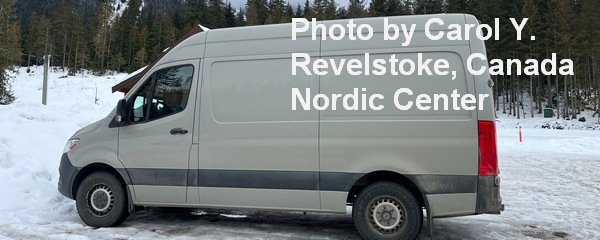
Sprinter Van of the Week!
 Click here for the Sprinter Van map of the world!!!
Have an awesome day!