| Snow level | 4a-8a | 8a-12p | 12p-4p | 4p-8p | 8p-4a |
|---|---|---|---|---|---|
| Saturday 5000′->2500′ |
 |
 |
 |
|
|
| Sunday 2500′->3500′ |
 |
|
|
|
|
| Monday 3000′->4500′->2500′ |
|
|
|
|
|
Mt. Hood Snow Forecast
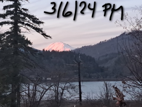
Well, it’s back to winter after a couple sunny days of… well, cold winter sunshine. We’ll have light snow on Saturday, heavier snow on Sunday, and potentially even heavier snow on Monday. Models are still sticking with 2-2.5” water equivalent (WE) – at least a couple feet of snow – over the next several days.
Friday night brings increasing high clouds, and the freezing level drops from 8000′ to 5000′ with SW wind at 10-20. Partly high overcast sky early Saturday gives way to snow, then a break, then another round of light snow overnight. The snow level will be 5000′ in the morning, 3500′ in the afternoon, and 2500′ after midnight. About 0.2” WE falls during the day for a couple inches of new. Just a trace falls overnight. Wind: SW 15-25 in the morning, SW 25-40 in the afternoon, and SW 35-60 overnight into Sunday (when we lose an hour of sleep and spring forward an hour on the clocks).
Sunday starts way too early thanks to federally-mandated clock mischief. It also starts snowy and stays that way. The snow level will be 2500′ in the morning, 3500′ in the afternoon, and 3000′ overnight. About 0.3” WE falls during the day for about 3” new. Overnight: 0.4” to 0.5” of medium-density snow. Wind will be SW 35-60 in the morning, SSW 15-25 in the afternoon, and WSW 30-40 overnight. The latest round of the GFS deterministic calls for moderate snowfall (0.4” WE) Monday daytime followed by heavy snowfall (over 1.0” WE) overnight with the snow level starting around 3000′, rising to 4500′, and falling back to 2500′. That overnight number might be overly optimistic, but not if the west wind and orographics kick in. Anyway, the wind on Monday will be WSW 30-40 early, SW 25-40 in the afternoon, SW 30-60 in the evening, and W 40 (there’s the orographics!) overnight.
Another half a foot of snow is forecast for the 24 hour period known as Tuesday. After that: back to sunshine with the weather warming quickly Thursday onward. It’ll be spring skiing, for sure, with 850mb forecast to rise to 10C. Winter. Then Spring. Enjoy!
A poem:
Was that forecast helpful?
Did it save you time or gas money?
Did it make your life more fun?
Then please make a contribution.
Writing this takes me an hour or two a day.
Without your support, I can’t keep it up.
Keep the forecast going.
Subscribe or donate.
And share my forecast with your friends!
 |
 |
 |
|
Not ready to subscribe? No problem – please share this forecast with all your friends too!
Or try a month for free!

Gorge Wind Forecast
Not much happening in the next few days, maybe just enough for a few of you, but there’s a better chance on Tuesday afternoon. Let’s keep watching. For Saturday, expect Stevenson to start with E 20 and Iwash (Rooster) with E 15. The wind goes calm mid-morning and turns to westerlies in the afternoon. You’ll find 10-13 from Stevenson to Doug’s with gusty 18-22 from Avery to Biggs. River flow Saturday was 90-159kcfs, river temp is 43F, and high temp forecast is 50F. Sunday starts with E 20 at Stevenson and E 5-10 at Iwash. The wind turns calm late morning and picks up to W 10-13 from Rooster to Avery in the afternoon. East of Avery, you’ll find gusty 15-18. High temp: 49F. Monday starts with 7-10 from Stevenson to Arlington, holds in the western Gorge, and picks up to gusty 16-19 from Biggs to Boardman. Models are holding out hope for mid to upper 20’s east of The Dalles on Tuesday. If that happens, it’s just enough to get Rufus and the Wall and maybe Arlington going. Fingers crossed.
 |
|
Jones, Sauvie’s, Coast Forecast – On vacation ‘til summer unless otherwise noted
Very basic Hood River weather forecast. Don’t plan your life around this. You really should read TATAS
Saturday will be mostly cloudy in the morning, slightly drizzly later, and dry and partly cloudy in the afternoon. Temps start in the low-mid 30’s and rise to 50 or so. Easterlies early, calm wind midday, light westerlies in the afternoon. 99% chance of rainbows. Sunday will be rainy, then briefly dry, then rainy again. Temps start in the mid 30’s and rise to the upper 40’s. Light westerlies. 99% chance of rainbows. Monday will be rainy. Temps start in the upper 30’s and rise to the upper 40’s. Light westerlies. 99% chance of rainbows. Read Temira’s Awesome Travel Advisory Service on Facebook for a detailed forecast that may help you plan your day.
Local-ish Events
Please let me know of outdoor-related local-ish events. If you don’t tell me, I don’t know!
On Thursday, March 21st, you can watch the BEST MOVIE EVER, The Neverending Story, at the Trout Lake Hall at 5pm (free). On Thursday, March 21st, you can watch the BEST MOVIE EVER, The Neverending Story, at the Trout Lake Hall at 5pm (free). March 23rd is the Glides of March Nordic race at Teacup. Skibowl has their spring party March 23rd and 24th.
Regular weekly events:. NK Studio’s by-donation Tuesday morning yoga class is back. Ferment’s Tuesday night 4-mile walk/run is at 6pm. There’s meditation with monks at 5:15pm (an hour) and 6:30pm (30 minutes plus a talk) at Yoga Samadhi in White Salmon. The Tri Club is done for the season. At 7:15am on Wednesdays, there’s a run from the White Salmon Bakery. At 7am on Friday morning, there’s a run from Pine Street Bakery. On Fridays at 2:30pm, there’s a free meditation and stretching class at Yoga Samadhi. On Saturday at 9am, there’s a by-donation outdoor group fitness on the 2rd floor deck about Ferment Brewing.
Cycling
ATTENTION: HRATS is looking for volunteers to help on the Kleeway project on Thursday and Friday (March 7th and 8th) from 9:30am to 1pm. Meet at the Seven Streams kiosk off Post Canyon Road. Bring rakes, shovels, buckets, gloves, water, and snacks. Sisterwives and Kleeway in Post Canyon are currently closed for rebuilding. Regarding the trails in general: don’t ride in the mud. You’ll damage the trails. Don’t ride if it was below freezing the previous night and is above freezing (or sunny) when you go to ride; freeze-thaw trails are susceptible to permanent damage. Ride gravel. Ride your trainer. Build trails. There are trail builders seeking extra hands on seven additional miles of trail on Whoopdee. Contact HRATS for more information. If you’re parking at Post Canyon, you will need a parking pass. Those can be purchased at many local shops or online.
Sprinter Van of the Week!
 Click here for the Sprinter Van map of the world!!!
Have an awesome day!