| Mt. Hood Snow Forecast – 5000′ |
|
4a-8a |
8a-12p |
12p-4p |
4p-8p |
8p-4a |
Thursday
6000′->3500′ |
 |
 |
 |
 |
 |
Friday
3500′ |
 |
 |
 |
 |
 |
Saturday
4000′->2000′ |
 |
 |
 |
 |
 |
Mt. Hood Weather Forecast
It’s a bit warm for snow on Mt. Hood this morning, but the next few days will be plenty cool for snowfall. There’s not a ton in the forecast, but there’s some. Before we dive in, some good news: Mt. Hood Meadows jumped on the #fightfor15 bandwagon. They’ve just announced a $15 minimum wage for all their employees with a corresponding $1.25 wage increase for all non-executive employees. That’s awesome, and kudos to Meadows for taking these steps!
Now, on to the mountain weather. A cold front moving in today drops a mix of rain and snow on the slopes. The snow level will be 6500′ early, 6000′ in the afternoon, 4500′ in the evening, and 3500′ overnight. The bulk of the precip will fall as rain at 5000′. Let’s call it 0.5 to 0.6” rain. Another 0.1” to 0.2” falls as snow, for 1-2” of accumulation. Wind will be feisty: SW 35-60 in the morning. It shifts to WSW 45-55 in the afternoon and drops to SW 15-30 overnight.
Friday starts cloudy and quickly picks up some light snow. In the afternoon, the snow stops and the sun comes out. The snow level will bounce around between 3500′ and 4000′. 0.3” water equivalent (WE) is forecast during the day, for 3” new. A trace might fall overnight. Wind: SW 20-45 in the morning, WSW 10-15 in the evening, and SW 20-40 overnight.
Light snowfall is forecast for much of Saturday, although the day starts clear. The snow level will be 4000′ in the morning and will slowly fall to 2000′ by evening. About 0.1” WE is forecast for the day, for an inch of snow. Another 0.2” WE is on tap overnight, for 2” new. Wind: SW 20-40 in the morning dropping to SW 15-30 midday and holding through the night. The cool, snowy weather continues for a couple more days. Models are hinting, but definitely not certain about, an atmospheric river in the Wednesday time frame. We’ll just keep an eye on that. Have a good day!
Gorge Wind Forecast
The next three days will all have both easterlies and westerlies. Thursday starts with 30-35 at Rooster, 15-20 at Stevenson, and 10-15 at Viento. The wind quickly turns around. From late morning on, we’ll have gusty westerlies at 23-28 from The Dalles to Arlington with gusty, rainy 15-20 in the far west and lighter wind in the central Gorge. River flow is 101kcfs, river temp is 55F, and high temp forecast is 55F. Friday starts with easterlies at 10-15 at Stevenson with light/variable wind everywhere else. Westerlies arrive late morning with 7-10 in the west and gusty 16-19 from The Dalles to Arlington. High temp: 53F. Saturday starts with E 30-35 at Stevenson and E 20-25 at Rooster. The wind turns to gusty westerlies at 18-23 all through the Gorge late morning. The wind fades early afternoon. High temp: 49F.
Coast, Jones, Coast
Done until spring, unless there’s an obvious Coast or Sauvie’s or Jones day.
Hood River Weather Forecast
Clouds this morning add rain late morning. It sticks around through sunset. Temps will be in the mid 40’s early and mid 50’s later. Moderate westerlies after a light start. 99% chance of rainbows. Friday will be rainy in the morning and dry in the afternoon. Temps will be in the upper 30’s early and low 50’s later. Light westerlies after a light/variable start. 99% chance of rainbows. Saturday will be rainy prior to dawn then dry with sunshine by afternoon. Temp will be in the upper 30’s early and upper 40’s later. Easterlies early. Moderate westerlies in the afternoon. 2% chance of rainbows.
Looking for a complete Columbia Gorge forecast? Looking for more humor in your weather? Obscenities? You’re looking for my TATAS: Temira’s Awesome Travel Advisory Service on Facebook.
Cycling
SDS, Kreps, and DNR lands have all reopened. Regulated use closure has ended and motorized use is allowed on moto trails. Be aware of recent snowfall about 4500′ or so and plan your rides accordingly.
Local Events
Please send me information about events. You probably know about something I don’t!
There are two gear swaps on November 6th. Teacup Nordic has one in Portland at the DLR Nordic Volvo showroom – that’s Nordic gear only. The HRVHS gear swap is the same day at Hood River Alliance Church.
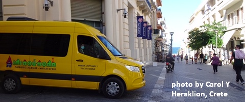
Sprinter Van of the Week!
 Click here for the Sprinter Van map of the world!!!
Have an awesome day!
Temira Lital is a recreation and travel weather forecaster based in Hood River, Oregon. Temira uses they/them pronouns. They're also a mental health counselor. Temira bikes, skis, windsurfs, paddles a SUP, swims in mountain lakes, and loves gardening. Most recently they've taken up SUP foiling. Temira is powered by La Croix, protein, and beets.
View Archive →


