


Thank you for using this forecast. I offer it freely so you can have more fun and plan your life. It does take significant time and energy to produce. If you find yourself using it often, or if you feel your life is more awesome because of my work, please make a donation. You can get this forecast via email by donation. The email subscription isn’t $99/year. Not $50/year. Donating $12.34 or more gets you on the list for 12 months. Thank you for your support and thank you for trusting my forecast.
Click here to donate using a credit card.
Click here to donate via PayPal.
Venmo: @theGorgeismyGym
Snail Mail: PO Box 841, Hood River, Oregon 97031
Get the email version free through the end of January – try it out! Click here.
| 4a-8a | 8a-12p | 12p-4p | 4p-8p | 8p-4a | |
|---|---|---|---|---|---|
| Wednesday 0′->5500′ |
 |
 |
|
 |
|
| Thursday 5500′->2500′ |
|
|
|
 |
|
| Friday 2500′->10000′ |
 |
|
|
|
 |
Mt. Hood Weather Forecast
A very active weather pattern over the next few days will bring quite a bit of precipitation in various forms to Mt. Hood. Without model agreement on the exact path of the heaviest precip, it’s going to be difficult to give a precise forecast. So, let’s just jump in and sort it all out as you read!
For Wednesday, the mountain starts out foggy. A few snowflakes will fall during the day, followed by a complicated precipitation situation overnight. The snow level will be at the surface early with temps rising to 0-1 degree C at 6000′ overnight. Most likely this will result in wet snow tonight, but it’s possible there will be some freezing rain mixed in. Precip between 4pm and 4am will be 0.5” to 0.7” water value (WV), for 3-4” of wet snow with ice a possibility too. Wind will be S 5-10 early, building to SW 20-30 overnight.
Thursday starts off with light wet snow and switches to increasingly dry, heavy snowfall overnight. Snow level 5500′ early, 4500′ in the evening, and 2500′ after midnight. A trace of snow falls during the day. Models disagree on the overnight snowfall, but very strong W wind will enhance the snowfall rate. Let’s call it 1.0” to 1.7” WV overnight, for 10 to 17” of new snow (models do disagree on amounts – that’s the best-case scenario). That snow will be wind-affected on Friday morning due to the overnight wind: Thursday starts with SW 20, rises to SW 30 in the afternoon, becomes WSW 45 in the evening, and W 50 overnight.
Lift operations may be affected Friday morning (storm recovery required, too much wind), but it’ll be worth the wait. Get it as early as possible, because warming temps in the afternoon will ruin the pow-pow. The snow level will be 2500′ early, 5000′ when the next system hits around 4pm, 8000′ at 7pm, and 10,000′ overnight with heavy rain. Precip: 0.2” WV during the day, for 2” of new snow. 2.5” WV overnight, for 3-5” of snow followed by 2” of rain. Wind will be W 50 early, W 35 mid-morning, SW 15 in the afternoon, and WSW 60+ overnight.
After Friday, models disagree. The ECMWF keeps us in the Pineapple Express zone. The GFS does not. But hey, you’ve got three days to work with!
Gorge Wind Forecast
Easterlies continue… for Wednesday, we’ll have 45-50 near Rooster, 30-35 near Stevenson, and 20-25 near Viento, The speeds will back off 5-10mph this afternoon and pick up overnight, maxing out at 50-60mph near Rooster Rock. Thursday starts with 35-40 near Rooster, drops to 20-25 in the afternoon, and goes light overnight with W 15-25 west of Bonneville Dam. Friday starts with 20-25 in the far west, calm wind in the central gorge, and 13-16 east of Biggs. The wind turns light westerly midday and then switches to E 20-30 in the afternoon.
JONES, SAUVIE’S, COAST: now on vacation for the fall and winter. Will return in spring.
Virtual Spin – video, beats, friends, BIKES!!
Got a schedule that makes it hard to link up with scheduled classes? No worries, we got you. Our virtual spin program gives you access to our all new Spin Studio built for our Cycling program. Connect up with Virtual Classes led by a live coach, or with voiceover some fresh beats and paired with Scenic Rides all over the world. You can even hit one button and play your favorites from NetFlix and a variety of other media services. Or jam out to tunes and catch up with your friends for an all-time great experience in a private studio. Bike Max is 10 people. Meet up with your friends on your schedule and keep your cycling fitness strong all winter long!Get signed up now by clicking here!
Gorge Weather Forecast
Nothing is out there this morning, but don’t you worry. Something will arrive later. We’ll have a few scattered snowflakes through the day. Heavier precipitation arrives tonight, most likely as wet snow, possibly switching to cold rain or freezing rain. Hard to tell with temps/dewpoints this marginal. Temps will be 33 early, dropping this evening into the upper 20’s or low 30’s as heavier precip arrives. Worst case scenario: 1/4” to 1/2” snow before 5pm, 2-3” tonight with 1/10” ice. East wind. No rainbows.
Thursday may see continued freezing rain until mid-afternoon above 500′. Up to 1/10” ice, but probably not that much. Heavy rain arrives after 4pm. Temps will be 30ish early and in the mid-30’s late afternoon. East wind. No rainbows. Friday looks showery in the morning with very heavy rain in the evening and overnight. Variable wind. No rainbows.
For weather specifically directed at travel through the Gorge, please visit Temira’s Awesome Travel Advisory Service on Facebook.
White Sprinter Van of the Week!
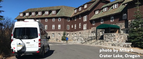
Click here for the White Sprinter Van map of the world!!!
Road and Mountain Biking
Lower Syncline might be okay today, but the upper parts are likely to be in the freeze thaw. Stay on the trails. Don’t shortcut the corners. Remember, if you damage the trails, volunteers have to spend timing fixing them rather than building new trails. You could also try any trail under the canopy in Post or on Hospital Hill – those should be frozen. Lower Whoopee is exposed to the open air, so don’t do that! There are lots of other options: gravel grinding, road biking, trainer biking. Don’t knock ’em ’til you try ’em!
Upcoming Events
Coming up today, there’s free yoga at 10am at the FISH food bank in Hood River. Mark your calendar now for the Super Wolf Blood Moon eclipse on Sunday night. Good luck finding somewhere cloud-free!
Random Morning Thoughts
Click here for the full events calendar.
Have an awesome day today!
Temira
