


Thank you for using this forecast. I offer it freely so you can have more fun and plan your life. It does take significant time and energy to produce. If you find yourself using it often, or if you feel your life is more awesome because of my work, please make a donation. You can get this forecast via email by donation. The email subscription isn’t $99/year. Not $50/year. Donating $12.34 or more gets you on the list for 12 months. Thank you for your support and thank you for trusting my forecast.
Click here to donate using a credit card.
Click here to donate via PayPal.
Venmo: @theGorgeismyGym
Snail Mail: PO Box 841, Hood River, Oregon 97031
Get the email version free through the end of January – try it out! Click here.
| 4a-8a | 8a-12p | 12p-4p | 4p-8p | 8p-4a | |
|---|---|---|---|---|---|
| Monday 10000′->5000′ |
 |
|
|
|
|
| Tuesday 5000′->4000′ |
|
 |
 |
 |
|
| Wednesday 4000′->7000′->4500′ |
|
|
|
 |
 |
Mt. Hood Weather Forecast
It’s Monday, and it’s another sunny and awesome day on Mt. Hood. Go there to escape the Gorge Gloom, ‘cuz it’ll be sunny up there all day. Free air freezing level: 10,000′ this morning, 8000′ this afternoon, and 5000′ overnight. It appears the sub-freezing line will be about 3000′ today… maybe that will help with your planning. Wind all day will be SE 25.
Tuesday starts out clear and turns cloudy in the afternoon. A snow/rain mix or wet snow moves in around 10pm. According to the sounding model, the snow level will be 5000′ during the day and 4000′ after midnight. However, the 850mb temp forecast is for 0-2 degrees C, meaning the precip will be borderline for snow. Having said all that, overnight precip will be about 0.1” water value (WV), meaning we’re looking at up to 1” or snow or mixed precip. Not much. Wind will be S 10 early, rising to SW 15-20 in the evening.
Wednesday dishes up light snowfall during the day and light rain overnight. The snow level will be 4000′ early, rising to 7000′ overnight and falling back to 4500’ after midnight. Precip will be 0.2” WV during the day, for 2” of new snow. Another 0.2” WV falls overnight, as rain (sad) followed by a trace of snow (happy). Wind Wednesday will be SW 15 early, SW 20-25 in the afternoon, and SW 30-40 overnight.
Models seem to agree on a trace of snow on Thursday. After that, they disagree on the intensity and timing of the next system. Why do they disagree on that? Because they disagree on the track and timing of a deep offshore low.
Gorge Wind Forecast
Nuking easterlies continue… For Monday, the all-day forecast is: 40-50 at Rooster, 35-40 at Stevenson, 30-35 at Viento. Gradient, in case you were curious, was 0.29 at 7am. River temp 41 degrees. Flow: 156kcfs. Tuesday starts with 30-35 at Stevenson and 40-45 at Rooster. The wind will back off to 25-30 and 35-40 respectively. Wednesday morning starts with 30-35 at Stevenson and 40-45 near Rooster. The wind drops to 20-25 midday and picks back up to 35-40 near Stevenson and 40-45 near Rooster in the afternoon. The easterlies finally back off on Thursday afternoon.
JONES, SAUVIE’S, COAST: now on vacation for the fall and winter. Will return in spring.
Virtual Spin – video, beats, friends, BIKES!!
Got a schedule that makes it hard to link up with scheduled classes? No worries, we got you. Our virtual spin program gives you access to our all new Spin Studio built for our Cycling program. Connect up with Virtual Classes led by a live coach, or with voiceover some fresh beats and paired with Scenic Rides all over the world. You can even hit one button and play your favorites from NetFlix and a variety of other media services. Or jam out to tunes and catch up with your friends for an all-time great experience in a private studio. Bike Max is 10 people. Meet up with your friends on your schedule and keep your cycling fitness strong all winter long!Get signed up now by clicking here!
Gorge Weather Forecast
There’s Nothing out there this morning, and it’ll stay that way. Temps will be in the mid 30’s early and near 40 later. East wind. No rainbows. Tuesday looks Nothing in the morning with higher clouds later. Light snow starts up around 11pm, continuing through Wednesday morning. Temps will be in the mid 30’s early and upper 30’s to low 40’s in the afternoon, dropping back into the 30’s over night. East wind. No rainbows. Wednesday starts off with light snow. Best guess is that river level will switch to rain after noon. Temps will be in the low 30’s early and upper 30’s in the afternoon. East wind. No rainbows.
For weather specifically directed at travel through the Gorge, please visit Temira’s Awesome Travel Advisory Service on Facebook.
White Sprinter Van of the Week!
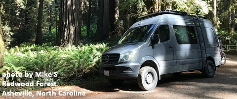
Click here for the White Sprinter Van map of the world!!!
Road and Mountain Biking
Syncline is probably fine to ride today. Stay on the trails. Don’t shortcut the corners. Remember, if you damage the trails, volunteers have to spend timing fixing them rather than building new trails. There are lots of other options: gravel grinding, road biking, trainer biking. Don’t knock ’em ’til you try ’em!
Upcoming Events
Our Monday community events start with by donation yoga at Flow at 8;30. There’s meditation at Trinity Natural Medicine at noon, $5 Tai Chi at the Hood River Adult Center at 2:30, free stress reduction class at HAVEN in The Dalles at 5:30, yoga at Samadhi at 6, and Zumba at Mid-Valley Elementary at 6:30. There’s also pickup kickball at Bingen’s Daubenspeck Park at 6.
Random Morning Thoughts
Click here for the full events calendar.
Have an awesome day today!
Temira
