

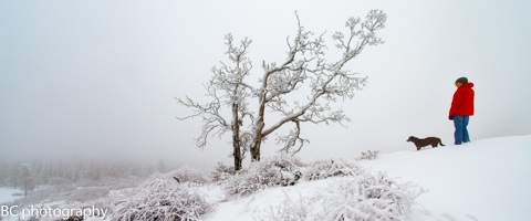
Mt. Hood Snow Forecast
It’s been absolutely dumping snow on Mt. Hood for the last … however many days… We’ll see the snowfall taper off dramatically today, possibly leaving us with sunbreaks. The snow level today will be around 1500′, dropping down to sea level (in the Gorge, cuz that’s where I live) tonight. We’ll see .1-.3” WV between 7am and 4pm, for 2-4” of fluffy snow. We’ll see another .1” or so tonight, for another inch or so. Wind today will be WNW 25 early, fading to W 5-10 after midnight. Continued after the chart…
 |
4a-8a | 8a-12p | 12p-4p | 4p-8p | 8p-4a |
|---|---|---|---|---|---|
| Monday 1500′->0′ |
 |
|
 |
|
|
| Tuesday 0′ |
 |
 |
|
|
|
| Wednesday 0′ |
|
|
 |
 |
 |
Mt. Hood Snow Forecast, continued…
Tuesday starts off partly cloudy or clear. The free air freezing level will be at your house and my house and everyone else’s house. Temps on the mountain will be in the teens. The wind will be light and variable, perfect for opening up lots of terrain on all the hills!
Wednesday’s models are disagreeing about when we see precip. It’s either going to start snowing in the morning or the afternoon. Not so helpful, is it? Anyway, the snow level will be at your house and my house on Wednesday all day. However, the incoming system is warm, so the incoming snow will be heavy, and we’ll likely see a switch to sleet, freezing rain, or even rain at some point. Let’s go with the Wednesday afternoon precip arrival time, just so we have a place to work from… between 4pm Wednesday and 4am Thursday, we’ll see .8”+ WV, giving us 5-7” of heavy, dense snow. That may switch to freezing rain and sleet after midnight. Wind on Wednesday will be SE 15 in the morning, S 10 in the afternoon, and SW 25 after midnight.

Say “thanks for the forecasts”
by making a donation!
Keep the forecasts coming.
Does this forecast save you time, gas money, or help you have more fun in your life? Make a donation to support continued forecasting, and get the forecast in your inbox each day. Click on the button to donate. The email subscription isn’t $99/year. Not $50/year. No, just $12.34 or more gets you on the list for 12 months. Don’t PayPal? Send a check to Temira @ PO Box 841 in Hood River. Thank you for your support and thank you for trusting my forecast.

Mt. Hood Snow Forecast, finished
Sticking with the GFS model timing of precip arriving early Wednesday, we are going to see a switch to very wet snow, rain, or snain on Thursday morning, followed by a switch back to snow on Thursday afternoon. We’ll see .5”+ WV between 4am and 4pm, for an unspecified amount of various precip types. We’ll see .1-.2” WV that falls as snow on Thursday night, for a couple inches of new. Wind on Thursday will be SW 30ish all day.
The forecast currently shows flurries on Friday. Keep in mind that models are all over the place on the timing of this system for now. We’re going to have to wait until we get closer to Wednesday to see – wild, isn’t it, that we’re just a couple days out and have this much uncertainty?
Simcoe Accounting
Simcoe Accounting, LLC is a full-service accounting firm. Serving clients throughout the Columbia gorge, dedicated to providing our clients with professional, personalized services and guidance in a wide range of accounting and business needs. We believe in getting it right the first time. The right service at the right time, at the right price. Contact us for a free quote by clicking the headline above.
Gorge Wind Forecast
Light west wind this morning holds during the day, turns light and variable in the afternoon, and turns light easterly after midnight. Tuesday starts with E 15-20 and turns to E 30-40 in the afternoon, building overnight. Wednesday looks like E 40-50 all day. Thursday looks like E 40 early and light E wind late. Stronger easterlies return on Friday.
Jones, Sauvie’s, Coast Beta Test Forecast
If you click right here , you’ll find NOAA’s coast forecast.
Random Morning Thoughts
As much as we humans would like to control our lives, there are some things we’re never going to control outside the pages of science fiction novels. Take the weather: we can only control it by avoiding it, by staying indoors and cranking up the heat.
Given the sudden appearance of another snow and ice storm in the forecast, it’s time to relax into our lack of control. By this, I’m not talking about weather. I’m talking about everything. You can’t control the weather. You can’t control the behavior of others. There’s a lot you can’t control, but there is one thing you can learn to control: your reactions to this out-of-control life.
Learn to see what is within your power to change and what is not. Stop making yourself crazy about things that are out of your control, and take small steps to control the things you can. When you rail against your powerlessness, you only increase your suffering. When you take little steps to change the things you can, you decrease your sense of powerlessness and increase your self-efficacy. This will make you happier.
So, don’t get all upset about the next incoming storm. There’s nothing you can do to stop it. Change the things you can that it will impact, and set the rest aside. Have an awesome day.
Disclaimer required by my grad school program: I am not your therapist (but I could be 51 graduate school credits from now). I am your weather forecaster. Take everything I say with a grain of salt, and consult with your actual therapist about your mental health issues. One other thing: I plan to keep doing this forecast indefinitely, even when I am a therapist.
Gorge Weather Forecast
It’s just cold and rainy out there this morning. We’ll see showers and sprinkles through tis afternoon with a chance of sprinkles and flurries through midnight. Temps will be in the upper 30’s all day, dropping below freezing tonight. Watch out for icy roads. Light west wind early, light east wind late. 97% chance of rainbows.
Tuesday looks cold with the Nothing. Temps will be in the mid 20’s early and the low 30’s in the afternoon. East wind. No rainbows. Wednesday is up in the air. One model has snow starting in the morning and one has snow starting in the evening. Either way, models are currently leaning towards snow, potentially lots of snow continuing through Thursday. East wind. No rainbows.
Thursday looks very snowy with freezing rain possible in the wee hours through the afternoon. Temps will be in the upper teens early and the upper 20’s in the afternoon. East wind. No rainbows. Friday just brings flurries and east wind and sub-freezing temps.
For weather specifically directed at travel through the Gorge, please visit Temira’s Awesome Travel Advisory Service on Facebook.
White Sprinter Van of the Day

Road and Mountain Biking
You can ride your bike if you have a fat bike. =)
Upcoming Events
It’s Monday, and there’s meditation at Trinity Natural Medicine at noon. That’s followed by Tai Chi at the Mt. Hood Town Hall at 1pm. There’s a walking happiness group that leaves One Community Health in The Dalles at 5pm, there’s Kickball at Daubenspeck Park at 6, free yoga at Samadhi at 6, Pickup Basketball at the Mt. Hood Town Hall at 6:30, free Zumba at St. Francis House in Odell and at the Parkdale Community Center, and YogaFaith (Christ-centered yoga) at Pure Yoga in The Dalles.
Coming up Thursday (weather permitting?) the HRVHS Nordic team has a fundraiser workout at HRVHS at 3:30. This should be super fun – get dressed up and stuff. I’m hoping they have an indoor backup plan. Fingers crossed!
Have an awesome day today!
Temira
