| Your favorite launch | dawn patrol |
morning max | afternoon max | executive session |
|
|---|---|---|---|---|---|
| Iwash (Rooster) Rock | morning | clouds | afternoon | buns | |
| Stevenson | 5-10 | 14-17 | 17-20 | 14-17 | |
| Viento | 17-20 | 17-20 | 14-17 | 14-17 | |
| Swell-Hood River | LTV | 17-20 | 14-17 | 14-17 | |
| Lyle to Doug’s | 7-10 | 11-14 | 16-19 | 16-19 | |
| Rufus, etc: 94-143kcfs flow | 7-10 | 7-10 | 7-10 | 7-10 | |
| Roosevelt & Arlington | 7-10 | 7-10 | 7-10 | 7-10 | |
| River flow last 24 hours: 94-143kcfskcfs | =River temp: 70.52F | HR High temp: 79F | |||
Gorge Wind Forecast
Hi friends! Nice to see you on the river yesterday. We have three more days of predictable wind – that’s plenty of time to hang together on the bumpy river. Beyond Friday, major uncertainty leaves the forecast up in the air. Wednesday morning PSAs: first, aircraft working Williams Mine Fire will be scooping between Memaloose Island and Lyle (or potentially Swift Reservoir). That mostly affects folks recreating at the Lyle sandbar. If you see aircraft, clear the river (or the Coast Guard will clear you). Better yet, go elsewhere! Next, a wildfire started at MP 57.5 I-84 last night. I84 westbound is closed MP 57.5 to MP 62 (Hood River), meaning you may need to leave the Gorge some other way. I just double-checked Tripcheck and caught that I-84 is closed from Biggs to Rufus today due to road maintenance. Ok. On to the forecast.
Is this feeling helpful? If so, go ahead and make a contribution using Paypal to support it. Send $19.99 or more, and I’ll send the forecast to your inbox for a year.
Wednesday starts with a nice marine layer to the west of Hood River. We’re lacking in support from the offshore waters, but we’ll have some support from heat in the desert. Gradients dropped dramatically as I was writing this forecast; they went from 0.07/E0.01 when I woke up to 0.05/W0.01 after gathering the necessary info. What’s this mean for today? Well, we’ll start with 17-20 near Viento, and only near Viento, with light/variable wind everywhere else. By mid to late morning, westerlies rise to 17-20 from Stevenson to Mosier with 11-14 from Lyle to Doug’s. After 2pm, as the metro area clears and heats, the wind drops to 14-17 from Stevenson to Hood River and rises to 16-19 from Lyle to Avery. Areas east of Avery remain below 15mph all day. River flow over the last 24 hours was 94-143kcfs, river temp is 70.52F, and high temp forecast is 79F for Hood River.
The action ramps up on Thursday as a low moves into central Oregon. This drives gradients up. With little to no support from the offshore waters, the wind won’t be as strong as it could be, but it’ll still be plenty! One thing to note: instability east of the Cascade Crest could affect wind quality east of The Dalles. Expect 21-24 from Viento to Mosier to start with 18-21 at Stevenson and also from Lyle to Arlington. A dip mid-morning shouldn’t fool you into giving up. From late morning on, we’ll have 25-28 from Stevenson to Threemile with the potential for 28-31 from Mosier to Doug’s. Rufus could also climb to that 28-31 range. Remember that these predictions are for the iWind/iKite sensor readings, and that those sensors read about 5mph higher for The Wall and Arlington than they do for Swell. Calibrate your plans accordingly. High temp: 74F for Hood River and 82F with a chance of showers/thundershowers for Arlington.
Writing the complete forecast takes me 1-2 hours a day. If it saves you time, gas money, or helps you plan your life, please consider contributing.

On Friday, offshore high pressure briefly rebuilds. Marine clouds push to Viento in the morning. As of right now, models call for 20-23ish from Stevenson to Arlington early and 20-23 from Stevenson to Avery in the afternoon. High temp: 76F for Hood River.
That was helpful in planning your life, wasn’t it? Go ahead and subscribe to the forecast using the fancy auto-renew option. Don’t like electronic payment? No problem! You can send a check or cash to: Temira / PO Box 841 / Hood River, Oregon, 97031. Thank you so much for supporting the forecast. I’m glad you find it helpful, and I appreciate your kindness in supporting the work I’m doing!

Extended: active weather is forecast for the weekend as an unseasonably cool/strong low moves inland sometime Saturday. Timing is everything, and models don’t agree on the timing. We have ensembles calling for anything from no wind to very strong wind. They’re also tossing out the possibility of rain and/or thundershowers. Sunday also looks uncertain – models offer up a wide range of wind speeds. Until we have more clarity, we can’t have a forecast. Hang in there for updates. See you on the river!

Jones, Sauvie Island, Oregon Coast
North/Central/South coast, waves (swell forecast provided by NWS). Wind forecast for the afternoon (unless it’s a storm on the coast, in which case that’s peak wind during the day). Wind direction N (coast/Sauvie Island) and W (Jones) unless otherwise noted. Wednesday: NW10-15/LTN/LTV, W swell 3′ at 10 seconds. Thursday: LTNW/LTN/N15, NW 3′ @ 9. Friday: LTNW/N10/N20, NW 3′ @ 9. Jones Wednesday: 15-18. Thursday: 7-10. Friday: 9-12. Sauvie Island Wednesday: 12-15. Thursday: 10-13. Friday: 10-13.
Alan’s Sauvie Island Wind Sensor
Mt. Hood Weather Forecast
I’m tired. It’s on vacation.
Very basic Hood River weather forecast. Don’t plan your life around this. You really should read Temira’s Awesome Travel Advisory Service on Facebook
Mostly clear sky this morning stays that way. Temps start in the low 60s and rise to the upper 70s. Moderate westerlies. No rainbows. Thursday will be partly high cloudy. Temps start in the upper 50s and rise to the mid 70s. Strong westerlies. No rainbows. Friday will be partly cloudy then clear. Temps start in the mid 50s and rise to the mid 70s. Moderate westerlies. No rainbows.
Local-ish Events
Please let me know of outdoor-related local-ish events. If you don’t tell me, I don’t know!
There’s a weekly social for Wind Johnnies (The Gorge Wind Social) at Ferment Brewing every 3rd Monday this summer. There’s a free community paddle at Wylde Wind and Water every Saturday at 10am (gear provided, all ages). They also have a free community wingfoil orientation every Thursday at 5:30pm at the Hook (all ages, gear provided). Northwave and GoFoil sponsor wingfoil races on Tuesday evenings.
The Columbia Gorge Junior Kayak Club offers free roll sessions (gear provided) for kids at the Hood River Pool every other Tuesday from 5:30 to 7pm. Visit their website for more deets: https://www.columbiagorgejuniorkayakclub.org/. Amayah’s offers a free meal every First Thursday from 1pm to 4pm. Regular weekly events:. NK Studio’s by-donation Tuesday morning yoga class is back. Ferment’s Tuesday night 4-mile walk/run is at 6pm. There’s meditation with monks at 5:15pm (an hour) and 6:30pm (30 minutes plus a talk) at Yoga Samadhi in White Salmon. Columbia Gorge Tri Club meets at Mayer State Park at 6pm Tuesdays. At 7:15am on Wednesdays, there’s a run from the White Salmon Bakery. At 7am on Friday morning, there’s a run from Pine Street Bakery. On Fridays at 2:30pm, there’s a free meditation and stretching class at Yoga Samadhi. On Saturday at 9am, there’s a by-donation outdoor group fitness on the 2rd floor deck about Ferment Brewing.
Cycling
All vehicles on HR County forest roads need a gallon of water and a shovel. All areas to the west of 140 trail in Post Canyon are closed. Please see the HRATS for complete details, but essentially, all that is open is 7 Streams, Eldorado, 140, GP, and other trails in those areas. Mobius, Mitchell Ridge, Spaghetti, etc are all closed. People have been riding the closed trails. If this continues, all of Post will be closed. The sheriff is patrolling, and will ticket you. The Twin Tunnels Trail between Hood River and Mosier is closed due to wildfire. Kreps and Green Diamond Land (formerly SDS) are now closed to fire danger. That includes Whoopdee, Hospital Hill, and Underwood. Those lands will remain closed until significant rain in the fall. Also closed: Gorge 400 and lots of other trails due to the Whisky Creek Fire. Ape Canyon and Plains of Abraham are open per USFS website. 44 Road trails are all open and clear, including upper 450 and Fifteenmile. Gunsight is open. Boulder Lakes and other more remote trails are not bucked out yet. Remember that E-bikes are not allowed on USFS non-moto trails. They are allowed on moto trails.
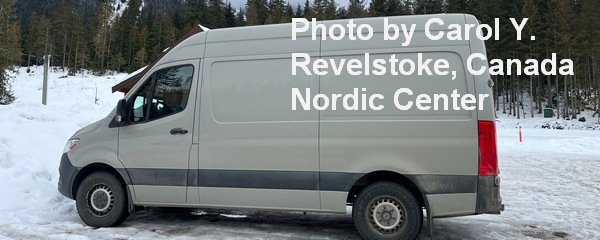
Sprinter Van of the Week!
 Click here for the Sprinter Van map of the world!!!
Have an awesome day!


