

Support it with a contribution!

Thank you for using this forecast. Writing it takes 60-120 minutes a day; I can only keep it going with your generous financial support. Make a contribution or subscribe and get it in your inbox with bonus material. What’s that cost? Not $99 a year. Nope. Not $49. Contribute $19.99 or more, and you’re on the list for a year. People are added to this list on Thursday and Sunday. Thanks for your patience! Click below to contribute and keep the forecast going for everyone, nearly every day.
Click here to use your PayPal
Venmo: @theGorgeismyGym
Snail Mail: Temira Lital, PO Box 841, Hood River, Oregon 97031
(note: I am not a non-profit entity. The only way to accept credit cards with a user-defined amount is to use the ‘donate’ button. Thanks for understanding!)
Auto-renewing subscription. New! Awesome!
The Forecast
| 4a-8a | 8a-12p | 12p-4p | 4p-8p | 8p-4a | |
|---|---|---|---|---|---|
| Wednesday 1500′->10000′ |
 |
|
 |
|
 |
| Thursday 10000′-9000′ |
|
|
|
|
 |
| Friday |
|
|
 |
 |
|
Mt. Hood Weather Forecast
There’s a beautiful sight on the webcams this morning – snow! Get up there and play in it right now. Build a snowperson. Schuss around on skis. Do some sledding. Do it right now, because the next week looks too-warm on the slopes.
Wednesday starts off chilly and clear. Clouds move in this afternoon and stick around all night, but no precip is forecast. The free air freezing level will be 1500′ this morning, 8000′ this afternoon, and 10,000′ overnight. Wind: SE 5 this morning, SW 10-20 this afternoon, and WSW 20-25 overnight.
Thanksgiving day looks cloudy. Rain arrives in the evening and sticks around all night. The snow level will be 10,000′ in the morning and 9000′ in the evening. About 0.4” rain is forecast overnight. Wind: WSW 20-30 through the evening becoming W30 after midnight.
Rain continues Friday daytime and tapers to drizzle, mist, or sprinkles in the evening. The snow level will be 9000′ in the morning, 6000′ in the afternoon, and 8000′ overnight. About 0.6” rain is forecast during the day. A trace to 0.1” falls overnight. Wind: W30 in the morning, W 20 in the afternoon, and WSW 15 overnight.
Models do not agree on the weather for the weekend. An atmospheric river is forecast to make landfall somewhere between Vancouver Island and Newport, Oregon. The GFS keeps us high and dry all weekend. The ECMWF puts us at the southern edge of the AR. Result of that – lots of rain. So, no certainty on precipitation. What is certain is the temps; they’ll be warm, perhaps even record breaking on Sunday. Warm weather extends through the start of December. Models then hint at a shift to colder weather a few days into December. As always this far out, details are unclear. That said, this shift has been apparent for over a week, and models do agree, so the potential for cooler, snowier weather is high. Have a great Thanksgiving holiday!
Gorge Wind Forecast
Light westerlies and light west gradients start the day Wednesday, but they wont’ last. We then go into a three-day period of relatively light wind. Longer-range models for the weekend haven’t coalesced on a solution yet.
So. Wednesday starts with light westerlies. The wind turns to easterly mid-morning and builds to 15-20 at Rooster and Stevenson by noon. In the evening, Rooster picks up to 20-30. River flow is 98,100cfs, river temp is 49F, and high temp forecast is 47F. Thursday starts with E 10-15 at Rooster and Stevenson. The wind turns calm midday all through the Gorge. We could see some very light westerlies, less than 10mph, in the afternoon. High temp: 46F. Friday starts calm. Westerlies pick up to 10mph or so from Stevenson to Viento in the afternoon. High temp: 52F.
Coast, Jones, Coast
Done until spring, unless there’s an obvious Coast or Sauvie’s or Jones day.
Hood River Weather Forecast
Partly cloudy sky this morning turns high overcast later. Temps will be in the mid 30’s early and upper 40’s this afternoon. Light westerlies early. Calm/light easterlies later. No rainbows. Thursday will be cloudy in the morning. The inversion might break, maybe, leaving clear sky before rain moves in overnight. Temps will be in the mid 30’s early and mid 40’s later. Calm wind early, very light westerlies late afternoon. No rainbows. Friday starts rainy. Rain tapers off mid-morning and the afternoon should be mostly dry. Temps will be near 40 early and in the low 50’s later. Calm wind early. Light westerlies or calm wind in the afternoon. 78% chance of rainbows.
Looking for a complete Columbia Gorge forecast? Looking for more humor in your weather? Obscenities? You’re looking for my TATAS: Temira’s Awesome Travel Advisory Service on Facebook.
Cycling
FREEZE-THAW ALERT: if you notice that temps were below freezing last night and will be above freezing today, don’t ride any trail that’s not under a tree canopy. If you do so, you WILL do significant damage. DON’T DO IT! Plentiful rain recently means most tree-covered trails are muddy. Please don’t ride them either. If you do, you’ll be doing significant and possibly permanent damage. No really, please don’t. There are lots of gravel roads and lots of pavement you can ride instead. Enjoy!
Local Events
There are two running events tomorrow. The Mosier School has their annual Turkey Trot at the Twin Tunnels. 9:30am. There’s another benefit run at Sorosis Park in The Dalles. 8am.
Please let me know about events. I often only hear about them if you folx let me know!
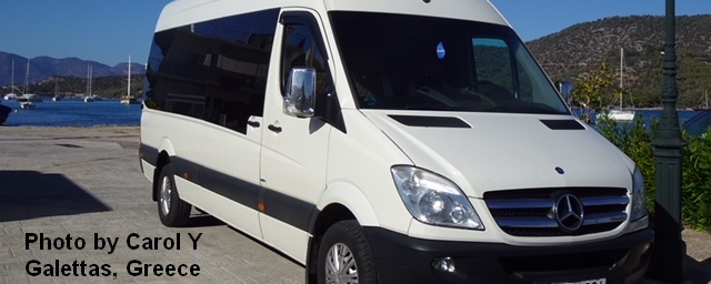
Sprinter Van of the Week!
 Click here for the Sprinter Van map of the world!!!
Have an awesome day!
Click here for the Sprinter Van map of the world!!!
Have an awesome day!
