

GORGE WIND FORECAST
If you’re still seeing yesterday’s and it’s after 9am, try opening this in an incognito window
today’s gorge wind forecast
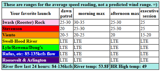
Hi friends! Solid easterlies are on the schedule for today, and then we’re looking at several days of light/variable wind. Next chance for windsport wind after today is Monday – westerlies. No promises, but fingers are crossed! Wednesday sees easterlies ramp up to 35mph at Iwash (Rooster) Rock, 30-35mph at Stevenson, and 25mph at Viento. The wind holds into early afternoon when it falls to 25mph at Iwash and Stevenson and 15-20mph at Viento. River flow over the last 24 hours was 84-136kcfs, river temp is 53.8F, and high temp forecast is 49F.
RIVER FLOW FOR SITES BETWEEN AVERY (EAST OF THE DALLES) AND RUFUS: CLICK HERE FOR JOHN DAY DAM FLOW.
RIVER FLOW FOR SITES BETWEEN STEVENSON AND DOUG’S BEACH (WEST OF THE DALLES): CLICK HERE FOR THE DALLES DAM FLOW

EXTENDED gorge wind forecast
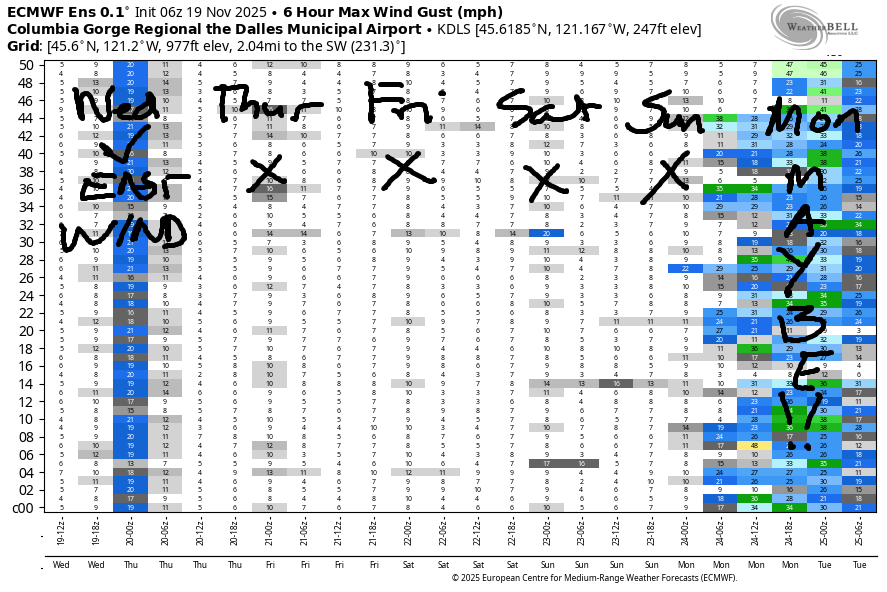
Thursday, Friday, Saturday, and probably Sunday all bring light/variable wind. For Monday, models hint at a cold front followed by building high pressure offshore. This often results in a period of moderately strong westerlies between Viento and Rufus. Fingers are crossed. Other than that, your water time will be limited to non-wind sports – dock starting, e-foiling, kayaking, etc… Hope to see you out there on the Nch’i Wana one of these days!
Was that helpful? I knew it was! Guess what? All of this crucial work – from your personal wind and snow reports to the invaluable TATAS updates – is made possible by my relentless efforts. Maintaining this labor of love isn’t easy. Each daily forecast takes hours. Website hosting, weather model access, and back-end admin work takes time and money. That’s where you come in.
YOUR CONTRIBUTION MAKES A DIFFERENCE
- SUPPORT ACCURATE, HYPER-LOCAL WEATHER FORECASTING
- ENABLE ACCESS FOR ALL, EVEN THOSE WITH LESS MEANS
- SUPPORT A COOL HUMAN WHO WORKS HARD SO YOU CAN PLAY
Take a moment to click one of the buttons below. Donate $19.99 or more (how much does this forecast enhance your life?) and get the email in your inbox. Whether it’s a renewing subscription (auto-renew) or a one-time donation, every contribution makes a real difference. Help me keep this labor of love alive, so we can all continue playing, commuting, and living in the Gorge with peace of mind and the best weather forecasts possible. Thank you!


Hood River, Oregon 97031


MT HOOD SNOW FORECAST

Hey skiers and snowboarders! The start of ski season keeps slipping deeper into the future. It’s clear now that we won’t have ski season by Thanksgiving. Beyond that, models have a lot of range in the potential outcome but no clear signs of the two feet or so of snow we need to get things moving at Meadows and Skibowl.
Looking at today, Wednesday, Mt. Hood starts clear and ends cloudy. An inch of so of snow is forecast overnight as the snow level falls to 4000′. Wind: ESE 15 this morning, SW 15-25 overnight. Light snowfall on Thursday morning – just an inch of accumulation – gives way to clear sky. The snow level will be 3500-4000′ for the 24 hours period. Wind: SW 15-25 in the morning and light/variable in the afternoon and overnight. Friday looks sunny with light wind. The free air freezing level rises from 4000′ in the morning to 8500′ in the afternoon and 9000′ after midnight.
In a shift from previous forecasts, the weekend now looks dry both days. Light to moderate precip is possible Monday evening, but total precip looks to be under 0.5” for less than half a foot of new at 5000′. Uncertainty increases after Monday. For now, the middle of next week is almost certainly going to be dry. Models then have about an 80% chance of some precip (temps uncertain) towards the end of next week. Let’s leave it there for now and make plans to do some mountain biking instead!
BARE BONES HOOD RIVER WEATHER FORECAST
Partly Nothing this morning. Clear midday. Partly high cloudy later. Temps start in the low 30s and rise to the upper 40s. Light easterlies. No rainbows. Thursday will be cloudy with drizzle then mostly clear. Temps start in the upper 30s and rise to the low 50s. Light easterlies then calm. 17% chance of rainbows. Friday will be partly Nothing then partly high cloudy. Temps start in the mid 30s and rise to the low 50s. Calm wind. No rainbows.
TEMIRA’S AWESOME TRAVEL ADVISORY SERVICE
HYPERLOCAL WEATHER FORECAST FOR THE COLUMBIA GORGE
THE DALLES, HOOD RIVER, WHITE SALMON, TROUT LAKE, STEVENSON, CASCADE LOCKS, PARKDALE, ODELL, HUSUM, BZ, MILL A, WILLARD, GOLDENDALE, RUFUS, ARLINGTON, boardman
Good morning, neighbors! It’s a chilly November morning here in the Gorge, and so far today, the community appears clear of ice. That doesn’t mean you won’t encounter slick roads – frost is certainly possible and maybe even some black ice in the shadowy darkness. Gorge weather for the next five days looks unexceptional: mostly dry, mostly not very windy, and not particularly cold or hot. Before we dive in… if it’s still early and you haven’t had a chance to say hello to the Nch’i Wana, it’s worth making soime time – the entire river is covered in fog this morning thanks to the combo of still-warm water and cold air. It’s BEAUTIFUL!!!
Glenwood this morning
Speaking of cold, Glenwood started this morning at 24 degrees. Most people expected this and had coals in the wood stove ready to stoke. Now they’re all sitting in rocking chairs in front of blazing fires sipping black coffee. PEACEFUL! Lots of other places are nearly as cold as Glenwood this morning, but nobody beat the OG. Goldendale came close with 25, and the lower parts of Parkdale were reading 26. My garden: 30ish, so that’s the end of the dahlias for the year. Good thing I labeled them yesterday!
Today’s Gorge weather forecast
Today’s weather sees the near-river Nothing break up. Sun midday gives way to mid and high level clouds this afternoon as a weather system approaches. Temps rise to 50 degrees, more or less. East wind starts the day at 30-35mph near Iwash (RELEASE THE FILES WITHOUT REDACTING THEM) Rock and Stevenson. Afternoon: 25mph. Up in the hills, easterlies rise to 5-15mph.
Extended Gorge weather forecast
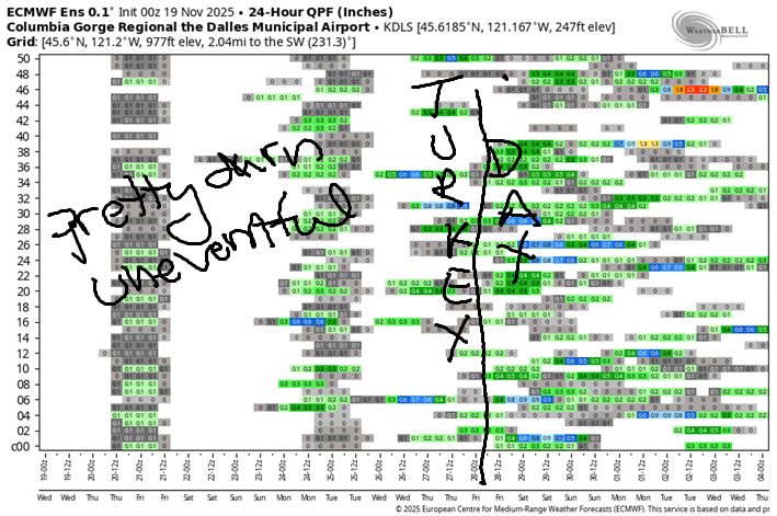
Overnight, a weather system makes landfall. This gives us drizzle as far east as Celilo Village starting around midnight and ending around sunrise. There’s a good chance you’ll sleep through the entire round of drizzle! Temps Thursday morning will be in the upper 30s. They’ll rise to 50-53F in the afternoon. Wind: unexciting. E 15mph in the usual spots in the morning and calm in the afternoon. Friday, Saturday, and Sunday all look uneventful. Calm wind, dry weather, temps in the low to mid 50s, warmest on Saturday. Our next weather system presents itself on Monday, but the timing, intensity, and exact type are still fuzzy. Generally speaking, the weather remains far from the extremes for the next week or so. Safe travels. -TATAS
HEY! DON’T STOP READING! Is this community-focused forecast helpful to you? It sure is! It takes me a couple hours a day to write. Please join your friends and neighbors in contributing to keep it going. Venmo: @thegorgeismygym PayPal: twomirrors@gmail.com USPS: Temira / PO Box 841 / Hood River, Oregon 97031 You can test out the forecast subscription for a few days for free by signing up below. Easy! Do it!
JONES BEACH, SAUVIE ISLAND, & COAST FORECAST
ON WINTER VACATION UNLESS DESPERATELY NEEDED.
