Mt. Hood Snow Forecast
It’s Wednesday morning, and I’m headed out for an internet-free vacation this afternoon. I will return for you on the 4th of January. In between now and then, if you feel so inclined, I’d love it if you dropped me a birthday card in the mail. Birthday cards make me very, very happy. They put a big smile on my face. If you include a few words about how my forecasting makes your life better, you’ll totally make my day. My address is PO Box 841, Hood River, 97031. Now, on to the forecast… Mt. Hood received exactly one ton of snow over the last 24 hours. Snowfall will continue this morning before tapering off by midday. The snow level will be around 1500′ all day, rising to 6000′ after midnight. We’ll see just a couple inches of snow before the sky clears. Wind today will be NW 25 early, dropping to SW 5-10 in the afternoon. Continued after the chart…
 |
4a-8a | 8a-12p | 12p-4p | 4p-8p | 8p-4a |
|---|---|---|---|---|---|
| Wednesday 1500′->6000′ |
 |
 |
 |
 |
 |
| Thursday 6000′->8000′->4000′ |
 |
 |
 |
 |
 |
| Friday 4000′->0′ |
 |
 |
 |
 |
 |
Mt. Hood Snow Forecast, continued…
Thursday looks partly cloudy early and sunny in the afternoon. A warm weather system will pass over the mountain during the day, but it looks like it will be far enough north to spare us from precipitation, thankfully, because it would fall as rain. The free air freezing level Thursday will be 6000′ early, 8000′ in the afternoon, and 4500′ overnight. Wind will be SW 10-15 early, SW 20-25 in the afternoon, and W 30 after midnight.
Friday starts off with low and mid-level clouds that will likely lead to fog on at least the lower elevations of the ski resorts. By mid-morning, or early afternoon at the latest, the sky should clear. The free air freezing level will be 4000′ Friday morning, dropping to 1500′ in the afternoon and sea level after midnight. Wind on Friday will be W 35 early, WNW 25 mid-morning, and NE 10 in the evening.
Say “thanks for the forecasts”
by making a donation!
Keep the forecasts coming.
Does this forecast save you time, gas money, or help you have more fun in your life? Make a donation to support continued forecasting, and get the forecast in your inbox each day. Click on the button to donate. The email subscription isn’t $99/year. Not $50/year. No, just $12.34 or more gets you on the list for 12 months. Don’t PayPal? Send a check to Temira @ PO Box 841 in Hood River. Thank you for your support and thank you for trusting my forecast.

Mt. Hood Snow Forecast, finished
Saturday currently looks clear for most of the day, cloudy in the evening, and snowy after midnight. The snow level will be at sea level in the morning, 1500′ in the afternoon, and sea level in the evening. Snow starts up around midnight, with steady snowfall leading to 12-18” of new in the next 24 hours. It’s worth noting that it will almost certainly be snowing in the metro areas between midnight Saturday and midnight Sunday, with 2-4” of accumulation at sea level.
Looking at the long-range models, we appear to remain cold and dry through at least the middle of next week. That’s good, because it’ll keep the snow on the mountain in pristine shape.
Hood River Soaring
Glider rides for holiday gifts!
Give a gift certificate this winter to enjoy a scenic glider ride next spring and introduce a friend or family member to the thrill of soaring. Experience a grand view of the snow capped mountains, river valleys, verdant orchards and countryside that make the Hood River valley a truly unique and breathtaking place to fly. Your purchase supports Hood River Soaring’s goal to help young people discover their potential by learning to fly.
Gorge Wind Forecast
Light west wind this morning (Wednesday) becomes light and variable midday and E 20-25 after 4pm. Thursday starts with E 35-45 at Iwash (Rooster) and backs off to light easterlies in the afternoon. Friday looks like W 13-16 from Steven’s Locks to Arlington.
Jones, Sauvie’s, Coast Beta Test Forecast
If you click right here , you’ll find NOAA’s coast forecast.
Random Morning Thoughts
As you might have noticed, it’s time for my annual request for love and affection in the form of birthday cards. Even though I do this every year, it still feels awkward. Most of us, including me, are conditioned to feel uncomfortable basking in the limelight. When we really check in with ourselves, we find that there’s something delightful about being the center of attention.
Often, however, that delight is accompanied with shame. This, I think, is a shame. We humans are social animals, and we humans need love. When we don’t ask for love and recognition, we are undermining ourselves. We want to be seen, we want to be heard, and we want to be loved. It’s important to advocate for ourselves, or we’re unlikely to get these things.
Think, for a moment, what it feels like to know you are loved. Feels good, right? What if you could have more of that? It’s scary to ask; Freud once said, “We are never so defenseless against suffering as when we love.” I would argue that we’re equally defenseless when we ask for love.
But go ahead, be bold. Take a risk. Ask for love and attention. Bask in it when it comes your way. You might just find that your desire is sated, and you’re filled with love more of the time. You’re awesome and deserving of love. Have an awesome day.
Disclaimer required by my grad school program: I am not your therapist (but I could be 40 graduate school credits from now). I am your weather forecaster. Take everything I say with a grain of salt, and consult with your actual therapist about your mental health issues. One other thing: I plan to keep doing this forecast indefinitely, even when I am a therapist.
Gorge Weather Forecast
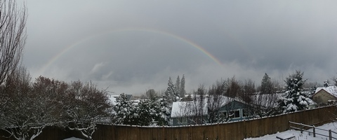
It’s partly cloudy out there this morning and 39 degrees, and despite that seemingly innocuous temp, there’s black ice on the roads. Expect a partly cloudy day with high clouds in the afternoon. Temps will be in the upper 30’s to low 40’s. Light west wind early turns easterly this afternoon. 2% chance of rainbows. Models suggest partly cloudy weather Thursday, but I suspect we’ll see some Nothing. Temps will be in the low 30’s early and the mid to upper 30’s in the afternoon. East wind. No rainbows. Friday starts off with low clouds and clears off in the afternoon. Temps will be in the low 30’s early and the upper 30’s in the afternoon. Light westerlies. No rainbows.
Things get more interesting after midnight on Saturday as the next system moves in. Expect 3-4” of new snow near Hood River with 2-4” in Portland by Sunday night. After that, temps drop below freezing, well below freezing, for the extended forecast.
For weather specifically directed at travel through the Gorge, please visit Temira’s Awesome Travel Advisory Service on Facebook.
White Sprinter Van of the Day

Road and Mountain Biking
Temps were above freezing last night, meaning you’ll find some roads open for riding today after the black ice melts off. Mountain biking, on the other hand, is a no-go. Syncline is in the midst of a freeze-thaw cycle topped with rain and snow, and you’ll do major damage if you ride today. Wait until the ground completely refreezes and then give it a shot. Or better yet, ride gravel roads.
Upcoming Events
It’s Wednesday morning. There’s community meditation at Flow at 8:15. There’s community yoga at the FISH food bank at 10am. There’s ping pong at the Hood River Armory at 5pm and Zumba at the Parkdale Community Center at 6:30pm.
Have an awesome day today!
Temira


