

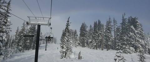
Mt. Hood Snow Forecast
As of this morning, it still looks like the incoming weather system will stay far enough to the south to keep us on the cold and snowy side of the upper level low. That said, I expect the snow on the mountain will be heavier than we’d expect, given the temperatures. The snow level today will be at sea level all day. Temps at 8000′ will warm up into the mid to upper 20’s during the period of max precip, leading to relatively dense snow. Continued after the chart…
 |
4a-8a | 8a-12p | 12p-4p | 4p-8p | 8p-4a |
|---|---|---|---|---|---|
| Wednesday 0′ |
 |
 |
 |
|
|
| Thursday 0′ |
 |
 |
 |
|
|
| Friday 0′ |
|
|
|
|
|
Mt. Hood Snow Forecast, continued…
We’ll see snow start up sometime between 10am and noon, with approximately .6” water value (WV) between the start and the end around 1am. That’ll give us 5-6” of new snow. If the storm track does shift a little to the north, we could see quite a bit more water value along with even denser snow. Wind today will be SE 25 in the morning, switching to SW 20 around 7pm and turning to the W at 20-25 after midnight.

Say “thanks for the forecasts”
by making a donation!
Keep the forecasts coming.
Does this forecast save you time, gas money, or help you have more fun in your life? Make a donation to support continued forecasting, and get the forecast in your inbox each day. Click on the button to donate. The email subscription isn’t $99/year. Not $50/year. No, just $12.34 or more gets you on the list for 12 months. Don’t PayPal? Send a check to Temira @ PO Box 841 in Hood River. Thank you for your support and thank you for trusting my forecast.

Mt. Hood Snow Forecast, finished
Thursday looks sunny up high with clouds down low. Temps on the slopes will be in the teens. The wind will be out of the W at 20-25 in the morning, turning to NW 10 in the afternoon and evening. Friday starts off with low clouds and turns clear in the afternoon. Temps on the slopes will be in upper single digits to the low double digits. Wind will be N 15mph or so. Saturday currently looks clear with a possibility of high clouds at times. Temps will be in the teens with NW wind at 20mph.
The extended GFS run isn’t available this morning, so I don’t have any long-range wishcasting for you.
Simcoe Accounting
Simcoe Accounting, LLC is a full-service accounting firm. Serving clients throughout the Columbia gorge, dedicated to providing our clients with professional, personalized services and guidance in a wide range of accounting and business needs. We believe in getting it right the first time. The right service at the right time, at the right price. Contact us for a free quote by clicking the headline above.
Gorge Wind Forecast
Expect east wind at 40-50 through 4pm today, backing off to 25-30 overnight. Thursday starts with east 25-30 and backs off to E 15-20 by 4pm. Easterlies pick back up on Friday morning with 30-35 early and 20-25 in the afternoon. Given that upper level winds will turn northerly on Friday, Gorge wind could be stronger than models are suggesting.
Jones, Sauvie’s, Coast Beta Test Forecast
If you click right here , you’ll find NOAA’s coast forecast.
Random Morning Thoughts
I’m super tired and it’s the end of my work week. I think I’ll skip this section this morning. Have an awesome day in the snow!
Disclaimer required by my grad school program: I am not your therapist (but I could be 51 graduate school credits from now). I am your weather forecaster. Take everything I say with a grain of salt, and consult with your actual therapist about your mental health issues. One other thing: I plan to keep doing this forecast indefinitely, even when I am a therapist.
Gorge Weather Forecast
It’s a cold morning in the Gorge, and it’s not going to get any warmer. Expect the temp to hover in the mid 20’s all day. For those of you in the Nothing fog layer, you can expect freezing fog until the snow moves in. Expect snow starting around 12:36pm, ending by 1am. We’ll see 3-5” today. East wind. No rainbows.
Thursday may have a few flurries, and if you’re in the Nothing layer, you’ll have freezing fog. Temps will be in the low 20’s early. NWS claims we’ll see 32 degrees as a high. I would be surprised if that happens. Anyway, clouds all day. East wind. No rainbows. Friday sees the Nothing all day long, so again, freezing fog for those of you in the fog layer. Temps will be in the upper teens early and the mid 20’s in the afternoon. The sky should clear up Friday night, dropping us into the single digits, or for some lucky people in cold spots, near zero degrees. Next chance of precip is Monday, but the long-range GFS is down this morning, so no details.
For weather specifically directed at travel through the Gorge, please visit Temira’s Awesome Travel Advisory Service on Facebook.
White Sprinter Van of the Day

Road and Mountain Biking
You can ride your bike if you have a fat bike. =)
Upcoming Events
It’s Wednesday morning. There’s community meditation at Flow at 8:15. There’s community yoga at the FISH food bank at 10am. There’s ping pong at the Hood River Armory at 5pm and Zumba at the Parkdale Community Center at 6:30pm.
Coming up Thursday (rain, snow or shine) the HRVHS Nordic team has a fundraiser workout at HRVHS at 3:30. This should be super fun, and you should be there to make a donation. They are a club sport and receive zero funding from the school system.
Have an awesome day today!
Temira
