


Thank you for using this forecast. Like it? Find it useful? Support it (and me!) by sending some cash my way. Why should you keep doing this when the mountains and beaches are closed? Because my bills don’t stop – I hope you’ll consider subscribing even though the world has ground to a standstill. That’ll keep the forecast going through this crisis, and it’ll mean the forecast is here when we all emerge from our homes. What’s it cost to subscribe? Not $99 a year. Nope. Not $49. Just $12.34 or more gets you a subscription. Click below to subscribe. Thank you!!
Credit card payments click here – – – – – – – – – Click here to use your PayPal
Venmo: @theGorgeismyGym
Snail Mail: PO Box 841, Hood River, Oregon 97031
(note: I am not a non-profit entity. The only way to accept credit cards with a user-defined amount is to use the ‘donate’ button. Thanks for understanding!)
Auto-renewing subscription. New! Awesome!
The Forecast
CoronaChat
| Your favorite beach | Dawn Patrol |
9am- 11:30a |
11:30a- 3pm |
3pm- dusk |
|
|---|---|---|---|---|---|
| Rooster Rock | closed | beach | clothed | buns | |
| Steven’s Locks | E10-15 | LTV | W10-13 | W12-15 | |
| Swell-Hood River | LTV | 10-13 | 21-24 | 11-14 | |
| Doug’s, Lyle, Rowena | LTV | 10-13 | 21-24 | 11-14 | |
| Rufus, etc. | LTV | 10-13 | G21-24 | G21-24 | |
| Roosevelt & Arlington | LTV | 10-13 | G21-24 | G21-24 | |
Gorge Wind Forecast
Great news: some Washington state parks will reopen on May 5th, meaning that The Hatchery and Doug’s Beach are likely to reopen, although violators of the current closures have made that less likely. No word yet from the Army Corps (The Wall, Rufus, Roosevelt). No word yet from Oregon State Parks (Rowena, Viento). Mosier (Rock Creek) is open to residents of 97040 only. The Port of Hood River is considering a locals-only opening of some areas. Again, please continue to practice “essential travel only” – sadly, windsports are not considered essential, even if you are having FOMO.
For Wednesday, the morning starts with easterlies at 10-15 from Rooster to Stevenson. Westerlies return mid-morning with 10-13 from Stevenson to Hood River. An approaching weather system drives stronger westerlies this afternoon; you’ll find gusty 21-24 or a bit more from Avery to Arlington after 2pm with gusty 25-29 in the same stretch after 5pm. It’s also likely there will be a short-lived burst in the Corridor during the middle of the day.
Thursday starts off with a weak weather system, clouds, and light westerlies. Stronger westerlies are on tap for the afternoon, but not for the west. Stevenson to Doug’s hold in the 10-13 range. Avery to Arlington pick up to gusty 22-26. Looking at Friday, you’ll find a light and variable morning, perfect for your no-wind activities. Early afternoon brings 13-16 from Stevenson to The Dallas, and the evening sees the wind fill in to Biggs. Weekend weather currently looks unsettled, both in terms of the forecast and the atmosphere. We’ll have to wait for better precision, but it does looks rainy, at least in the western Gorge. Whatever wind we do have will likely be quite gusty due to the presence of offshore high pressure.
Jones, Sauvie’s, and Coast forecast are on break to discourage travel.
Mt. Hood Weather Forecast
All the mountains are closed, the forest is closed, and neither in-bounds nor out-of-bounds snowsports are available at this time. Some of you will be tempted to go out backcountry skiing. Please don’t – accidents do happen, and you may put others at risk. Timberline, Skibowl, and Meadows are all closed to uphill traffic at this time. It’s the law, folks. Please follow it!
Wednesday looks like a warm and partly cloudy day on the mountain with clear sky in the afternoon and a return to high clouds and drizzle overnight. The snow level will be 13,000′ in the morning, 12,000′ in the afternoon, and 4500′ overnight. A few sprinkles fall overnight, possibly transmuting to snowflakes in the wee hours of Thursday. No accumulation. Wind: SW 15-25 early, SW 20-35 in the afternoon, and SW 20-30 overnight.
Thursday brings high clouds and low clouds. It’s a cloud bonanza. A few flurries accompany the grey sky. The snow level will be 44500′ in the morning, 5000′ in the afternoon, and 4000′ overnight. Just a trace of snow falls. Wind: SW 20-30 early, W 15-20 in the afternoon, and SW 10-15 overnight. Friday starts clear. Clouds arrive early afternoon and drizzle arrives in the evening. The snow level will be 4000′ in the morning and 6500′ from mid-afternoon on. Just a trace of rain falls. Wind: SW 10-15 building to SW 15-25 overnight.
Saturday starts with light rain and transitions to light snow. It’s possible we’ll see heavier snow Sunday in to Monday, but details are far from clear and models have been backing off on precip amounts.
Hood River Weather Forecast
Partly cloudy weather Wednesday stays partly cloudy all day. A few raindrops may fall overnight. Temps will be int eh low 50’s early and low 70’s later. Muggy. Moderate westerlies by the afternoon. No rainbows. Thursday looks cloudy with light drizzle mostly west of Hood River. Temps will be near 50 early and in the low 60’s later. Light wind early. Moderate later. 3% chance of rainbows. Friday looks dry and sunny early, dry and cloudy in the afternoon, and possibly drizzly overnight. Temps will be in the low 40’s early and near 70 later. Light wind early, moderate westerlies in the afternoon. No rainbows. Saturday and Sunday both bring rain, but the amount and intensity is yet to be determined. Looking for a complete Columbia Gorge forecast? Looking for more humor in your weather? Obscenities? You’re looking for my TATAS: Temira’s Awesome Travel Advisory Service on Facebook.Cycling
Trails and roads on Hood River County land (Post Canyon, Pine Mont), have opened for residents of Hood River County ONLY. Staging and parking areas will remain closed – you will have to ride to the trailhead. The Sheriff will be checking ID’s; it is a class C misdemeanor with civil penalties (fines) for violating this “locals only” order. Other trails remain closed: SDS (Underwood, Whoopdee), and Kreps (Hospital Hill) lands. DNR land (Nestor) is closed per the DNR website and a little tiny sign at the bottom of the Nestor trail. USFS (44 Road trails, Syncline) are closed. State Parks (Columbia Hills, Twin Tunnels) are closed. According to the BLM website, BLM trails remain open in Oregon and Washington.
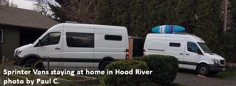
White Sprinter Van of the Week!
Click here for the White Sprinter Van map of the world!!!
Click here for the full events calendar.
Have an awesome day!
Temira
