

Support it with a contribution!

Thank you for using this forecast. Writing it takes 60-120 minutes a day; I can only keep it going with your generous financial support. Make a contribution or subscribe and get it in your inbox with bonus material. What’s that cost? Not $99 a year. Nope. Not $49. Contribute $19.99 or more, and you’re on the list for a year. People are added to this list on Thursday and Sunday. Thanks for your patience! Click below to contribute and keep the forecast going for everyone, nearly every day.
Click here to use your PayPal
Venmo: @theGorgeismyGym
Snail Mail: Temira Lital, PO Box 841, Hood River, Oregon 97031
(note: I am not a non-profit entity. The only way to accept credit cards with a user-defined amount is to use the ‘donate’ button. Thanks for understanding!)
Auto-renewing subscription. New! Awesome!
The Forecast
Today’s Gorge Wind – these are ranges for the average speed, not a predicted wind range. =)
Your favorite beach
Dawn
Patrol
9am-
11:30a
11:30a-
3pm
3pm-
dusk
Rooster Rock
sun
buns
super
fun!
Steven’s Locks
10-13
10-13
10-13
10-13
Viento
26-29
23-26
20-23
20-23
Hood River
19-22
G22-25
15-18
11-14
Lyle to Doug’s
15-18
15-18
23-26
26-29?
Rufus, etc.
26-29
21-26
26-29+
26-29+
Roosevelt & Arlington
26-29
21-26
26-29+
26-29+
Patrol
11:30a
3pm
dusk
Gorge Wind Forecast
Good morning and apologies for the missed forecast yesterday. That wasn’t the plan, but I woke up to no power and no internet and no time before my “real job” to go somewhere and write one up. And then I slept in this morning! And on top of that, the website I use to send the email version of this forecast to you lovely subscribers is down. Geez. So many delays! That’s okay – the strongest wind will be a bit delayed today as marine clouds have pushed all the way to Hood River. If you like your wind on the stronger side, you’ll want to hop on the swell train today. Westerlies back off for the next three-and-a-half days.
Looking at Wednesday, we see a coastal trough sending cool, marine air this way. 7Am gradients were 0.13 (pdx-dls) and 0.07 (dls-psc). That’s a good indicator for Lyle to Rufus today, and indeed, the GFS 12k agrees! Your best results will definitely be east today, although a couple good hours aren’t out of the question at Swell. The morning starts with wind at Viento as always (25-29), 10-13 at Stevenson, teens between Swell and Doug’s, and 26-29 from Maryhill eastward. Eastern Gorge sites may dip mid-morning before roaring back. Models indicate no roaring at all near Swell and Hood River today with the possible exception of a short period of 22-25 mid-morning. Westerlies rise by late morning to 23-26 from Mosier to Rufus with 15-18 from Stevenson to Swell and east of Rufus. In the afternoon, we’ll have 26-29 from Mosier to Arlington with lackluster 11-14 or so west of Mosier (exception: Viento, maybe) River flow is 132kcfs, river temp is 69F, and high temp forecast is 77F.
Moving on to Thursday… our offshore trough moves into Canada (like all the US people will be doing August 9th) and allows hotter air to push our way from the southwest. This knocks the wind down. Expect Dawn Patrol at 15-18 from Viento to Hood River with 7-10 everywhere else. Get that. The wind quickly drops to 10-13 in the west and light/variable to the east of Rowena. It’ll likely bounce back to 12-15 from Stevenson to Hood River in the evening. High temp: 83F
Offshore high pressure wields a bit more influence on Friday. That somewhat counteracts high pressure pushing into the east side from the Intermountain West. Westerlies at dawn will at 16-19 from Viento to Mosier and will bump to 20-23 from Viento to Mosier for a couple hours. East and west of there: 10-13. After that short-lived period of low 20’s, the wind falls to 17-20 from Stevenson to Mosier, fills to The Dalles in the afternoon, and holds. East of there: light westerlies or light and variable. High: 86F.
Weekend weather currently looks sunny and warm with temps nearing 90F. Saturday’s wind is currently forecast to be 14-17. Sunday will be 14-17 most of the day but, if the timing is right, will surge to 25-28 late in the afternoon or early in the evening in the Corridor. Sounds good. Enjoy!
Coast, Jones, Coast (north/central/south, waves. Wind Coast (north/central/south, waves. Wind direction north unless otherwise noted. Swell forecast from NWS.) Wednesday: NW10-15/N10-15/30-35, SW swell 2′ at 15 seconds. Thursday: 15-20/15-20/20-25+, SW 2′ @ 13. Friday: 10-15/15-20/30-35+, SW 2′ @ 13. Jones Wednesday: 11-14. Thursday: 15-18. Friday: 15-18. Sauvie’s Wednesday: 10-13. Thursday: 12-15. Friday: 10-13.
Mt. Hood Weather forecast
On vacation unless some wintry weather happens.
Hood River Weather Forecast
Partly cloudy sky Wednesday morning gives way to sunshine. Temps will be in the upper 50’s early and mid 70’s later. Moderate westerlies. No rainbows. Thursday starts in the mid 50’s and rises to the low 80’s. Moderate westerlies become light and then moderate again. No rainbows. Friday will be sunny. Temps will be in the mid 50’s early and mid 80’s later. Moderate westerlies. No rainbows.
Looking for a complete Columbia Gorge forecast? Looking for more humor in your weather? Obscenities? You’re looking for my TATAS: Temira’s Awesome Travel Advisory Service on Facebook.
Cycling
SDS (Whoopdee, Underwood), BLC, HFM, DGS, and Kreps Land (Hospital Hill) are now closed until the end of fire season. It is also vital that people respect this closure to maintain positive relationships between the landowners and trail users.
Open trails: Post, Falls Creek, Lewis River, Sandy Ridge, Columbia Hills, Gorge 400, Plains of Abraham / Ape Canyon. 44 Road: Eightmile, Fifteenmile, Bottle Prairie, Dog River, Superconnector, Cedar, Knebal, Cooks Meadows, 450 to the top, Underhill. Siouxon and Huffman Peak are “temporarily closed” due to wildfire last year.
Maple Road in Post Canyon is closed. DO NOT drive past the closed signs. If you do so, you will jeopardize TRAIL access for the entire summer. This is the road that runs to the west, just north of the Binns/Riorden intersection. Also, the trail from the bottom of Post Canyon to Seven Streams Staging Area is now closed. It’s on private land. Respect the closure.
Local Events
The Hood River County Fair starts today and runs through Saturday. The Gorge Downwind Champs continue through this week. The village is based at the Skamania Co. Fairgrounds.
IFPL 3 restrictions west of Highway 35 (source: Hood River County email) went into effect on 7/16. No more motorized use in Post Canyon trails. Mountain View Cycles women’s ride is every Thursday, bottom of Post at 5:30pm. They have an all-genders ride at 6pm on Wednesday, end of the pavement on Post Canyon Road. Their shop road ride leaves at 9am on Saturday for a 2 hour ride. Dirty Fingers has the Post n’ Pint on Thursday evenings at 5:30pm from the shop. They also have the women’s Post n’ Pinot Wednesday evening at 5:30pm from the shop. Oregon E-Bikes has ladies’ rides at 7:30am Sunday and Monday. The Small Boat Group does paddles every Thursday evening at 6pm at the Hatchery.
Other weekly events. Tuesday night there’s meditation with the Pacific Hermitage Monks at 5:15 (1 hour) and 6:30 (30 minutes followed by a talk) at Yoga Samadhi in White Salmon. Triathlon practice with the Tri Club is Tuesday at 6pm at West Mayer State Park. Sailboat races happen Wednesday night from the Hood River Marina. There are also lesser races on Friday nights.
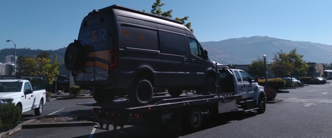
Sprinter Van of the Week!
 Click here for the Sprinter Van map of the world!!!
Have an awesome day!
Click here for the Sprinter Van map of the world!!!
Have an awesome day!
