

| Snow level | 4a-8a | 8a-12p | 12p-4p | 4p-8p | 8p-4a |
|---|---|---|---|---|---|
| Wednesday 2000′->4000′->3500′ |
 |
|
|
 |
 |
| Thursday 3500′->6000′ |
|
 |
|
|
|
| Friday 6000′->7500′ |
 |
 |
 |
 |
|
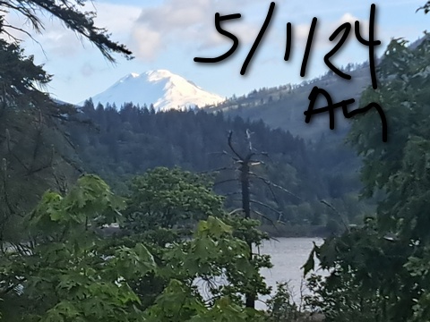
Mt. Hood Snow Forecast
Good morning skiers and riders! Well, I confirmed with Teacup yesterday that they won’t be bringing the grooming machines back out, so groomed skate/XC is officially done for the season. Meadows, as you may recall, is closed Monday through Thursday this week (no hiking allowed on Thursday). Timberline: open for you to shred the 28” of fresh powder they’ve picked up! Mostly dry weather is forecast through Friday midday. We’ll see some rain into Saturday morning followed by lots of snow through next Wednesday. It’s a little early to predict how much snow, but it’s probably safe to say 1-2 feet, even taking into account the rain Friday night into Saturday.
Wednesday looks sunny in the morning, high overcast in the afternoon, and lightly snowy overnight. The free air freezing level will be 2000′ in the morning. It rises to 4000′ in the afternoon with a snow level of 3500′ or so. There’s just a trace of snow forecast tonight. Wind: NW 20-30 this morning, W 10 this afternoon, and southerly becoming light/variable overnight.
Thursday starts with snow flurries, turns partly cloudy midday, and ends up clear overnight. The free air freezing level will be 3500′ in the morning and will slowly rise to 6000′ and stay there. Wind: light and variable all day becoming S 10-20 after midnight.
Friday starts clear and quickly turns high overcast. That’s just what we look for when predicting a spectacular sunrise. Keep your camera handy. Rain arrives early afternoon and sticks around all night. The snow level will be 6000′ in the morning and will rise to 7000′-7500′ in the afternoon. It stays there all night. About 0.3” rain is forecast overnight. Wind: S 10-20 in the morning, SW 15-30 in the afternoon, and SE 10+ overnight.
There’s lots of variation in the precip forecast and the timing for Saturday and Sunday, so let’s broad-brush it. Rain switches to snow mid-morning Saturday. Overnight, the snowfall intensifies. UP to a foot of new is possible with the snow level around 3500′. Heavy snow and very strong wind (serious storm skiing with the possibility of lift issues) is in the cards on Sunday. Temps stay low enough for accumulating snow at 5000 (and less!) through next Wednesday. What a fun and unexpected late season bonus. Enjoy!
A poem:
Was that forecast helpful?
Did it save you time or gas money?
Did it make your life more fun?
Then please make a contribution.
Writing this takes me an hour or two a day.
Without your support, I can’t keep it up.
Keep the forecast going.
Subscribe or donate.
And share my forecast with your friends!
 |
 |
 |
|
Not ready to subscribe? No problem – please share this forecast with all your friends too!
Or try a month for free!

Gorge Wind Forecast
Hi friends! Looks like we’ll have just enough wind today (Wednesday) to get some of you on the river. Thursday and Friday won’t be conducive to wind sports. Nope. They’ll be mostly calm, most of the day, and Friday will add some rain. Saturday and Sunday are looking darn good if you watch the deterministic GFS. Ensembles aren’t quite as optimistic; about 50% of them have a couple of big days, and about 15-20% are unimpressive. So… don’t get too excited yet, but do keep a close eye on the weekend forecast!
Wednesday’s going to be yet another active weather day, at least offshore. High pressure in the morning starts to give way to a low in the afternoon. But… that low will keep things cool and cloudy on the west side. The day starts with pressures of 30.27/30.20/30.17 for gradients of 0.07 and 0.03. During the morning, the wind slowly builds to gusty 17-20 from Stevenson to Mosier and then adds Lyle to Doug’s. East of The Dalles, the wind will be in the 10-13 range all day long. Models suggest areas west of The Dalles will drop to 14-17 after 2pm or so as the offshore low starts to dominate the Pacific. River flow over the last 24 hours was 120-176kcfs, river temp is 52.88F, and high temp forecast is 58F.
Thursday looks calm most of the day and light westerly (less than 10mph) in the afternoon. High temp: 64F under partly cloudy sky early and mostly clear sky later. Friday brings another offshore low pressure system to start the day. Models have that moving right overhead in the afternoon, which will result in rain, instability, and very gusty, very wet westerlies. Expect E 5-10 to start, calm wind midday, and gusty 13-16ish in the afternoon. That wind will show up from west to east and move quickly through the Gorge. High temp: 68F with rain after 11am. Hmm… I suspect it will be cooler.
Extended: there’s quite a bit of disagreement for the weekend. If you look at the deterministic GFS (it’s a thing that people look at), you’ll see very windy conditions both Saturday and Sunday. However… you’ll also see lots of rain on Saturday throughout the entire Gorge, all the way from Iwash (Rooster) to Boardman. Sunday sees this weather system exit, but timing will be everything. About 50% of the ensembles (variations on the deterministic) have a very, very windy day out east. We’ll keep a close eye on this, won’t we? See you on the river!
Jones, Sauvie’s, Coast Forecast – On vacation ‘til summer unless otherwise noted
Very basic Hood River weather forecast. Don’t plan your life around this. You really should read Temira’s Awesome Travel Advisory Service on Facebook
Partly cloudy sky this morning sticks around. Temps start in the mid 40s and rise to the upper 50s. Moderate westerlies. No rainbows. Thursday will be partly cloudy then mostly clear. Temps start in the upper 30s and rise to the mid 60s. Calm wind then light westerlies. No rainbows. Friday will be mostly clear then cloudy and drizzly. Temps start in the upper 30s and rise to the upper 60s. Light easterlies early. Light westerlies later. 89% chance of rainbows.
Local-ish Events
Please let me know of outdoor-related local-ish events. If you don’t tell me, I don’t know!
Regular weekly events:. NK Studio’s by-donation Tuesday morning yoga class is back. Ferment’s Tuesday night 4-mile walk/run is at 6pm. There’s meditation with monks at 5:15pm (an hour) and 6:30pm (30 minutes plus a talk) at Yoga Samadhi in White Salmon. The Tri Club is done for the season. At 7:15am on Wednesdays, there’s a run from the White Salmon Bakery. At 7am on Friday morning, there’s a run from Pine Street Bakery. On Fridays at 2:30pm, there’s a free meditation and stretching class at Yoga Samadhi. On Saturday at 9am, there’s a by-donation outdoor group fitness on the 2rd floor deck about Ferment Brewing.
Cycling
Cows are out on Hospital Hill. NO DOGS. That means you, all of you, even your dog that’s [insert adjective]. No dogs. Do not risk access for everyone. No parking at the corral. Whoopdee flowers are in full bloom. Hospital Hill and Syncline have ticks, oaks, and flowers. Columbia Hills is full of flowers and open to your bike. It’s trail-building season. Get on the HRATS mailing list if you’d like to help out. If you’re parking at Post Canyon, you will need a parking pass. Those can be purchased at many local shops or online.
Sprinter Van of the Week!
 Click here for the Sprinter Van map of the world!!!
Have an awesome day!
PREVIOUS POSTS
- Sunday-Monday Mt Hood snow forecast & Gorge wind n’ weather: same old same old sunshine, Nothing cloud, strong east wind…
- Saturday Mt Hood snow forecast & Gorge wind n’ weather: SOSO – sun for the slopes, nuking east wind + Nothing in the Gorge.
- Friday Mt Hood snow forecast & Gorge wind n’ weather: sunny and warm on the slopes; windy AF in the Gorge.
- Thursday Mt Hood snow forecast & Gorge wind n’ weather: sunny and warm on Mt Hood. Nothing + strong east wind in the Gorge.
- Tuesday-Wednesday Mt Hood snow forecast & Gorge wind n’ weather: lots of warm, sunny weather on Mt Hood. Big easterlies coming for the Gorge.

Have an awesome day.
Love, Temira